

MyTopo
Classic USGS Belle Chasse Louisiana 7.5'x7.5' Topo Map
Couldn't load pickup availability
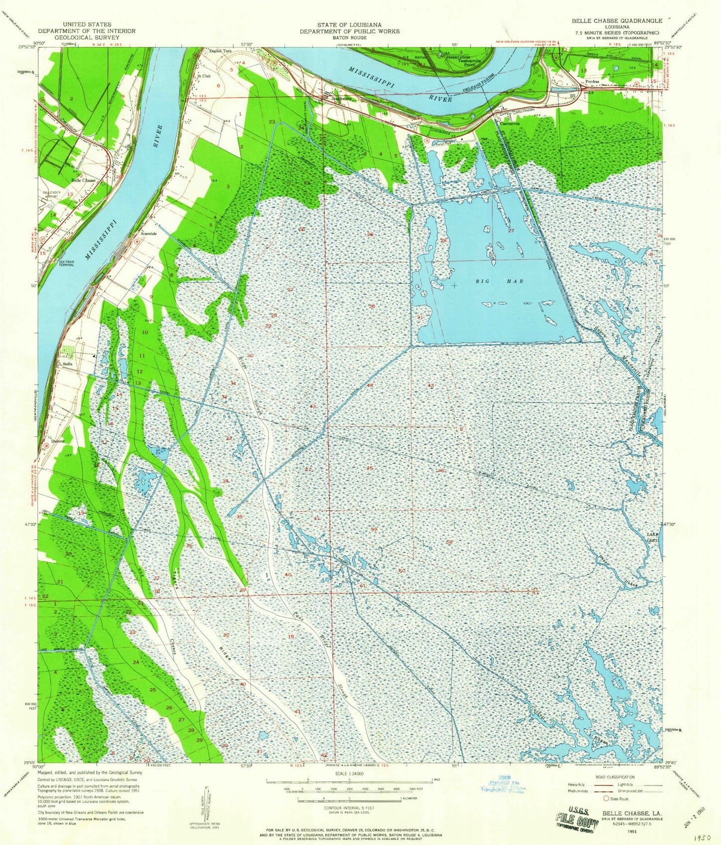
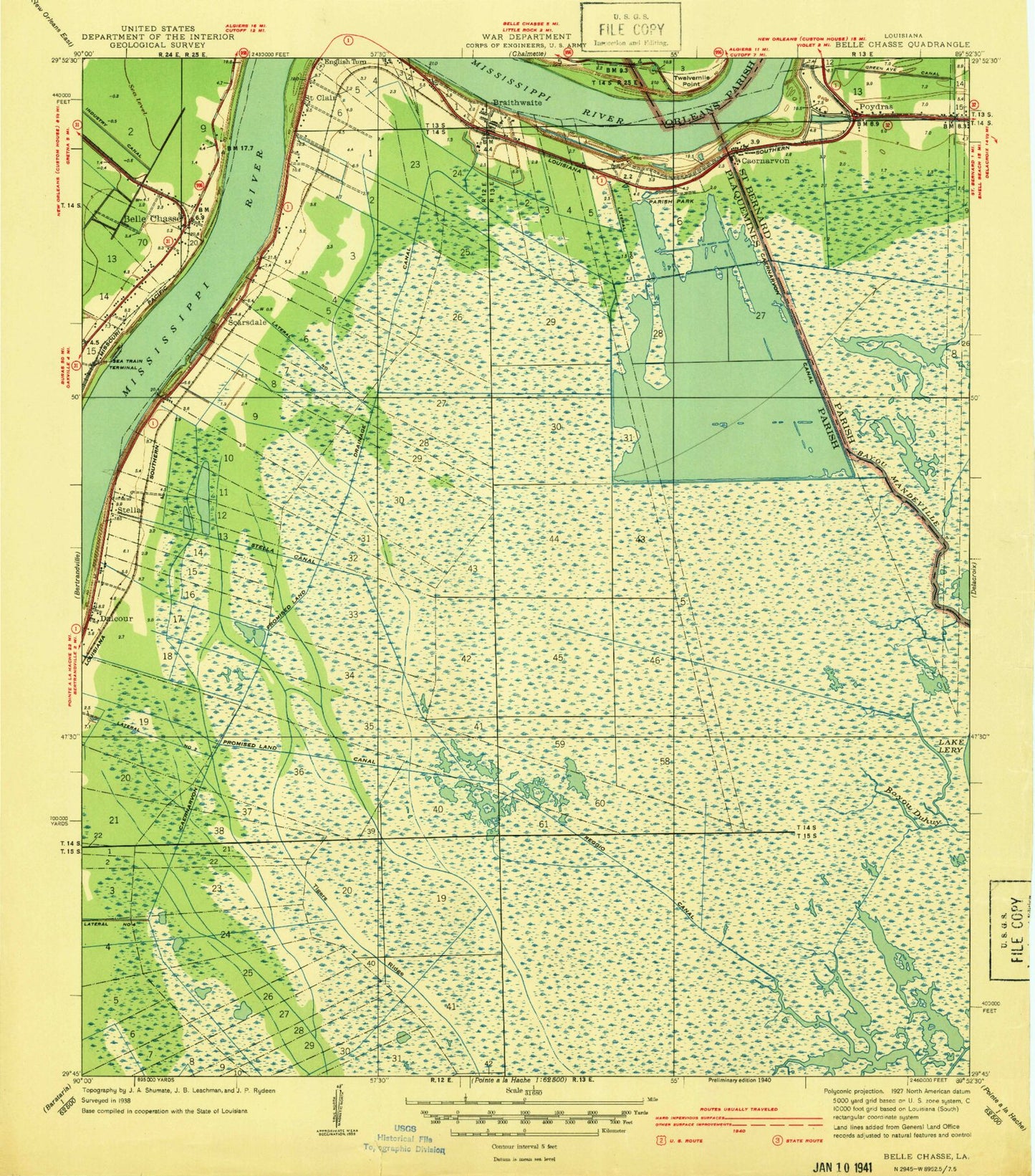
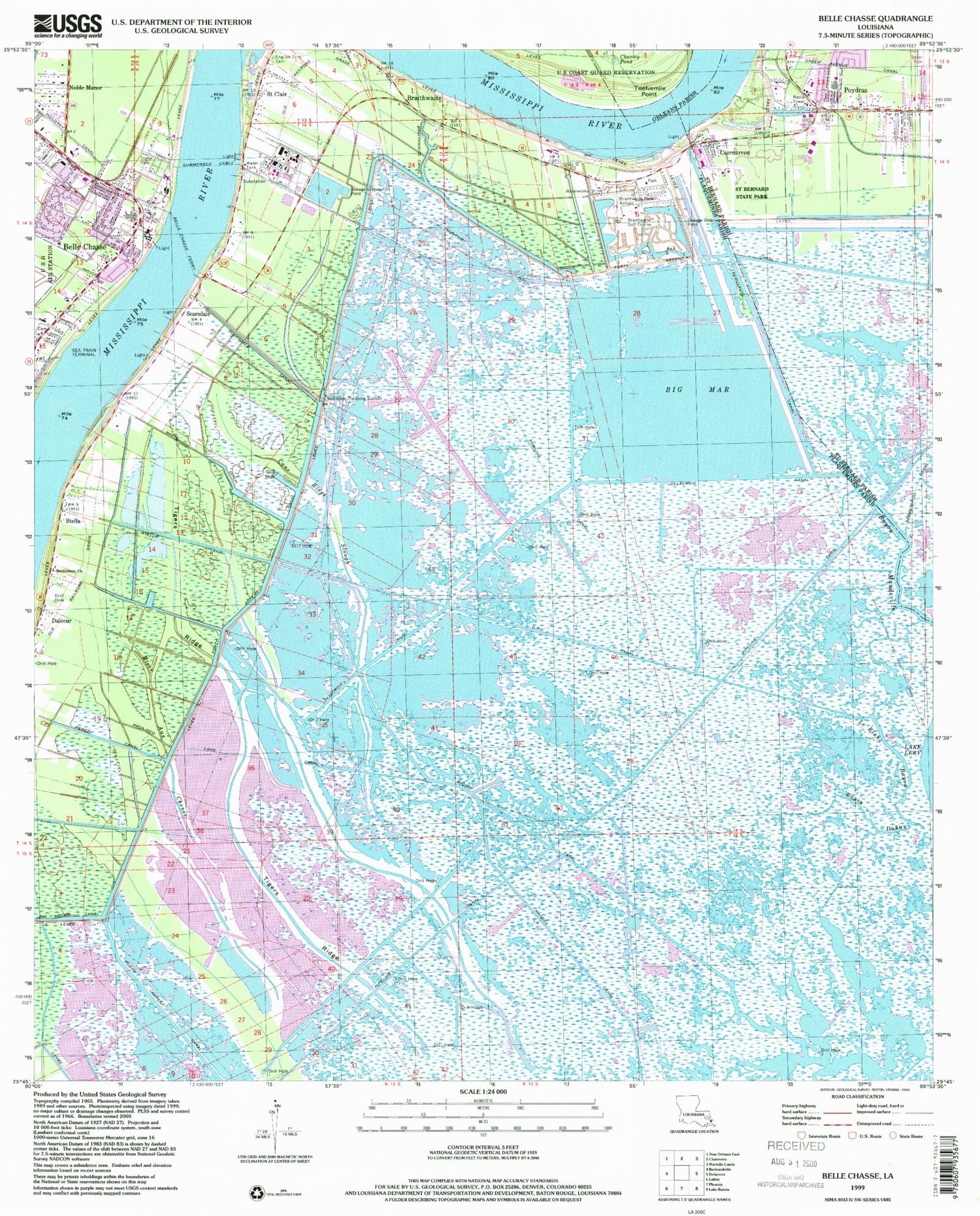
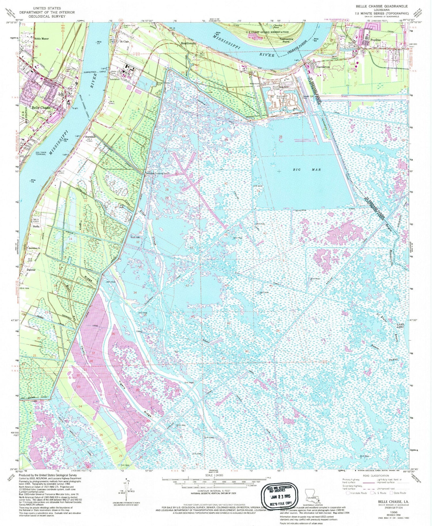
Historical USGS topographic quad map of Belle Chasse in the state of Louisiana. Map scale may vary for some years, but is generally around 1:24,000. Print size is approximately 24" x 27"
This quadrangle is in the following counties: Orleans, Plaquemines, St. Bernard.
The map contains contour lines, roads, rivers, towns, and lakes. Printed on high-quality waterproof paper with UV fade-resistant inks, and shipped rolled.
Contains the following named places: Amax Metals Recovery Incorporated Heliport, Bayou Duhuy, Bayou Mandeville, Belle Chasse, Belle Chasse Ferry, Belle Chasse High School, Belle Chasse Lockup, Belle Chasse Post Office, Bethlehem Church, Big Mar, Braithwaite, Braithwaite Canal, Braithwaite Park Airport, Caernarvon, Caernarvon Crevasse, Canary Islands Descendants Association Museum, Cane Ridge Slough, Caskett Bayou Gas Field, Charley Pond, D P Canal, Dalcour, Dalcour Gas Field, Delacroix Canal, English Turn Cemetery, English Turn Revetment, First Baptist Church of Belle Chasse, Green Avenue Canal, Hidden Oaks Golf Course, Industry Canal, Israelite Baptist Church, Le Blanc Bayou, Lynn Oaks School, Manuel Canal, Mumphry Ditch, Noble Manor, Our Lady of Perpetual Help Church, Our Lady of Perpetual Help Elementary School - Belle Chasse, Parish Governing Authority District 3, Perez Canal, Plaquemines Parish Fire District 2 Belle Chasse Volunteer Fire Department Station 1, Plaquemines Parish Library Belle Chasse Branch, Plaquemines Parish Sheriff's Office, Plaquemines Parish Sheriff's Office - Detective Bureau, Port Nickel, Poydras, Poydras Census Designated Place, Poydras Crevasse, Poydras Revetment, Promised Land Canal, Reggio Canal, Saint Bernard Parish Fire Department Station 8, Saint Bernard State Park, Saint Clair, Scarsdale, Scarsdale Canal, Scarsdale Cemetery, Scarsdale Pumping Station, Scarsdale Revetment, Southern Oaks Mobile Home Park, Stella, Stella Canal, Tigers Ridge, Truth and Praise, Twelvemile Point, Ward Five, White Ditch