MyTopo
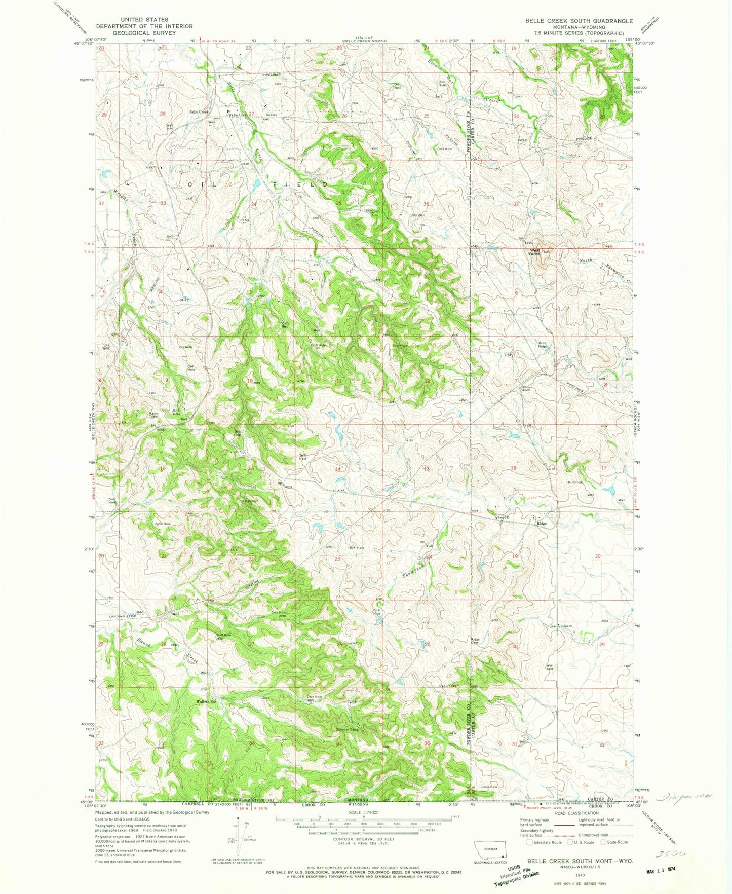
Classic USGS Belle Creek South Montana 7.5'x7.5' Topo Map
Couldn't load pickup availability
Historical USGS topographic quad map of Belle Creek South in the state of Montana. Map scale may vary for some years, but is generally around 1:24,000. Print size is approximately 24" x 27"
This quadrangle is in the following counties: Campbell, Carter, Crook, Powder River.
The map contains contour lines, roads, rivers, towns, and lakes. Printed on high-quality waterproof paper with UV fade-resistant inks, and shipped rolled.
Contains the following named places: 08S54E27BBCA01 Well, 08S54E27CBB_01 Well, 08S55E29CD__01 Spring, 08S55E31AA__01 Well, 09S54E02BCAD01 Well, 09S54E05DAAA01 Well, 09S54E16CD__01 Well, 09S55E19AAAB01 Well, Belle Creek Airport, Belle Creek Oil Field, Ridge, Ridge Cemetery, Ridge Church, Ridge Post Office, Ridge School, Walloth School, West Butte