MyTopo
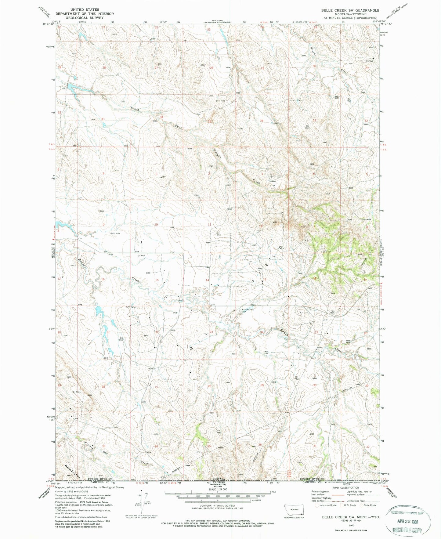
Classic USGS Belle Creek SW Montana 7.5'x7.5' Topo Map
Regular price
$16.95
Regular price
Sale price
$16.95
Unit price
per
Couldn't load pickup availability
Historical USGS topographic quad map of Belle Creek SW in the state of Montana. Map scale may vary for some years, but is generally around 1:24,000. Print size is approximately 24" x 27"
This quadrangle is in the following counties: Campbell, Powder River.
The map contains contour lines, roads, rivers, towns, and lakes. Printed on high-quality waterproof paper with UV fade-resistant inks, and shipped rolled.
Contains the following named places: 08S54E29CCCA01 Well, 08S54E30BDAA01 Well, 09S53E22ABAC01 Well, 09S53E22ABB_01 Well, 09S53E36AABD01 Well, 09S54E19CC__01 Well, Giacometto Number 1 Dam, Morris Ranch Airport, Porch Number 1 Dam, R Garst Number 1 Dam, R Garst Number 2 Dam, Ranch Creek Cemetery