MyTopo
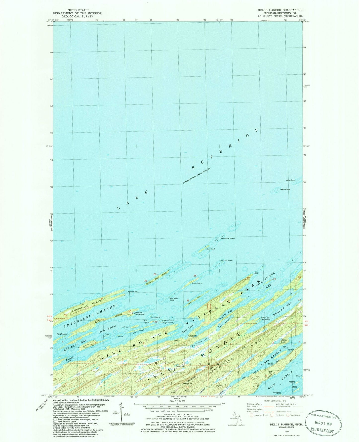
Classic USGS Belle Harbor Michigan 7.5'x7.5' Topo Map
Couldn't load pickup availability
Historical USGS topographic quad map of Belle Harbor in the state of Michigan. Typical map scale is 1:24,000, but may vary for certain years, if available. Print size: 24" x 27"
This quadrangle is in the following counties: Keweenaw.
The map contains contour lines, roads, rivers, towns, and lakes. Printed on high-quality waterproof paper with UV fade-resistant inks, and shipped rolled.
Contains the following named places: Lake Ahmik, Belle Harbor, Belle Isle, Belle Isle Campground, Burnt Island, Captain Kidd Island, Clay Island, Congdon Shoal, Cork Island, Crystal Cove, Dead Horse Rocks, Dean Island, Diamond Island, Duncan Bay, Duncan Bay Campground, Fire Island, Five Finger Bay, Mount Franklin, Green Island, Heron Island, Hill Point, Horner Island, Johnson Island, Lane Cove, Lane Cove Trail, Moose Lake, Net Island, Patterson Lake, Robinson Bay, Steamboat Island, Stockly Bay, Tallman Island, Tobin Creek, Tobin Harbor Trail, Tookers Island, Tookers Island Campground, Amygdaloid Channel, Amygdaloid Island, Mount Franklin Trail, Fryett Island, Fisher Island, The Keyhole, Lane Cove Campground, Chippers Island, Eagle Island, Picnic Island, Hancock Beach, Lauren Grove Park