MyTopo
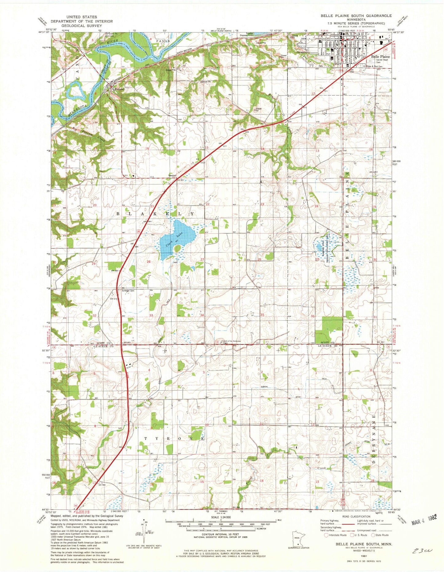
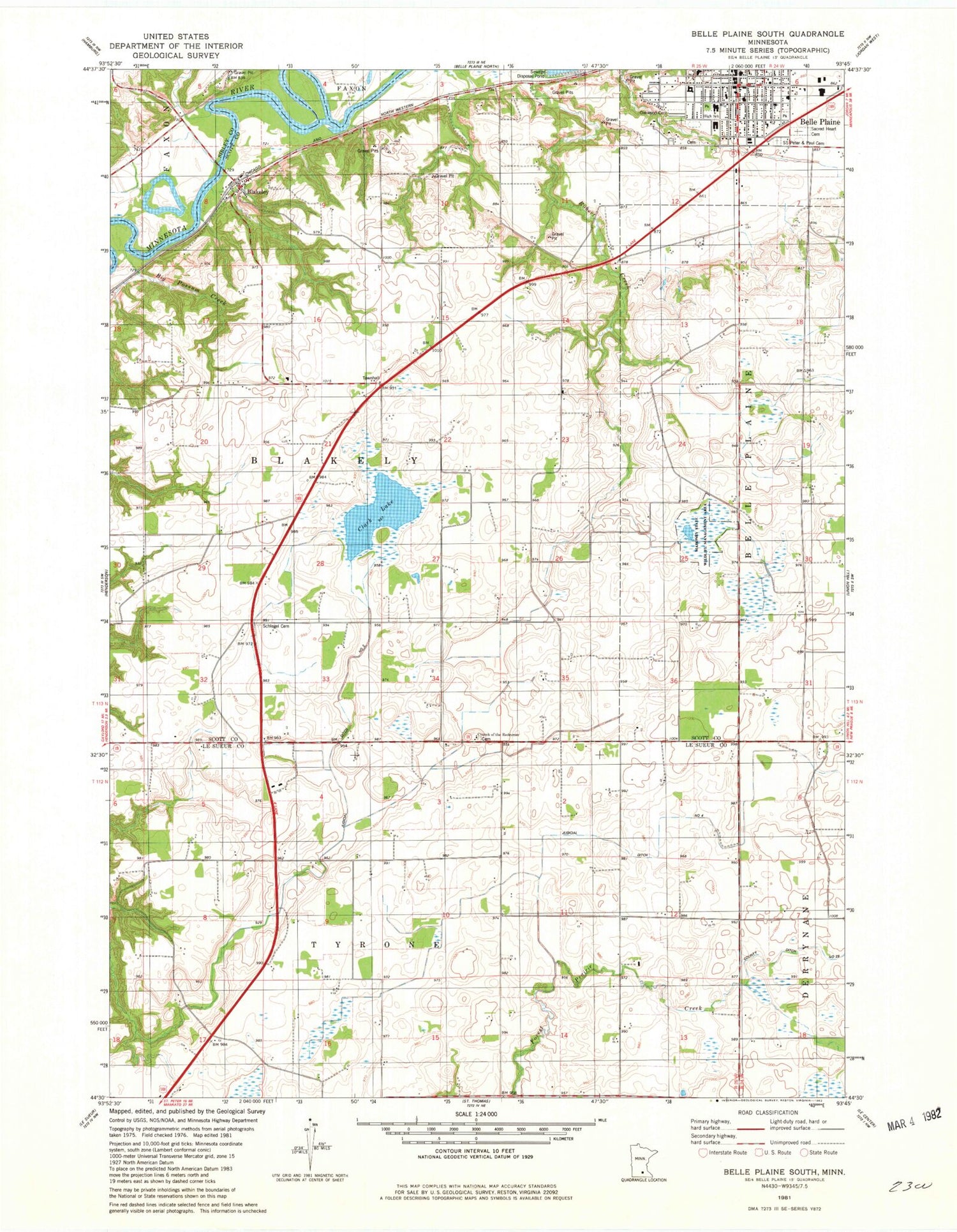
Classic USGS Belle Plaine South Minnesota 7.5'x7.5' Topo Map
Couldn't load pickup availability
Historical USGS topographic quad map of Belle Plaine South in the state of Minnesota. Map scale may vary for some years, but is generally around 1:24,000. Print size is approximately 24" x 27"
This quadrangle is in the following counties: Le Sueur, Scott, Sibley.
The map contains contour lines, roads, rivers, towns, and lakes. Printed on high-quality waterproof paper with UV fade-resistant inks, and shipped rolled.
Contains the following named places: Belle Plaine, Belle Plaine Fire Department, Belle Plaine Junior High School, Belle Plaine Police Department, Belle Plaine Post Office, Belle Plaine Public Library, Belle Plaine Senior High School, Big Possum Creek, Blakeley, Blakeley Post Office, Chatfield Elementary School, Church of the Redeemer, Church of the Transfiguration Protestant Episcopal Cemetery, City of Belle Plaine, Clark Lake, Early Childhood Program, Emma Krumbee's Apple Orchard, First Presbyterian Church, Judicial Ditch Number Four, Judicial Ditch Number Two, Mahoney State Wildlife Management Area, Minnesota River Valley Special Education Cooperative, Nagel and Schultz Airport, Oak Crest Elementary School, Oakwood Cemetery, Our Lady of the Prairie Catholic School, Our Lady of the Prairie Church, Prairie Park, Redeemer Lutheran Cemetery, River Rock Church, Sacred Heart Cemetery, Saint Johns Lutheran Church, Saints Peter and Paul Cemetery, Schlegel Cemetery, Southern Metro Medical Clinic, Township of Blakeley, Township of Tyrone, Trinity Lutheran Church, Trinity Lutheran School, Valley View Golf Club, ZIP Code: 56011