
MyTopo
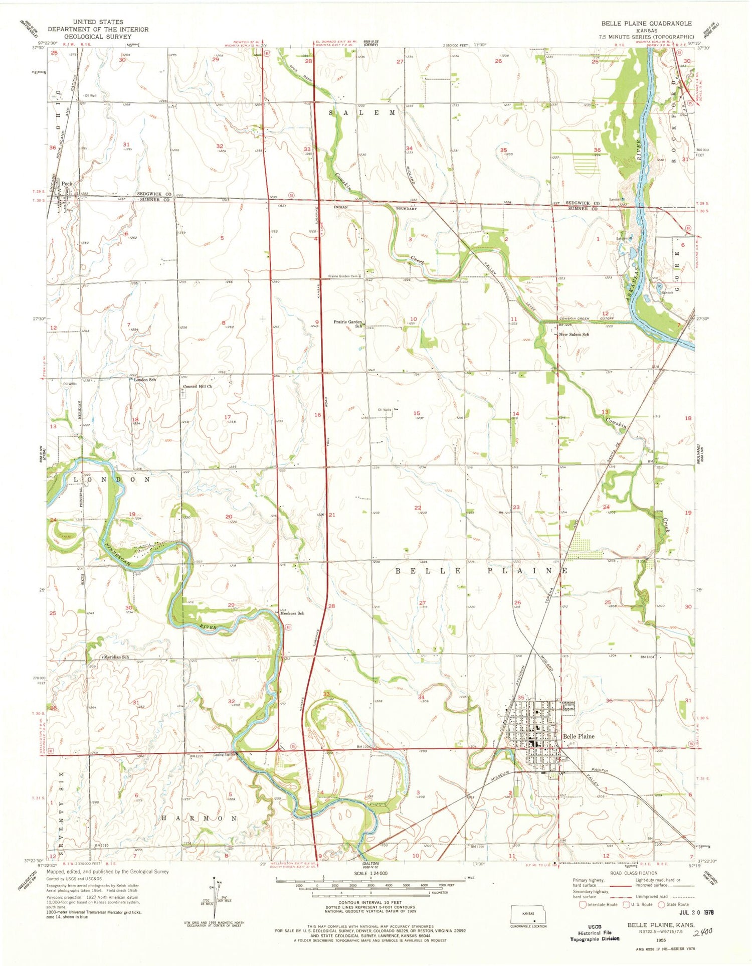
Classic USGS Belle Plaine Kansas 7.5'x7.5' Topo Map
Couldn't load pickup availability
Historical USGS topographic quad map of Belle Plaine in the state of Kansas. Map scale may vary for some years, but is generally around 1:24,000. Print size is approximately 24" x 27"
This quadrangle is in the following counties: Sedgwick, Sumner.
The map contains contour lines, roads, rivers, towns, and lakes. Printed on high-quality waterproof paper with UV fade-resistant inks, and shipped rolled.
Contains the following named places: Bartlett Arboretum, Belle Plaine, Belle Plaine Cemetery, Belle Plaine Church of Christ, Belle Plaine City Hall, Belle Plaine Elementary School, Belle Plaine Emergency Medical Services, Belle Plaine High School, Belle Plaine Middle School, Belle Plaine Police Department, Belle Plaine Post Office, Belle Plaine Presbyterian Church, Belle Plaine Public Library, Belle Plaine United Methodist Church, Belle Plaine Wastewater Treatment Plant, City of Belle Plaine, Council Hill Church, Cowskin Creek Cutoff, First Baptist Church, Kendrigan Airport, London, London School, Meekers School, Meridian School, Mulvane Wastewater Treatment Facility, New Salem School, Peck, Peck Census Designated Place, Peck Post Office, Prairie Garden Cemetery, Rands Airport, Sumner County Fire District 9 Belle Plaine, Township of Belle Plaine, Valley Mobile Home Park, ZIP Codes: 67013, 67120


