MyTopo
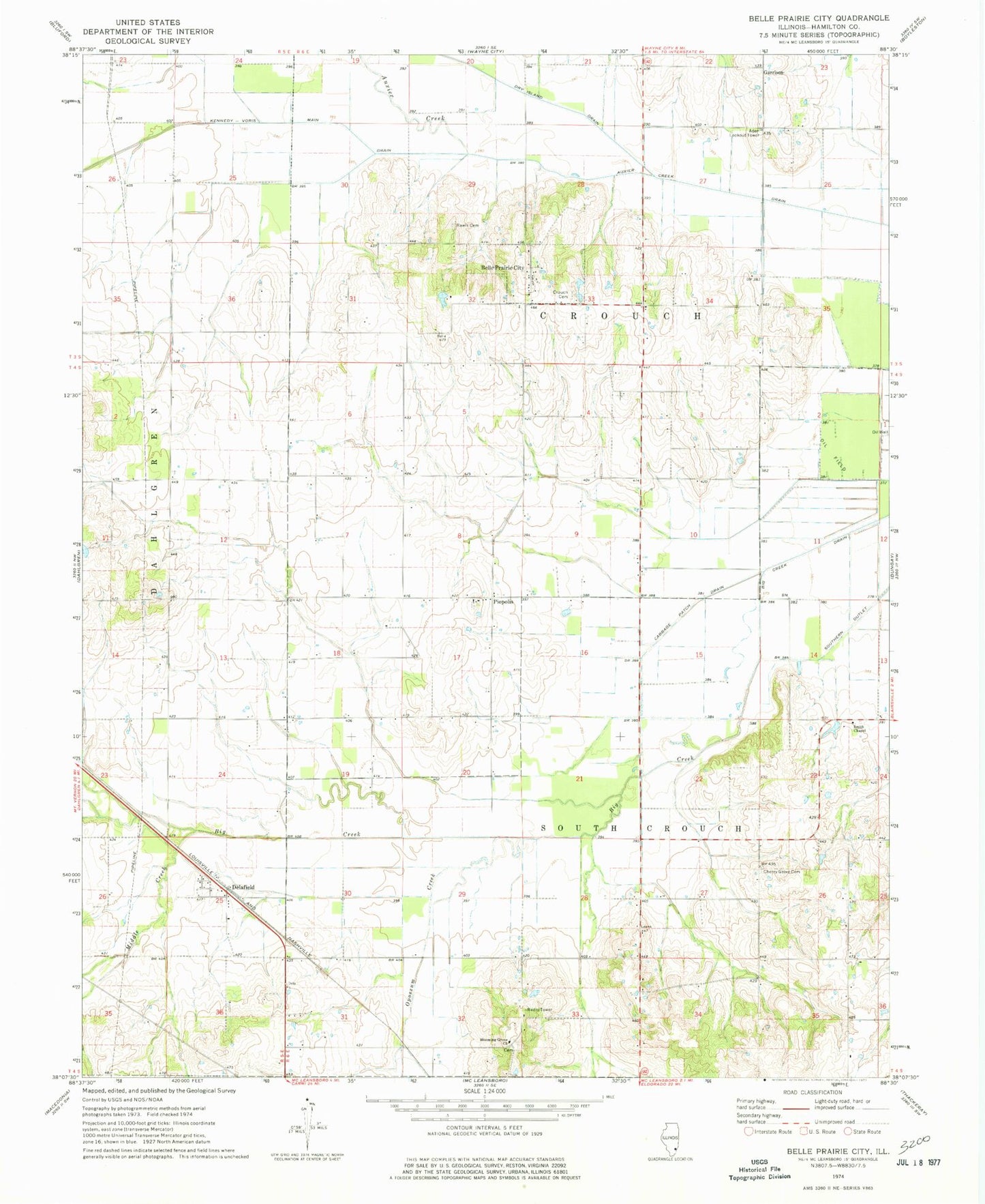
Classic USGS Belle Prairie City Illinois 7.5'x7.5' Topo Map
Couldn't load pickup availability
Historical USGS topographic quad map of Belle Prairie City in the state of Illinois. Map scale may vary for some years, but is generally around 1:24,000. Print size is approximately 24" x 27"
This quadrangle is in the following counties: Hamilton.
The map contains contour lines, roads, rivers, towns, and lakes. Printed on high-quality waterproof paper with UV fade-resistant inks, and shipped rolled.
Contains the following named places: Aden Lookout Tower, Auxier Creek, Auxier Creek Drain, Belle Prairie City, Black Branch, Blooming Grove Church, Buckingham School, Burnt Hill School, Cabbage Patch Drain, Cherry Grove Cemetery, Crouch Cemetery, Delafield, Delafield School, Dry Island Drain, Elm Grove School, Garrison, Garrison School, Karchers Post Oak Woods Nature Preserve, Kennedy-Voris Main Drain, Mason School, Maulding School, Middle Creek, Opossum Creek, Piopolis, Rally Hill School, Rawls Cemetery, Shelton Creek, Smith Chapel, Town of Belle Prairie City, Township of Crouch, Township of South Crouch, ZIP Code: 62828