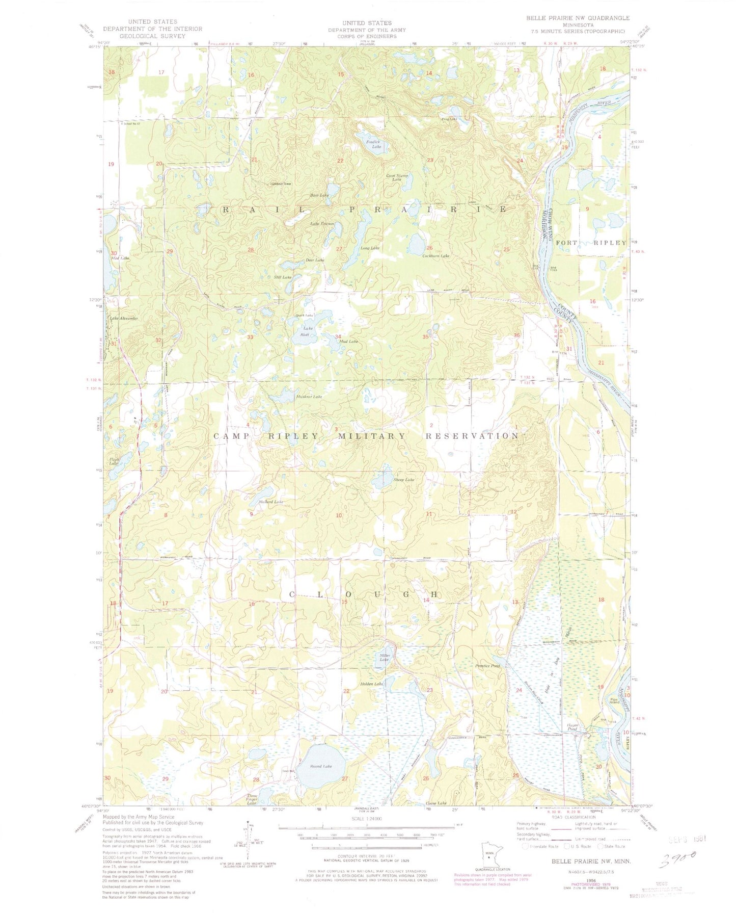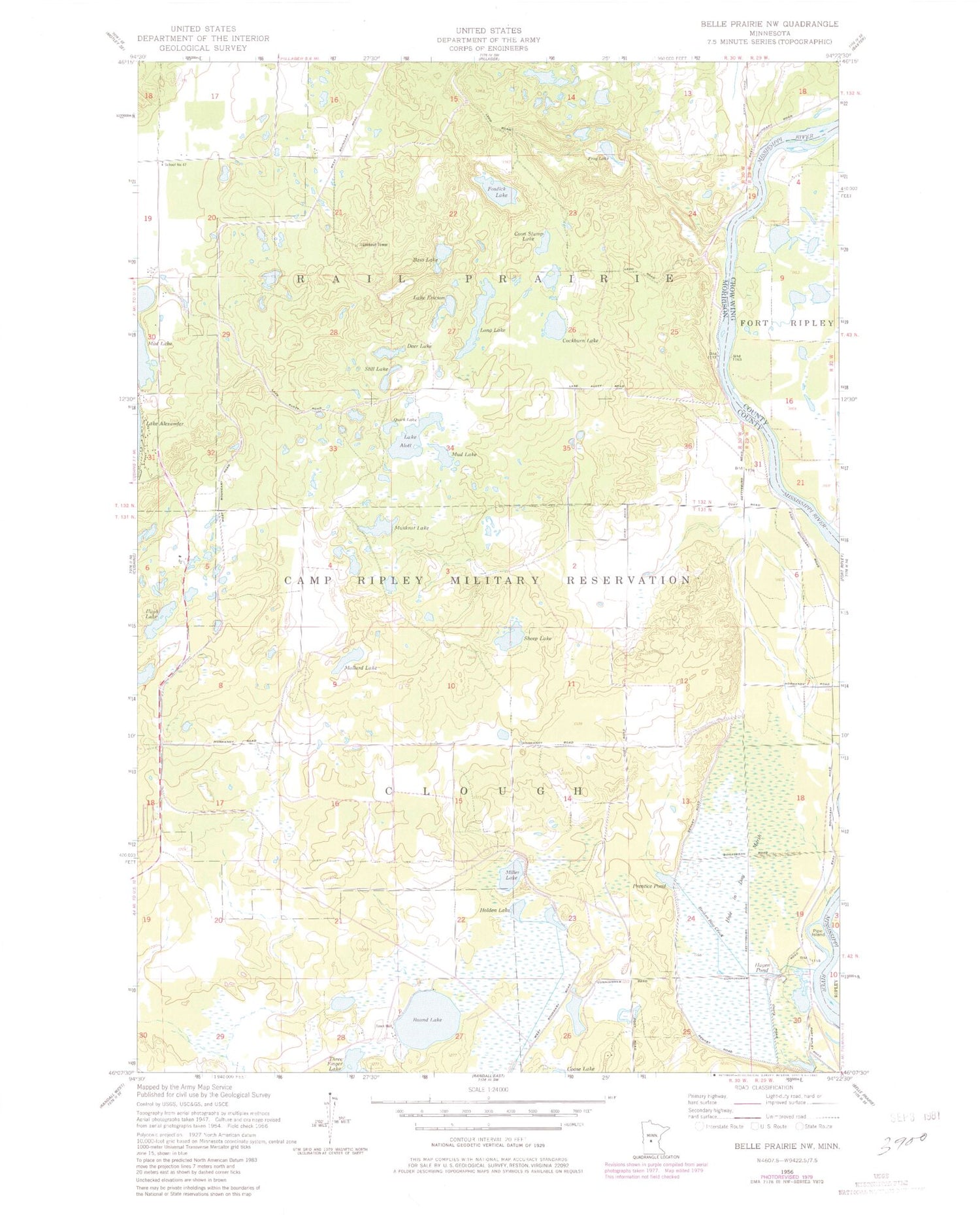
MyTopo
Classic USGS Belle Prairie NW Minnesota 7.5'x7.5' Topo Map
Couldn't load pickup availability
Historical USGS topographic quad map of Belle Prairie NW in the state of Minnesota. Map scale may vary for some years, but is generally around 1:24,000. Print size is approximately 24" x 27"
This quadrangle is in the following counties: Crow Wing, Morrison.
The map contains contour lines, roads, rivers, towns, and lakes. Printed on high-quality waterproof paper with UV fade-resistant inks, and shipped rolled.
Contains the following named places: Bass Lake, Broken Bow Creek, Camp Ripley, Camp Ripley Mounds, Cockburn Lake, Coon Stump Lake, Deer Lake, Fosdick Lake, Frog Lake, Hager Pond, Holden Lake, Hole in Day Marsh, Lake Alott, Lake Ericson, Lightner Baby Grave, Long Lake, Mallard Lake, Miller Lake, Mud Lake, Muskrat Lake, Pipe Island, Prentice Pond, Pugh Lake, Quick Lake, Round Lake, School Number 47, Sheep Lake, Still Lake, Stroming Grave Site, Township of Rail Prairie