MyTopo
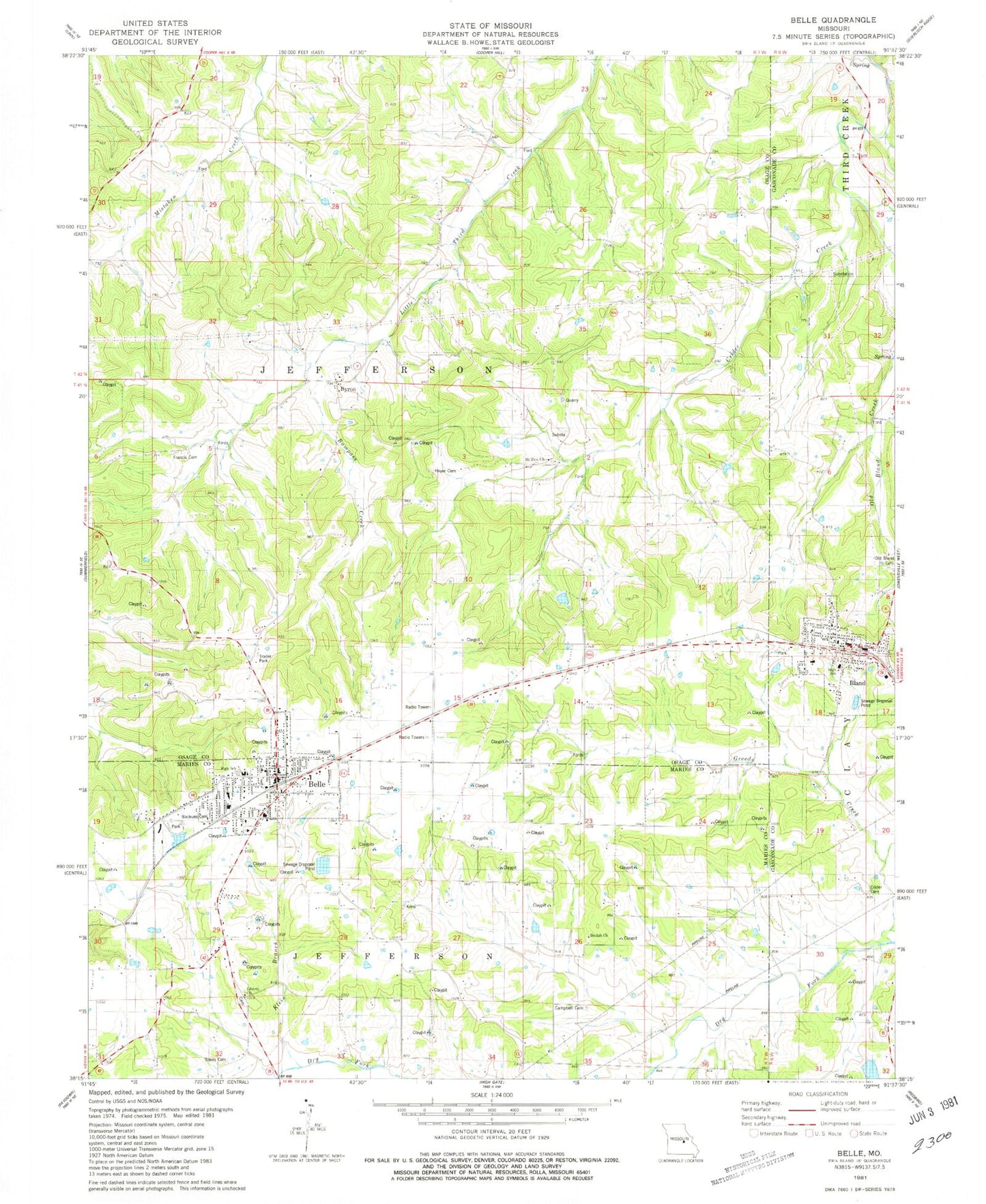
Classic USGS Belle Missouri 7.5'x7.5' Topo Map
Couldn't load pickup availability
Historical USGS topographic quad map of Belle in the state of Missouri. Map scale may vary for some years, but is generally around 1:24,000. Print size is approximately 24" x 27"
This quadrangle is in the following counties: Gasconade, Maries, Osage.
The map contains contour lines, roads, rivers, towns, and lakes. Printed on high-quality waterproof paper with UV fade-resistant inks, and shipped rolled.
Contains the following named places: Adkins School, Belle, Belle Police Department, Belle Volunteer Fire Department, Beulah Church, Bland, Bland Police Department, Bland Post Office, Bland Volunteer Fire Department Station 1, Bumpass Creek, Byron, Campbell Cemetery, City of Belle, City of Bland, Clear Fork, Crider Cemetery, Crossroads School, Dingley, Dingley School, Francis Cemetery, Gallaway Station, Garfield School, Hedenkamp Lake Dam, Heyer Cemetery, Klein Branch, Liberty Cemetery, Liberty Church, McKinley School, Mount Zion Baptist Church, Mount Zion School, Old Bland Cemetery, Pepper Field, Skillet Hollow, Township of Jefferson, Travis Cemetery, Weller School, ZIP Code: 65014