MyTopo
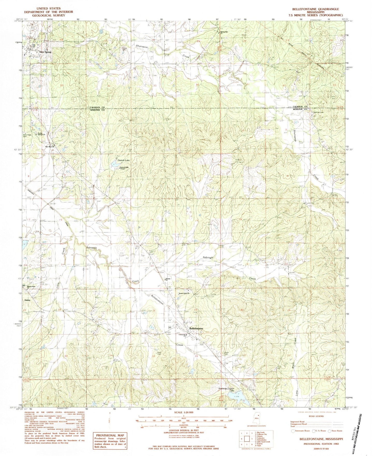
Classic USGS Bellefontaine Mississippi 7.5'x7.5' Topo Map
Couldn't load pickup availability
Historical USGS topographic quad map of Bellefontaine in the state of Mississippi. Map scale may vary for some years, but is generally around 1:24,000. Print size is approximately 24" x 27"
This quadrangle is in the following counties: Calhoun, Webster.
The map contains contour lines, roads, rivers, towns, and lakes. Printed on high-quality waterproof paper with UV fade-resistant inks, and shipped rolled.
Contains the following named places: American Legion, Bellefontaine, Bellefontaine Creek, Bellefontaine Methodist Church, Bellefontaine Post Office, Bellefontaine School, Bellefontaine Volunteer Fire Department, Dorroh Lake, Dorroh Lake Chapel, Dorroh Lake Dam, Double Springs Cemetery, Double Springs Church, Double Springs School, Dumas Church, Dumas School, Embry, Fellowship Church, Ford Cemetery, Hardy Lake Dam, Little Creek, Lovette Cemetery, McCain, Middleton, New Hope Baptist Church, New Hope Cemetery, North Union Cemetery, North Union Church, Old Bellefontaine, Pilgrim Rest Church, Pilgrim's Rest Baptist Church Cemetery, Point Pleasant School, Quinn Cemetery, Sabougla Creek, Slate Spring, Spencer Cemetery, Spring Hill Cemetery, Spring Hill Church, Vance, Vance Cemetery, West Lake Dam, ZIP Code: 39737