MyTopo
Classic USGS Bellefontaine Ohio 7.5'x7.5' Topo Map
Couldn't load pickup availability
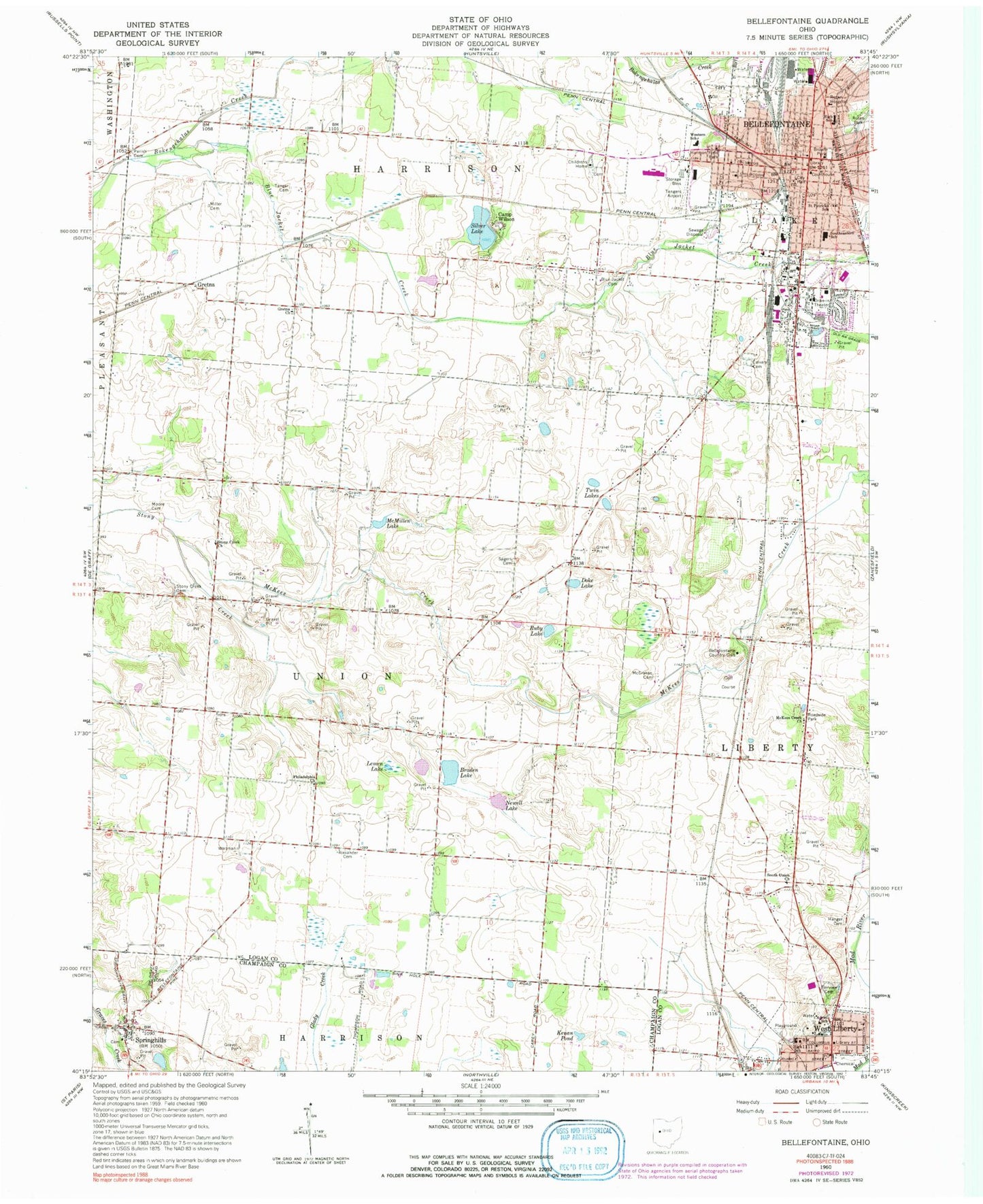
Historical USGS topographic quad map of Bellefontaine in the state of Ohio. Map scale is 1:24000. Print size is approximately 24" x 27"
This quadrangle is in the following counties: Champaign, Logan.
The map contains contour lines, roads, rivers, towns, and lakes. Printed on high-quality waterproof paper with UV fade-resistant inks, and shipped rolled.
Contains the following named places: Adriel School, Alexander Cemetery, Angle's Nursery, Auburn Avenue Baptist Church, Bellefontaine, Bellefontaine City Hall, Bellefontaine Country Club, Bellefontaine Fire / EMS, Bellefontaine High School, Bellefontaine Middle School, Bellefontaine Police Department, Bellefontaine Post Office, Bellefontaine Regional Airport, Bethel Mennonite Church, Bickham Farm, Blair Casey Park, Blue Jacket Cemetery, Blue Jacket Creek, Blue Jacket Dairy, Blue Jacket Park, Braden Lake, Brown Park, Burkhart School (historical), Calvary Cemetery, Camp Wilson, Central Elementary School (historical), Childrens Home Cemetery, City of Bellefontaine, Doke Lake, Fairview Cemetery, First Christian Church, First Church of God, First Friends Church, First Lutheran Church, First Regular Baptist Church, First United Methodist Church, First United Presbyterian Church, First United Presbyterian Church, Fontaine Plaza Shopping Center, Gretna, Gretna Church, Gretna Post Office (historical), Hanger Cemetery, Harmon Field Park, Highland Memorial Cemetery, Highpoint Village Shopping Center, Holy Trinity Episcopal Church, Iron City, Iron City Park, Jewel Hill, Kenan Pond, Lemen Lake, Lewis Ratcliff Park, Logan Baptist Church, Logan County Courthouse, Logan County District Library, Logan County Fairgrounds, Logan County Historical Society Museum, Logan County Sheriff's Office, Ludlow Center and Ross Training School, Macochee Joint Ambulance District, Mary Rutan Hospital, McCracken-Myrtle Park, McCraken Cemetery, McKee Creek School (historical), McKees Creek, McKees Creek Church, McMillen Lake, Miller Cemetery, Miller School (historical), Moore Cemetery, New Philadelphia Cemetery, Newell Lake, Oak Crest Campground, Parish Cemetery, Philadelphia Church, Pine Avenue Elementary School, Powell Park, Ruby Lake, Rutan Park, Sagers Cemetery, Saint Patricks Catholic Church, Saint Patricks School, School Number 1 (historical), School Number 2 (historical), School Number 2 (historical), School Number 3 (historical), School Number 3 (historical), School Number 3 (historical), School Number 4 (historical), School Number 5 (historical), School Number 8 (historical), School Number 8 (historical), Silver Lake, South Union Cemetery, South Union Church, Southeastern Elementary School, Southtowne Meadows, Spring Hills Cemetery, Springhill Post Office (historical), Springhills, Stony Creek Cemetery, Stony Creek Church, Sunnyside Farm, Tanger Cemetery, Tangers Airport (historical), The Centre City Mall Shopping Center, Township of Harrison, Township of Liberty, Township of Union, Twin Lakes, Village of West Liberty, Wammes Mobile Home Park, Wayside Mobile Home Park, West Liberty, West Liberty Branch Library, West Liberty Elementary School, West Liberty Fire Department, West Liberty Police Department, West Liberty Post Office, West Liberty United Methodist Church, Western Elementary School, Zeigler Cemetery


