MyTopo
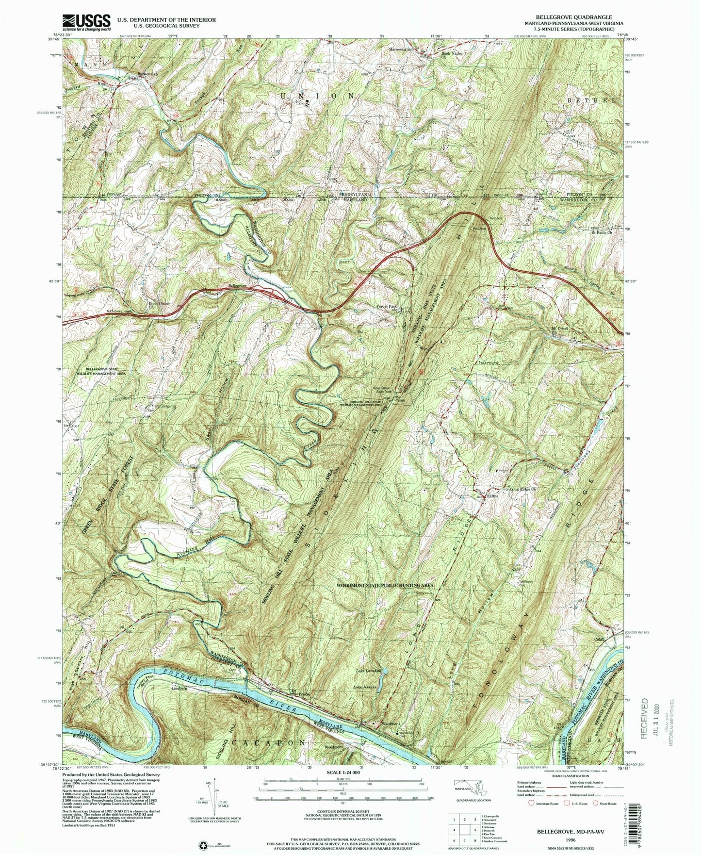
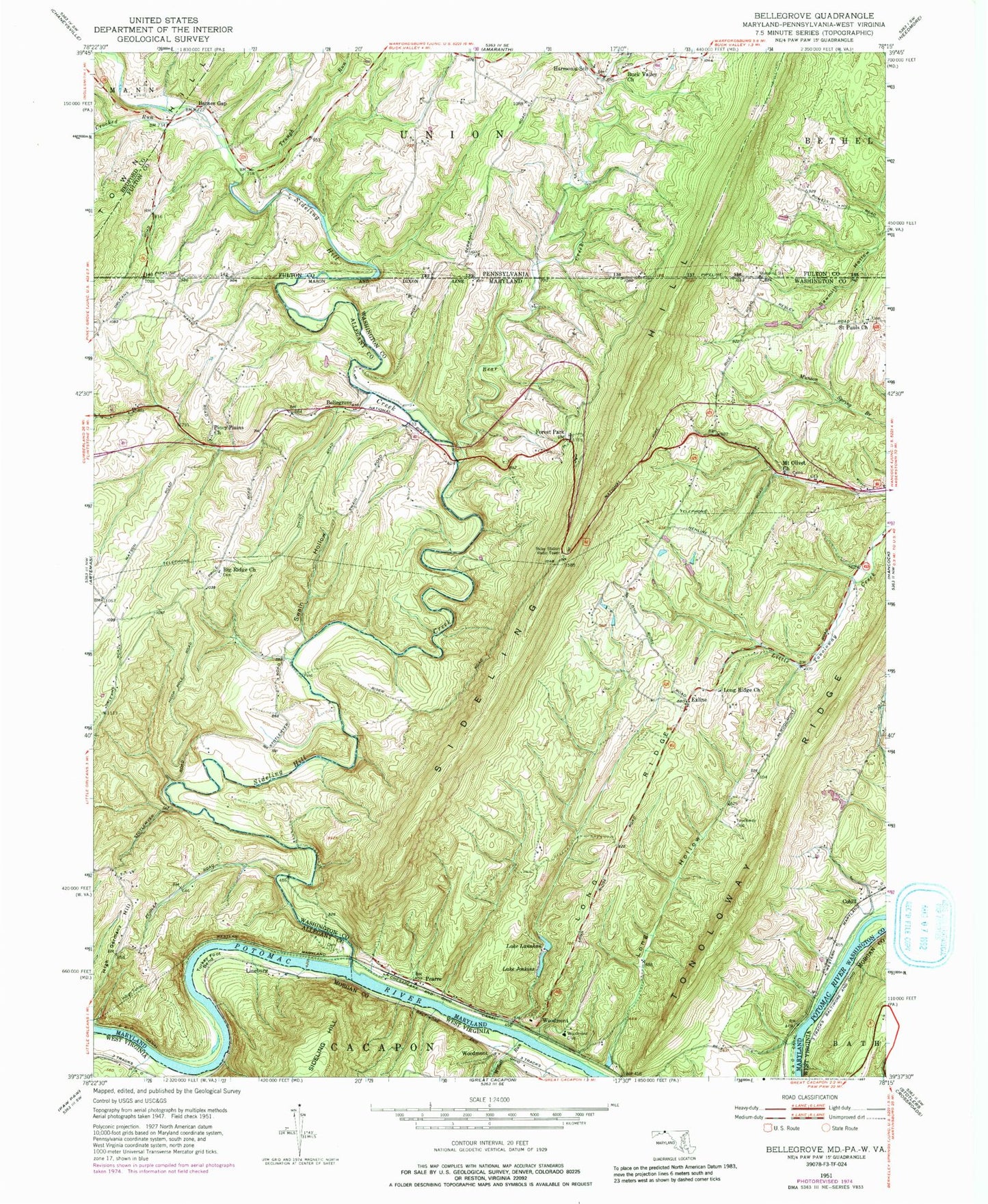
Classic USGS Bellegrove Maryland 7.5'x7.5' Topo Map
Couldn't load pickup availability
Historical USGS topographic quad map of Bellegrove in the states of Maryland, West Virginia, Pennsylvania. Typical map scale is 1:24,000, but may vary for certain years, if available. Print size: 24" x 27"
This quadrangle is in the following counties: Allegany, Bedford, Fulton, Morgan, Washington.
The map contains contour lines, roads, rivers, towns, and lakes. Printed on high-quality waterproof paper with UV fade-resistant inks, and shipped rolled.
Contains the following named places: Bear Creek, Big Ridge Church, Crooked Run, Forest Park, High Germany Hill, Indigo Tunnel, Lake Jenkins, Lake Lanahan, Long Hollow, Long Ridge, Long Ridge Church, Mount Olivet Presbyterian Church, Piney Plains United Methodist Church, Saint Pauls Church, Sideling Hill Creek, Swain Hollow, Tonoloway Club, Woodmont Club, Bellegrove, Cohill, Exline, Pearre, Woodmont, Lake Lanahen Dam, Lake Jenkins Dam, Bear Creek, Sideling Hill Creek, Camp Strauss, Indigo Neck Campground, Little Orleans Post Office, Lock 57, Sideling Hill Creek Aqueduct, Harvey, Lock 55, Lock 56, Mann, Mount Olivet Cemetery, Saint Pauls Lutheran Church Cemetery, Sideling Hill Wildlife Management Area, Woodmont Rod and Gun Club, Turkey Foot Bend, Willett Run, Lineburg, Woodmont, Barnes Gap, Buck Valley Church, Crooked Run, Harmonia School, Stahle Run, Trough Run, Northcraft (historical), Northcraft Post Office (historical), Buck Valley Christian Church Cemetery