MyTopo
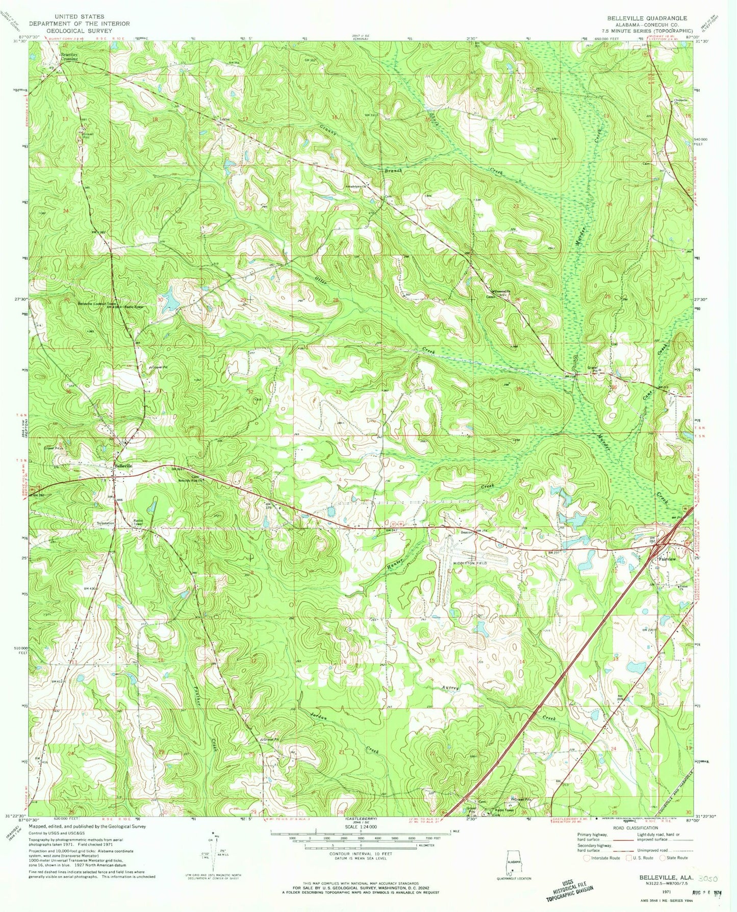
Classic USGS Belleville Alabama 7.5'x7.5' Topo Map
Couldn't load pickup availability
Historical USGS topographic quad map of Belleville in the state of Alabama. Map scale may vary for some years, but is generally around 1:24,000. Print size is approximately 24" x 27"
This quadrangle is in the following counties: Conecuh.
The map contains contour lines, roads, rivers, towns, and lakes. Printed on high-quality waterproof paper with UV fade-resistant inks, and shipped rolled.
Contains the following named places: Arkadelphia Cemetery, Arkadelphia Church, Baggett Pond, Belleville, Belleville Church, Belleville Elementary School, Belleville Fork Church, Belleville Lookout Tower, Belleville Missionary Baptist Church Cemetery, Belleville Volunteer Fire Department, Bellview Academy, Brantley Crossing, Cane Creek, Cenntial Church, Chappelle Church, Evergreen Naval Outer Landing Field, Evergreen Regional Airport/Middleton Field, Fairview, Fairview Church, Granny Branch, Hamden Ridge Cemetery, Hamden Ridge Church, Hunter Creek, Ivey Cemetery, Loree, Otter Creek, Rays Bridge, Riley Cemetery, Robinson Cemetery, Rudolph Temple, Shack Creek, Sparta, Stokes, Stowers Number One Dam, Stowers Number Three Dam, Stowers Number Two Dam, Stowers Number Two Lake, Stowers Pond, W C Allen Dam