MyTopo
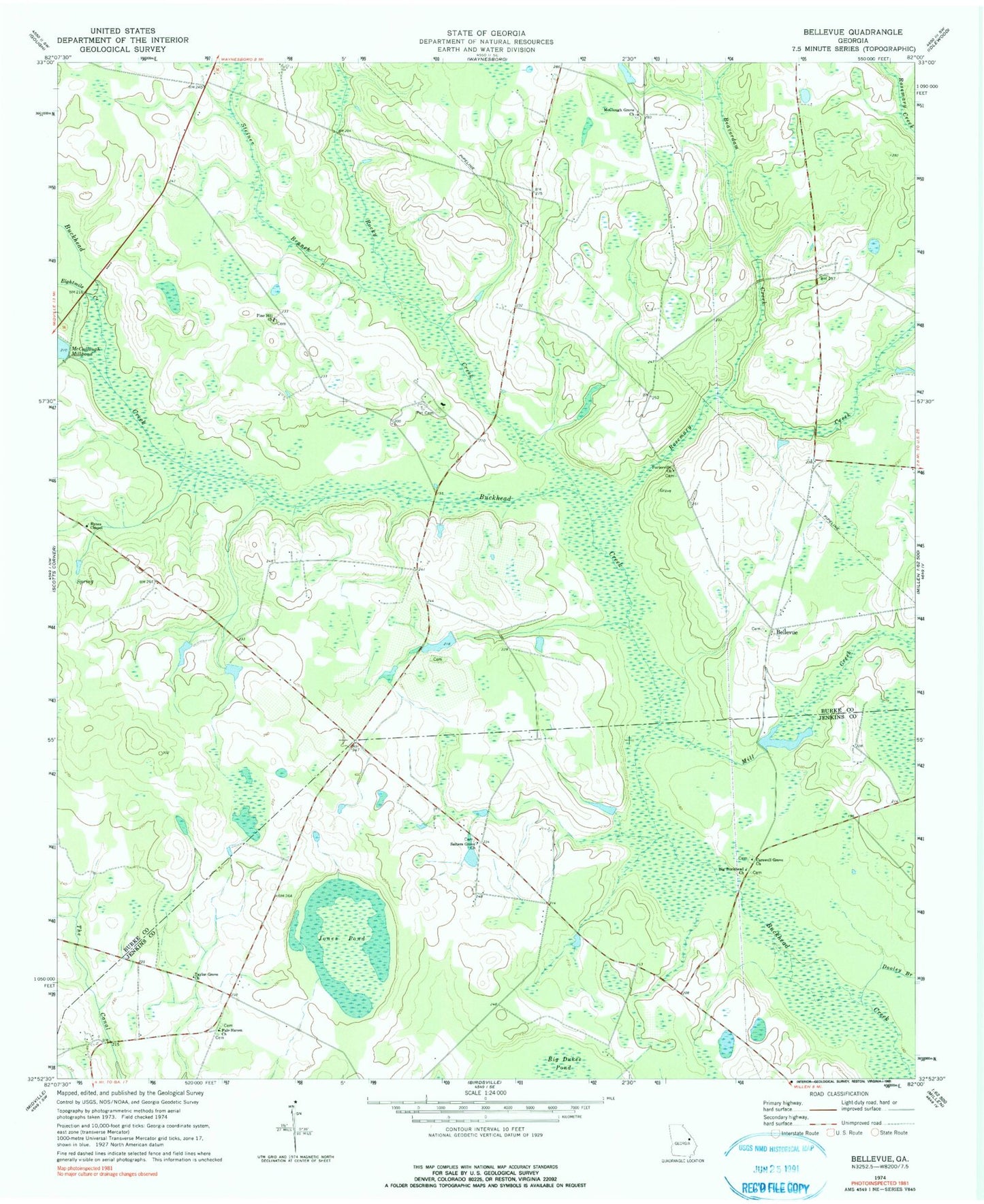
Classic USGS Bellevue Georgia 7.5'x7.5' Topo Map
Couldn't load pickup availability
Historical USGS topographic quad map of Bellevue in the state of Georgia. Map scale may vary for some years, but is generally around 1:24,000. Print size is approximately 24" x 27"
This quadrangle is in the following counties: Burke, Jenkins.
The map contains contour lines, roads, rivers, towns, and lakes. Printed on high-quality waterproof paper with UV fade-resistant inks, and shipped rolled.
Contains the following named places: Beaverdam Creek, Bellevue, Big Buckhead Baptist Church, Big Buckhead Baptist Church Cemetery, Bynes Chapel, Carswell Grove Church, Carswell Lake, Carswell Lake Dam, Days School, Dooley Branch, Eightmile Creek, Fairhaven Cemetery, Fair-Haven Church, Fairhaven School, Jones Pond, Knight Irrigation Dam Upper, Knight Lake, Knight Lake Dam, Lower Miller Lake, Lower Miller Lake Dam, McClough Grove Church, McCullough Millpond Dam, Mill Creek, Miller Lake, Miller Lake Dam, Pet Cemetery, Pine Hill Church, Porter School, Porterville Church, Rocky Creek, Rosemary Creek, Salters Grove Church, Souders Grove School, Steiner Branch, Taylor Grove Church