MyTopo
Classic USGS Bellevue Michigan 7.5'x7.5' Topo Map
Couldn't load pickup availability
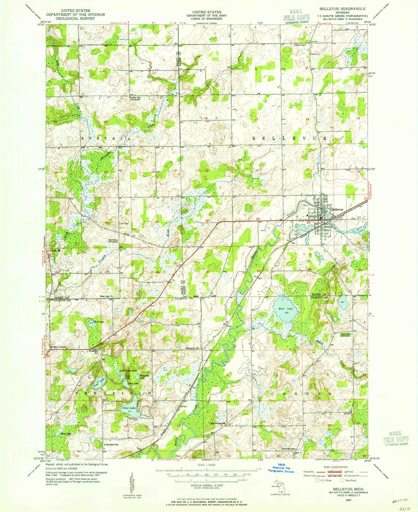
Historical USGS topographic quad map of Bellevue in the state of Michigan. Map scale may vary for some years, but is generally around 1:24,000. Print size is approximately 24" x 27"
This quadrangle is in the following counties: Barry, Calhoun, Eaton.
The map contains contour lines, roads, rivers, towns, and lakes. Printed on high-quality waterproof paper with UV fade-resistant inks, and shipped rolled.
Contains the following named places: Ackley Creek, Base Line Church, Bell Cemetery, Bellevue, Bellevue Christian Center, Bellevue Church of Christ, Bellevue Community Fire Department, Bellevue Elementary School, Bellevue First Baptist Church, Bellevue High School, Bellevue Middle School, Bellevue Mobile Home Park, Bellevue Police Department, Bellevue Post Office, Bellevue Riverside Cemetery, Bellevue Station, Bellevue Township Library, Bellevue United Methodist Church, Boughton School, Burleigh Corners, Ceylon Post Office, Charter Township of Pennfield, Clear Lake, Convis Post Office, Crooked Brook, Deep Lake, Ellis Creek, Follett Cemetery, Goose Lake, Little Goose Lake, Mud Lake, Pennfield School, Pine Lake, Saint Ann Catholic Church, Township of Bellevue, Township of Convis, Village of Bellevue, Wiegands Lake, Willis Lake, Wolf Lake, ZIP Code: 49021