MyTopo
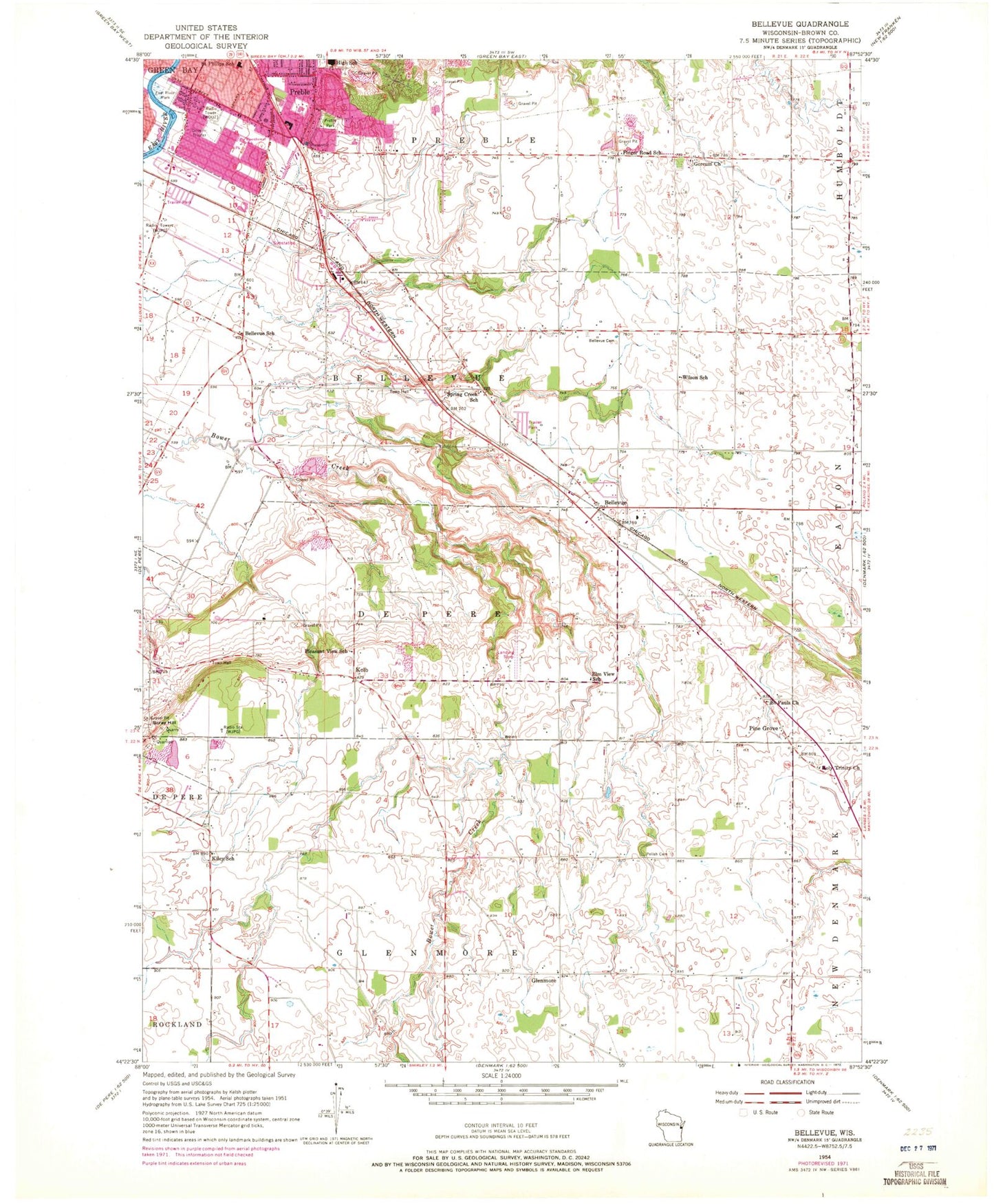
Classic USGS Bellevue Wisconsin 7.5'x7.5' Topo Map
Couldn't load pickup availability
Historical USGS topographic quad map of Bellevue in the state of Wisconsin. Map scale may vary for some years, but is generally around 1:24,000. Print size is approximately 24" x 27"
This quadrangle is in the following counties: Brown.
The map contains contour lines, roads, rivers, towns, and lakes. Printed on high-quality waterproof paper with UV fade-resistant inks, and shipped rolled.
Contains the following named places: Aurora Baycare Medical Center, Bellevue, Bellevue Cemetery, Bellevue Fire Department Station 1, Bellevue Fire Department Station 2, Bellevue School, Bellin College of Nursing, Bellin Health School of Radiologic Sciences, Brown County, Brown County Sheriff's Office, Brown County Sheriff's Office Bellevue Station, Cass Street Pumping Station, Christa McAuliffe Park, Community Church, County Rescue Services Headquarters, D and J Quarry, Donovan School, East River Park, Edison Middle School, Eisenhower Elementary School, Elm View School, Finger Road School, Fonferek Glen Natural Arch, Glenmore, Gorcum Church, Green Bay Fire Department Station 5, Hill Crest School, Kiley School, Kolb, Ledgeview Fire Department 1, Leo Scray Quarry, Martin Elementary School, Martins Aerodrome, McAuliffe Elementary School, Northeastern Wisconsin Lutheran High School, Oakdale Park, Pennings Farm, Pine Grove, Pleasant View School, Polish Cemetery, Preble, Preble Park, Prince of Peace School, Saint Bernard Catholic School, Saint Pauls Church, Saint Philips Roman Catholic Church, Saint Philips School, Scray Hill, Scray Quarry, Spring Creek School, Town of Bellevue, Town of De Pere, Town of Ledgeview, Trinity Church, Village of Bellevue, WDUZ-AM (Green Bay), Wilder Elementary School, Wilson School, WJLW-FM (De Pere), WLUK-TV (Green Bay), ZIP Code: 54311