MyTopo
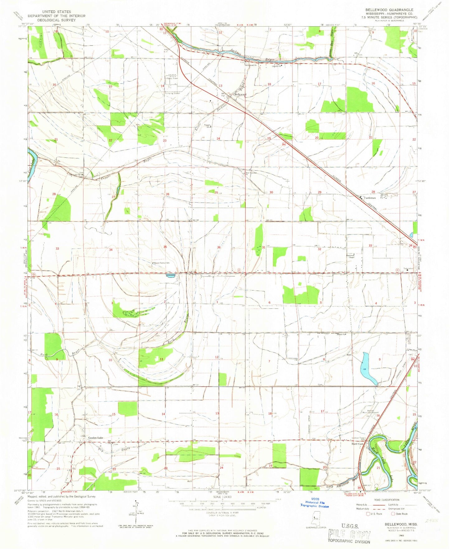
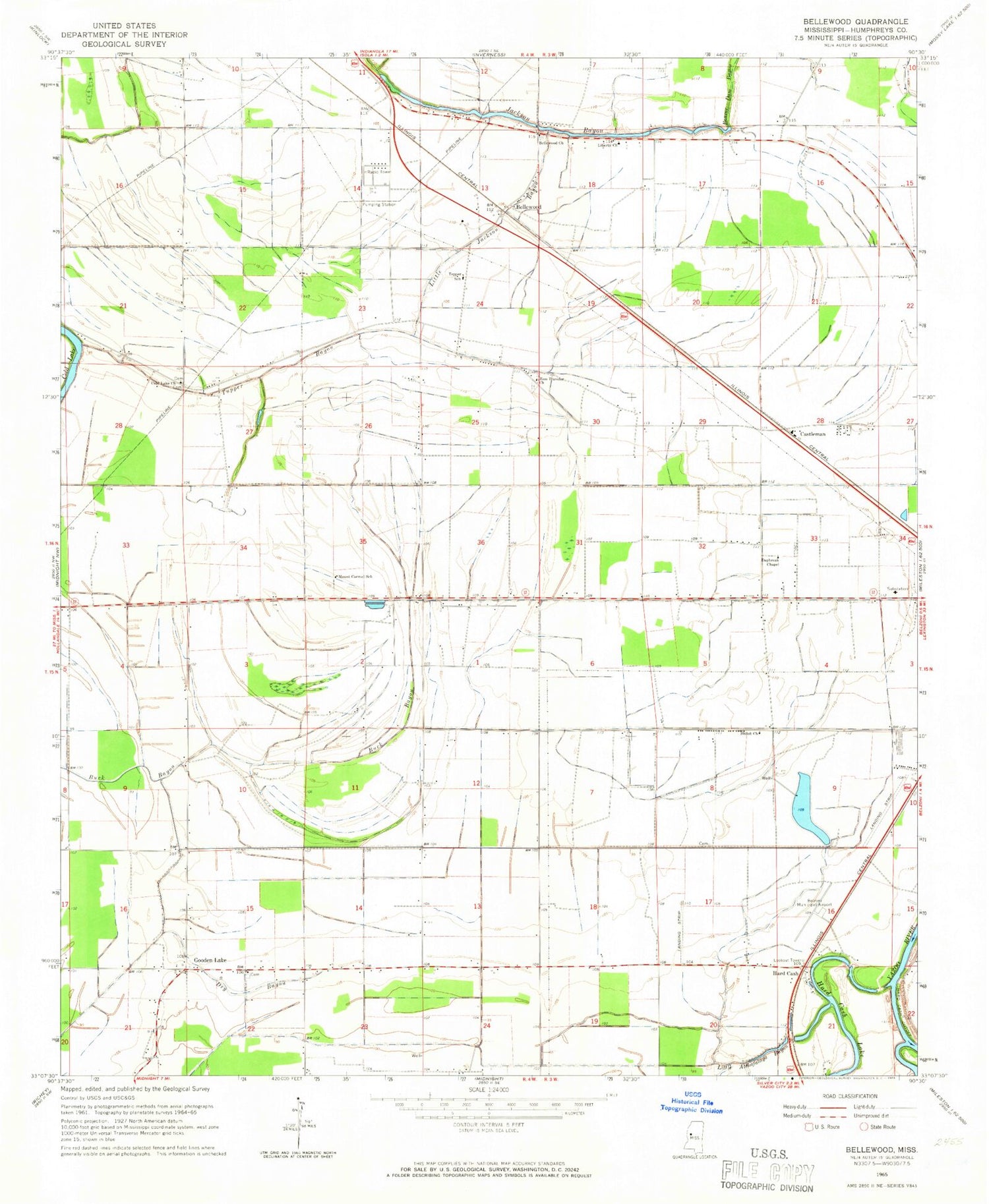
Classic USGS Bellewood Mississippi 7.5'x7.5' Topo Map
Couldn't load pickup availability
Historical USGS topographic quad map of Bellewood in the state of Mississippi. Map scale may vary for some years, but is generally around 1:24,000. Print size is approximately 24" x 27"
This quadrangle is in the following counties: Humphreys.
The map contains contour lines, roads, rivers, towns, and lakes. Printed on high-quality waterproof paper with UV fade-resistant inks, and shipped rolled.
Contains the following named places: A B Evans Lake Dam, Beautiful Zion Church, Beaver Dam Bayou, Beckwith Lake Dam, Bellewood, Bellewood Church, Belzoni Municipal Airport, Blue Sack Landing, Bridges Landing, Castleman, Cold Lake, Cold Lake Church, Cold Lake School, D E C Farms Pond Dam, Daybreak Chapel, Daybreak Plantation, Delta Company Pond Dam, Dry Bayou, Duke Lake Dam, Edward Brothers Pond Dam, Ell Chapel, Freedmans Bureau Landing, G B Mortarman Pond Dam, Goat Hill Landing, Gooden Lake, Gooden Lake Church, Gooden Lake School, H D Tharp Pond Dam, H O Tharp Dam, Hard Cash, Hard Cash Cutoff, Hard Cash Lake, Hill and Sons Lake Dam, Humphreys County, Liberty Church, Little Atchafalaya Bayou, Little Jackson Bayou, Morganza Landing, Mortimer Lake Dam, Mount Carmel Church, Mount Carmel Elementary School, Mrs S O Tharp Lake Dam, Pickell Lake Dam, R D Bearden Pond Dam, S B Thorton Lake Dam, S L Reed Lake Dam, Shady Grove Church, Shiloh Church, Springwood Landing, T W Aust Ponds Dam, Tepper Elementary School, Tharp Lake Dam, Thomas Turner Lake Dam, Tirey Lake Dam, Tupper Bayou, Turner Field, Tuscola Landing, Zion Traveler Church, ZIP Code: 38754