MyTopo
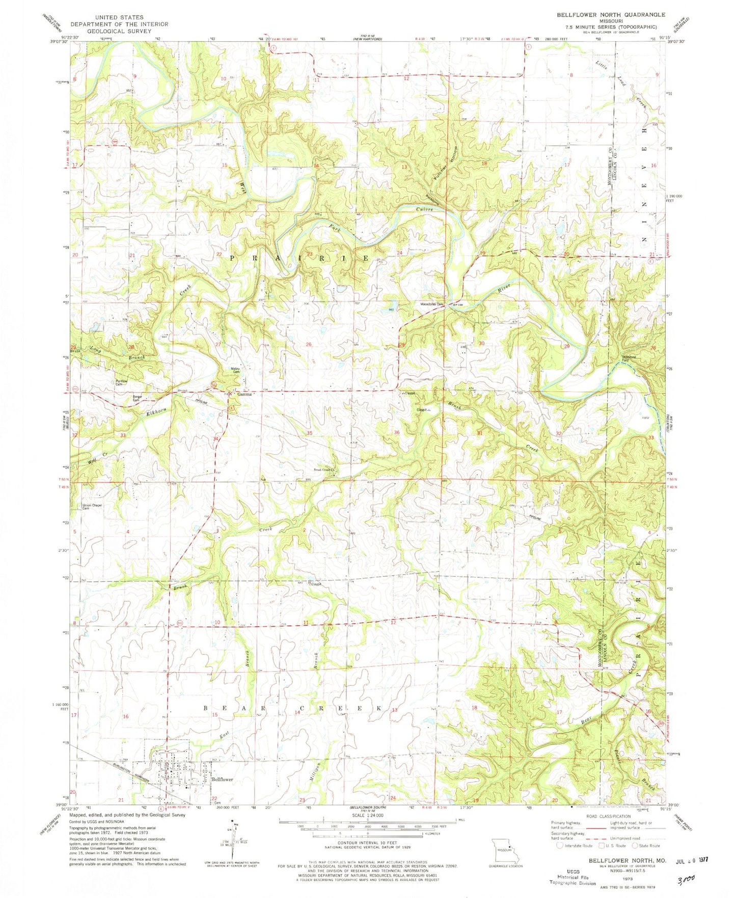
Classic USGS Bellflower North Missouri 7.5'x7.5' Topo Map
Couldn't load pickup availability
Historical USGS topographic quad map of Bellflower North in the state of Missouri. Map scale may vary for some years, but is generally around 1:24,000. Print size is approximately 24" x 27"
This quadrangle is in the following counties: Lincoln, Montgomery.
The map contains contour lines, roads, rivers, towns, and lakes. Printed on high-quality waterproof paper with UV fade-resistant inks, and shipped rolled.
Contains the following named places: Backbone, Bellflower, Bellflower Elementary School, Bellflower Post Office, Bellflower Volunteer Fire Protection District, Berger Cemetery, Brush Creek, Brush Creek Church, City of Bellflower, Dillon School, East Branch Brush Creek, Elkhorn Creek, Fulcher Hollow, Gamma, Hawkins Dam, Horeb Presbyterian Church, Lincoln School, Long Branch, Mabry Cemetery, Macedonia Cemetery, Macedonia Church, Maple Grove School, Milligan Branch, Milligan School, Mudd School, Picnic Branch, Pine Knot School, Pontlow Cemetery, Prairie Flower School, Stillhouse Ford, Township of Prairie, Union Chapel Cemetery, Walnut Grove Church, Wolf Creek, ZIP Code: 63333