MyTopo
Classic USGS Bellflower South Missouri 7.5'x7.5' Topo Map
Couldn't load pickup availability
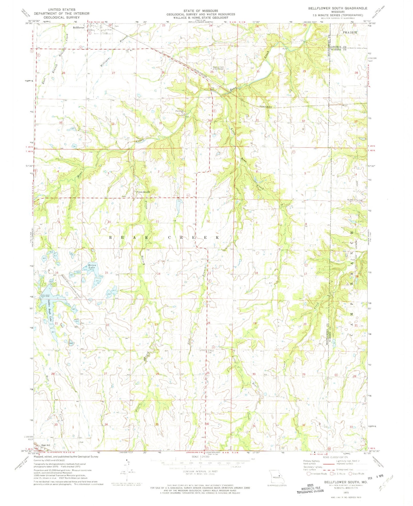
Historical USGS topographic quad map of Bellflower South in the state of Missouri. Map scale may vary for some years, but is generally around 1:24,000. Print size is approximately 24" x 27"
This quadrangle is in the following counties: Lincoln, Montgomery, Warren.
The map contains contour lines, roads, rivers, towns, and lakes. Printed on high-quality waterproof paper with UV fade-resistant inks, and shipped rolled.
Contains the following named places: Baptist Cemetery of Bellflower, Bass Lake, Bass Lake Dam, Bellflower Cemetery, Bishop Lake Dam, Cool Valley Lake Dam, Domermuth Lake Dam, Godbold Irrigation Reservoir, Godbold Reservoir Dam, Golden Eagle Lake, Golden Eagle Lake Dam, Golden Eagle Lake Dam - Upper, Heron Lake, Heron Lake Dam Lower, Heron Lake Dam Upper, Hickory Wood School, Honey Locust School, KHQA-TV (Hannibal), Little Bear Creek, Number 220 Reservoir, Oak Hall School, Pin Oak Cemetery, Pin Oak Church, Pin Oak Community, Pinoak School, Poor Branch, Prairie Light School, Prices Branch, Prices Branch Cemetery, Prices Branch Christian Church, Prices Branch School, Providence Church, Saint Paul Cemetery, Sanctuary Airport, Shelton School, Township of Bear Creek, Wells School, Winter Lake Dam, Wyatt School, ZIP Codes: 63350, 63381