MyTopo
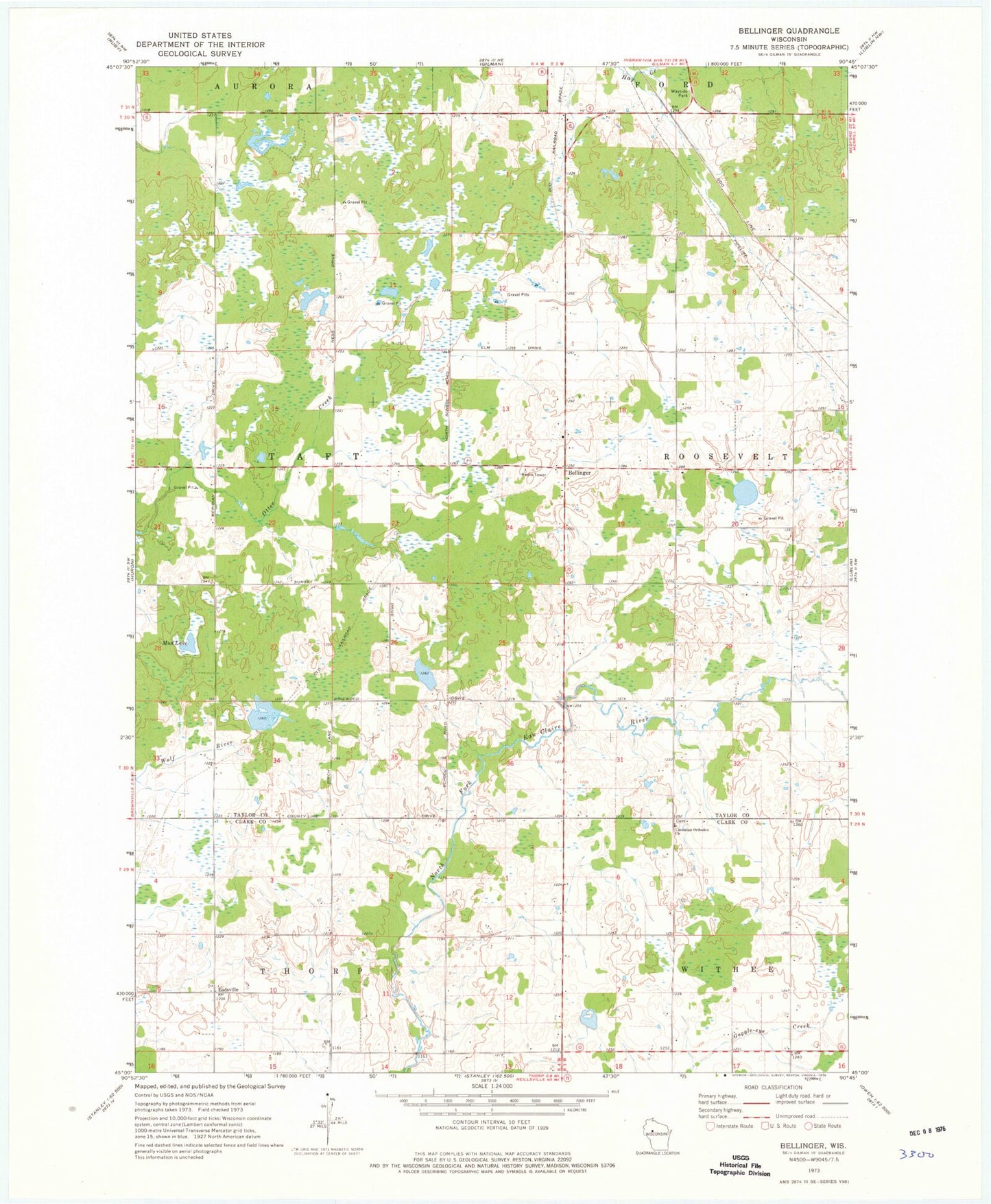
Classic USGS Bellinger Wisconsin 7.5'x7.5' Topo Map
Couldn't load pickup availability
Historical USGS topographic quad map of Bellinger in the state of Wisconsin. Map scale may vary for some years, but is generally around 1:24,000. Print size is approximately 24" x 27"
This quadrangle is in the following counties: Clark, Taylor.
The map contains contour lines, roads, rivers, towns, and lakes. Printed on high-quality waterproof paper with UV fade-resistant inks, and shipped rolled.
Contains the following named places: 1 Reservoir, Bellinger, Bellinger School, Burzynski E 5088.1 Dam, Eadsville, Euclide Wildlife Pond G1464 Dam, Field School, Mud Lake, Propst Flowage, Propst G1976 Dam, Raciborski G-5366 Dam, Red Brick School, Rosemeyer G-9498 Dam, Thorp Mennonite School, Town of Taft, Ukrainian Orthodox Church, Westland School, Yaeger School