MyTopo
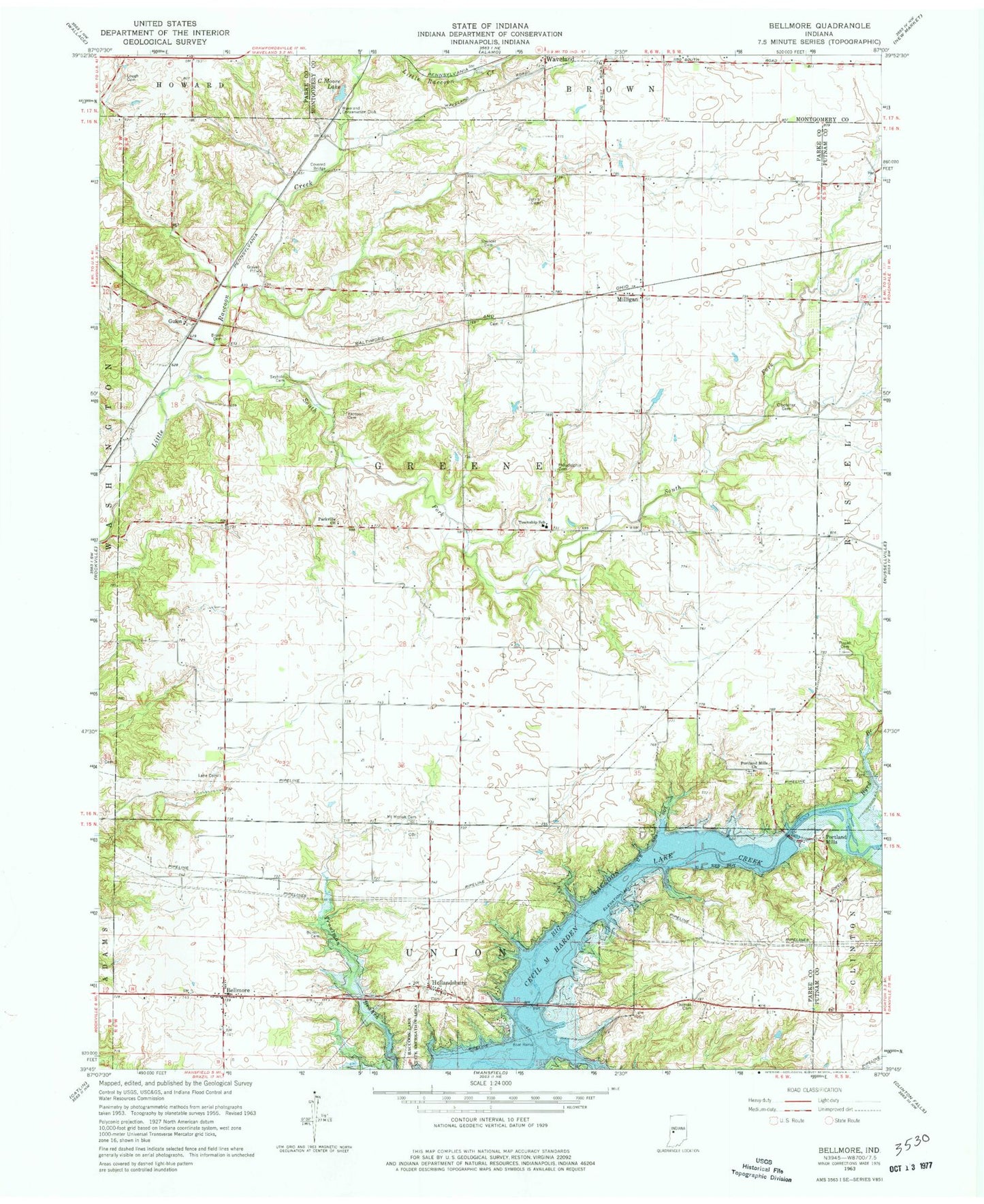
Classic USGS Bellmore Indiana 7.5'x7.5' Topo Map
Couldn't load pickup availability
Historical USGS topographic quad map of Bellmore in the state of Indiana. Typical map scale is 1:24,000, but may vary for certain years, if available. Print size: 24" x 27"
This quadrangle is in the following counties: Montgomery, Parke, Putnam.
The map contains contour lines, roads, rivers, towns, and lakes. Printed on high-quality waterproof paper with UV fade-resistant inks, and shipped rolled.
Contains the following named places: Bellmore, Black Cemetery, Bruin Cemetery, Burton Cemetery, Byrd Branch, C Moore Lake, Clodfelter Cemetery, Demeree Creek, Guion, Jarvis Smith Cemetery, Lane Cemetery, Lough Cemetery, Milligan, Mount Moriah Cemetery, Parkville Church, Philadelphia Cemetery, Pisgah Cemetery, Portland Mills, Portland Mills Church, Raccoon Cemetery, Seybold Cemetery, South Fork Little Raccoon Creek, Spencer Cemetery, Thomas Cemetery, Little Raccoon Structure Number 11, Bains Branch, Hollandsburg, Needmore (historical), Dooley Station (historical), Parkeville, Waveland Conservation Club, Township of Greene, Portland Mills Bridge, Bellmore Volunteer Fire Department, Bellmore Fire Department, Old Mount Moriah Cemetery