MyTopo
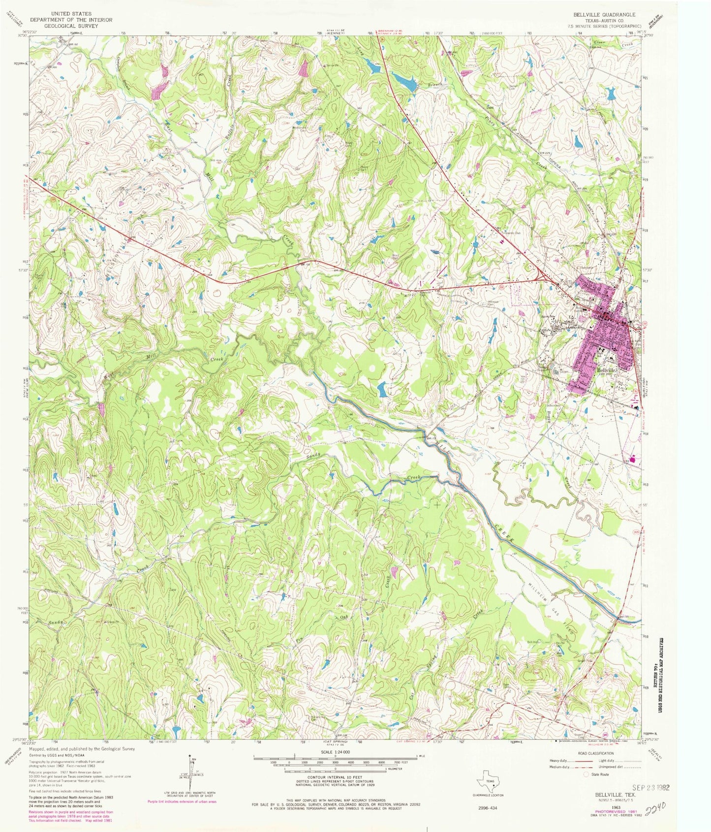
Classic USGS Bellville Texas 7.5'x7.5' Topo Map
Couldn't load pickup availability
Historical USGS topographic quad map of Bellville in the state of Texas. Map scale is 1:24000. Print size is approximately 24" x 27"
This quadrangle is in the following counties: Austin.
The map contains contour lines, roads, rivers, towns, and lakes. Printed on high-quality waterproof paper with UV fade-resistant inks, and shipped rolled.
Contains the following named places: Atkinson Cemetery, Austin County, Austin County Constable's Office Precinct 1, Austin County Constable's Office Precinct 1, Austin County Courthouse (historical), Austin County Emergency Medical Services, Austin County Jail, Austin County Jail (historical), Bellville, Bellville City Hall, Bellville High School, Bellville Junior High School, Bellville Medical Center, Bellville Police Department, Bellville Post Office, Brast Cemetery, Buffalo Creek, Burns Cemetery, Campbell Branch, Cat Spring Creek, City of Bellville, Dant, East Mill Creek, Jeff Cemetery, KACO-AM (Bellville), Keuffel Cemetery, Kollatschny Cemetery, Long Branch, Machemehl Cemetery, Mawis Lake, Mawis Lake Dam, Mewis Lake, Mewis Lake Dam, Meyer Cemetery, Millheim Gas Field, Muery Cemetery, Nelsonville Gas Field, Oak Knoll Cemetery, O'Bryant Intermediate School, O'Bryant Primary School, Old Masonic Hall, Palm Cemetery, Pin Oak Creek, Sandy Creek, Sevevin Cemetery, Spricer School, Traylor Tick Farm Airport, Ueckert Cemetery Number 2, Ward Branch, West Mill Creek