MyTopo
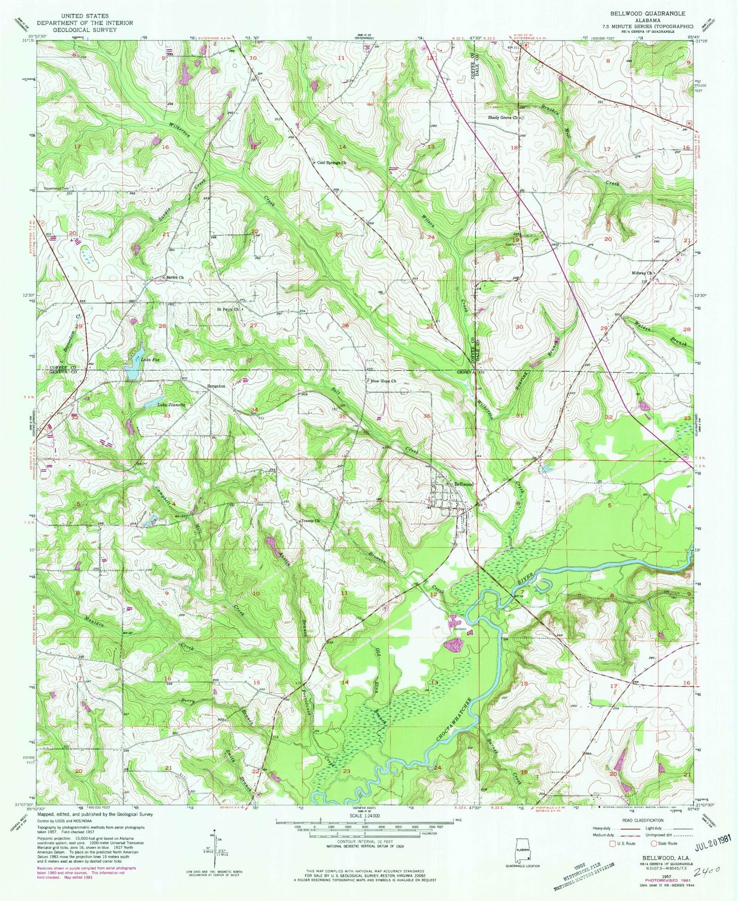
Classic USGS Bellwood Alabama 7.5'x7.5' Topo Map
Couldn't load pickup availability
Historical USGS topographic quad map of Bellwood in the state of Alabama. Map scale may vary for some years, but is generally around 1:24,000. Print size is approximately 24" x 27"
This quadrangle is in the following counties: Coffee, Dale, Geneva.
The map contains contour lines, roads, rivers, towns, and lakes. Printed on high-quality waterproof paper with UV fade-resistant inks, and shipped rolled.
Contains the following named places: Austin Branch, Barnes Creek, Bell Creek, Bells Mill Creek, Bellwood, Bellwood Cemetery, Bellwood Church, Bellwood High School, Bellwood Post Office, Bellwood Sand Plant, Bellwood Volunteer Fire Department, Berry Branch, Boiling Spring, Broxson Creek, Camp Wiregrass, Campbell Mill Creek, Consolation Cemetery, Cool Springs Baptist Church, Cool Springs Cemetery, Ed Averette Pond Dam Number One, Ed Averette Pond Number One, Frank Britt Pond, Frank Britt Pond Dam, Hillcrest Church, Hughes Lake, J A Hughes Number One Dam, J A Hughes Number Two Dam, Jimmy Henderson Pond, Jimmy Henderson Pond Dam, Lake Fox, Lake Fox Dam, Lake Jeanette, Martin Store, Mauldin Creek, Midway Church, Midway School, Mount Myrah Church, New Hope Church, Old Etna Branch, Peggy Molton Branch, Providence Creek, Roaring Branch, Saint Pauls Church, Sardis Cemetery, Sardis Creek, Sardis Methodist Church, Scranton, Shady Grove Baptist Church, Shady Grove Cemetery, Silverene Church, Thompson School, Tramp Church, Tri - Community Volunteer Fire Department Enterprise Station, Twin Lakes Fishing Lodge, Wilkerson Creek, Wilson Creek, ZIP Codes: 36313, 36316


