MyTopo
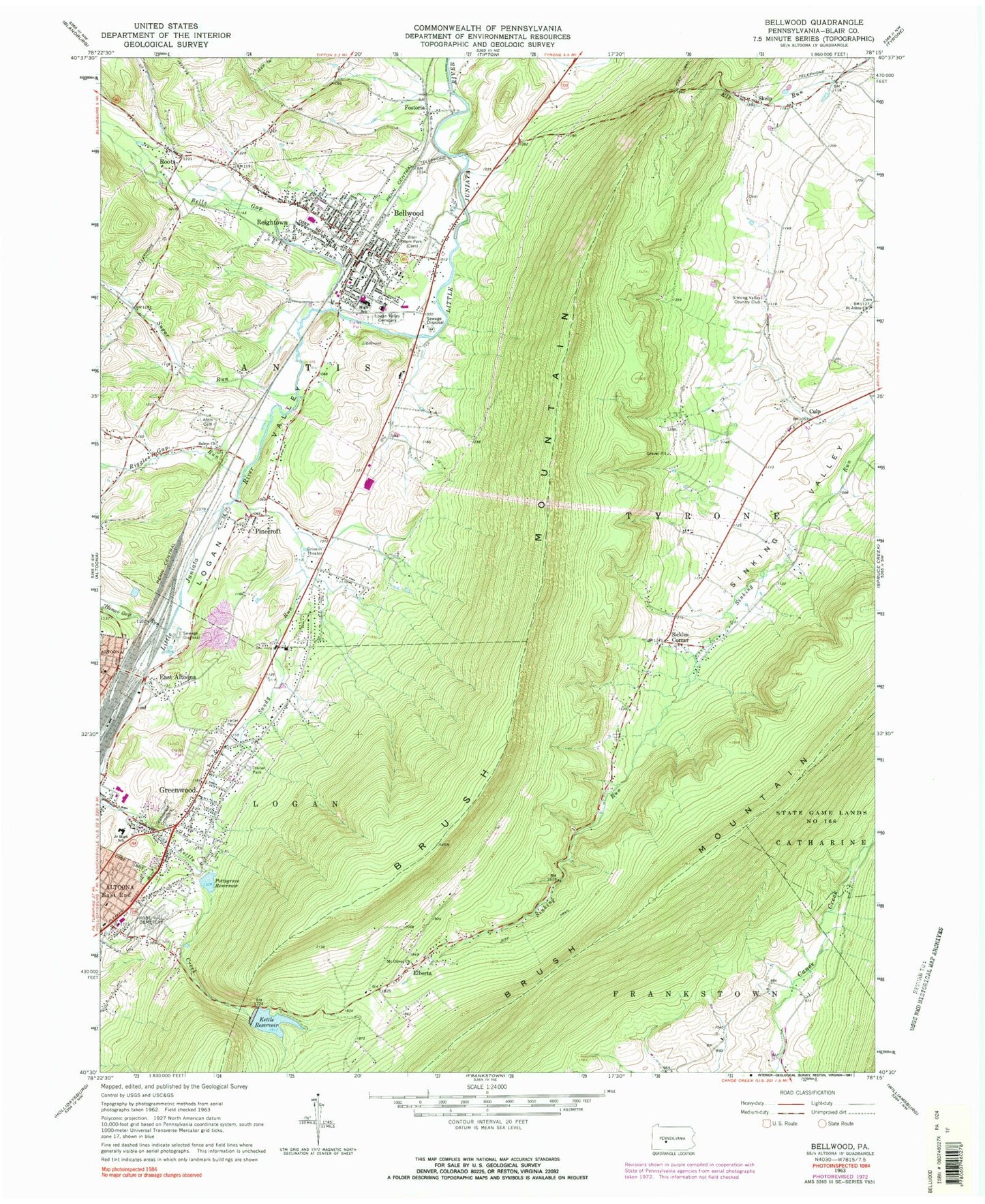
Classic USGS Bellwood Pennsylvania 7.5'x7.5' Topo Map
Couldn't load pickup availability
Historical USGS topographic quad map of Bellwood in the state of Pennsylvania. Map scale is 1:24000. Print size is approximately 24" x 27"
This quadrangle is in the following counties: Blair.
The map contains contour lines, roads, rivers, towns, and lakes. Printed on high-quality waterproof paper with UV fade-resistant inks, and shipped rolled.
Contains the following named places: Altoona Mobile Emergency Department Authority, Antis, Antis Cemetery, Beech Grove School, Bells Gap Run, Bellwood, Bellwood Antis Junior Senior High School, Bellwood Dam, Bellwood Police Department, Bellwood Post Office, Blair Memorial Park, Blair Memorial Park, Borough of Bellwood, Brush Mountain, Brush Mountain Dam, Celestine Locality, Culp, Culp Census Designated Place, East Altoona, East Altoona Census Designated Place, Elberta, Elberta Census Designated Place, Excelsior Fire Company 1 Bellwood Station 22, Fostoria, Fostoria Census Designated Place, Greenwood, Greenwood Cemetery, Greenwood Census Designated Place, Greenwood Golf Course, Greenwood Volunteer Fire Department Station 16, Homer Gap Run, Huntchinsons, Kettle Reservoir, Lewis M Myers Elementary School, Logan Valley, Logan Valley Cemetery, Moore School, Mount Olivet Church, Oak Grove School, Pinecroft, Pinecroft Census Designated Place, Pinecroft Volunteer Fire Company Station 23, Pottsgrove Dam, Pottsgrove Reservoir (historical), Reightown, Reightown Census Designated Place, Riggles Gap Run, Roots, Roots Census Designated Place, Rose Hill Cemetery, Sabbath Rest School, Saint Johns Church, Salem Church, Sandy Run, School Number 1 (historical), Sickles Corner, Sickles Corner Census Designated Place, Sinking Valley Country Club, Sinking Valley Lead Zinc Mines, Sinking Valley Volunteer Fire Company Station 24, Skelp, Skelp Census Designated Place, Sugar Run, Township of Antis, Township of Tyrone