MyTopo
USGS Classic Belmont Indiana 7.5'x7.5' Topo Map
Couldn't load pickup availability
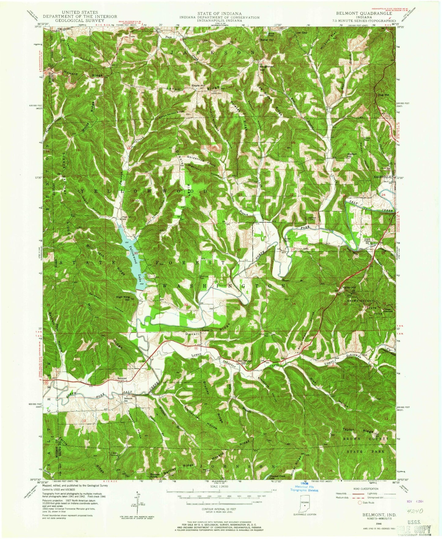
Historical USGS topographic quad map of Belmont in the state of Indiana. Scale: 1:24000. Print size: 24" x 27"
This quadrangle is in the following counties: Brown, Monroe.
The map contains contour lines, roads, rivers, towns, lakes, and grids including latitude / longitude and UTM / MGRS. Printed on high-quality waterproof paper with UV fade-resistant inks.
Contains the following named places: Annandale Estates, Baker Hill, Bartlett Hollow, Bartley Ridge, Baughman Hill, Belmont, Bill Jack Ridge, Bradley Ridge, Bucker Knob, Caldwell Hollow, Davis Branch, Dry Branch, Dubois Ridge, Dug Hill, Duncan Church, Duvall Ridge, East Branch Owl Creek, Ferris Ridge, Gold Well Hollow, Goldenrod Point, Graveyard Hollow, Green Valley Creek, Harden Hollow, Hickory Flat, Hickory Hill Cemetery, High King Hill, Hobbs Hollow, Honeycut Hollow, House Branch, Howard Ridge, Jackson Branch, John Floyd Hollow, Kelley Hill, Kleindorfer Hollow, Lanam, Lee Brown Ridge, Lick Creek, Low Gap, Lower Schooner Creek, Maple Hill, Mill Ridge, Mossop Ridge, Nashville, Oak Grove Church, Owl Creek, Pattys Garden Ridge, Pine Bluff, Polecat Ridge, Possum Hollow, Scarce of Fat Ridge, Sciscoe Branch, Sol Pogue Hollow, Somerset Lake, South View Cemetery, TC Steele State Memorial, Upper Schooner Creek, Watton Hill, West Branch Owl Creek, West Overlook, White Ridge, Wise Hollow, Wolfpen Branch, Yellowwood Lake, Berry Farm Lake Dam, Somerset Lake Dam, Annandale Estates Lake Dam, Annandale Estates Lake, Reverand Frame Lake Dam, Reverand Frame Lake, Sugarcamp Hollow, Yellowwood State Forest, Oak Farm Post Office (historical), Township of Washington, Lanam Ridge Cemetery