
MyTopo
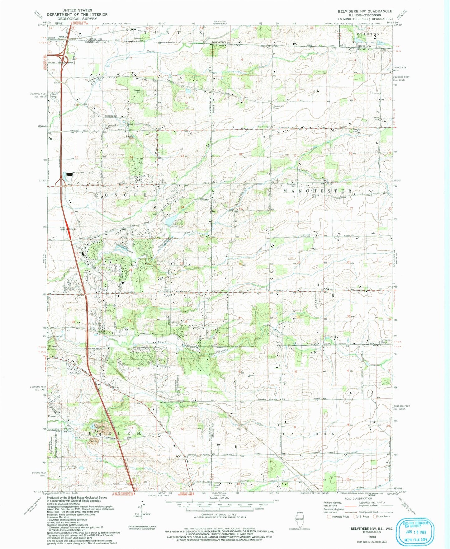
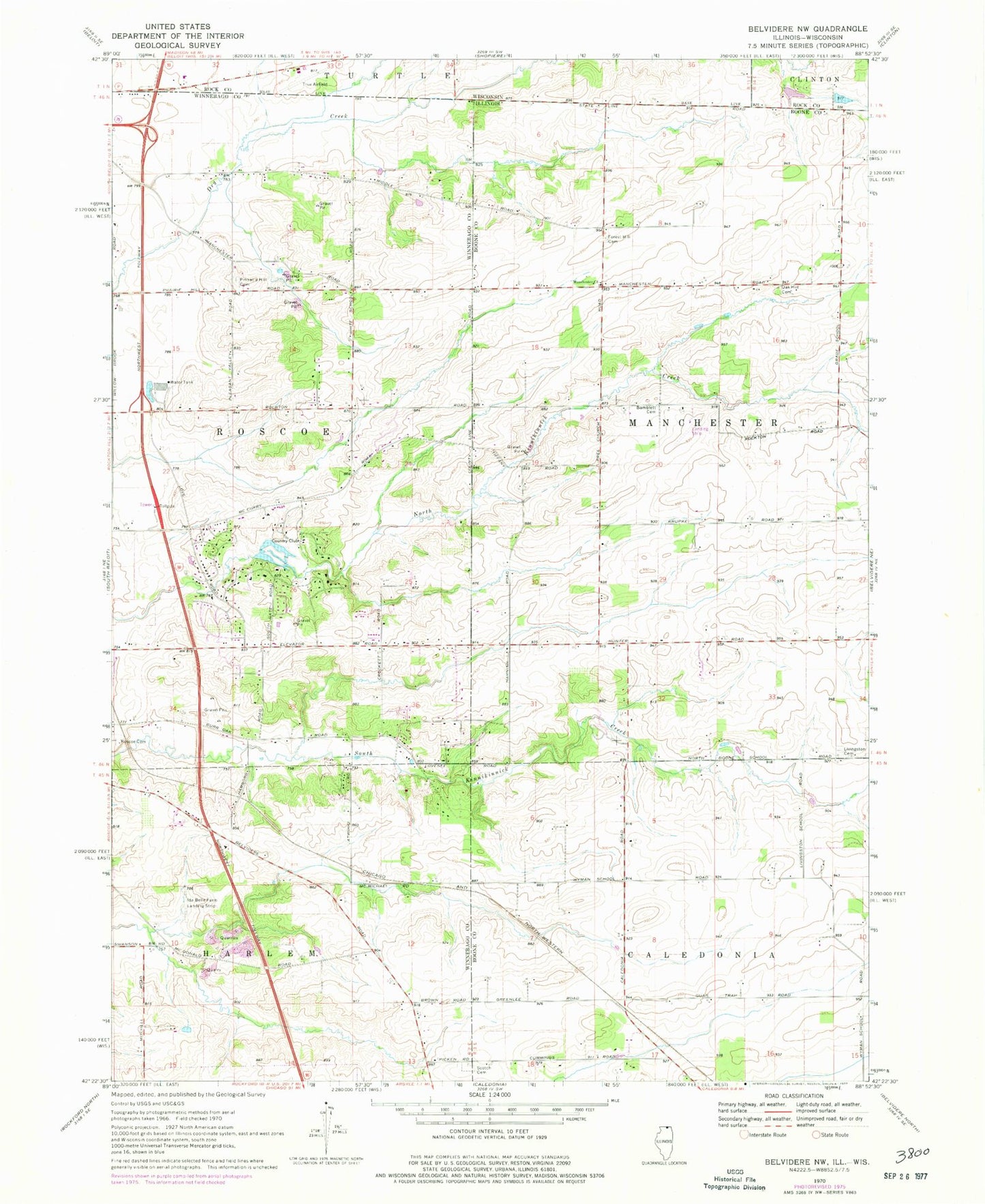
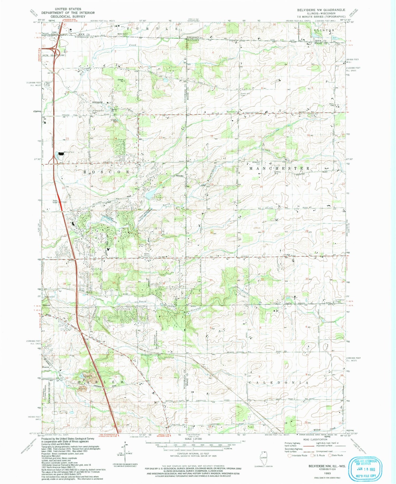
Classic USGS Belvidere NW Illinois 7.5'x7.5' Topo Map
Couldn't load pickup availability
Historical USGS topographic quad map of Belvidere NW in the states of Illinois, Wisconsin. Map scale may vary for some years, but is generally around 1:24,000. Print size is approximately 24" x 27"
This quadrangle is in the following counties: Boone, Rock, Winnebago.
The map contains contour lines, roads, rivers, towns, and lakes. Printed on high-quality waterproof paper with UV fade-resistant inks, and shipped rolled.
Contains the following named places: Bamblett Cemetery, Bamblett School, Beloit Airport, Booth School, Brown School, Burroak School, Clayton Andrews County Forest Preserve, Compass Rose Airport, Cummings School, Fish School, Forest Hill Cemetery, Gray School, Hayward School, Hunter Post Office, Kinnikinnick Creek Nature Preserve, Ledgewood School, Lee Creek Airport, Livingston Cemetery, Livingston School, Manchester Church, McCurdy Strip, Nichol School, Oak Hill Cemetery, Pinnacle Hill Cemetery, Porter Quarry, Red Brick School, Roland Olson County Forest Preserve, Roscoe Cemetery, Roscoe Quarry, Scottish Cemetery, Shaw School, Stagecoach Hills, The Ledges County Forest Preserve, Township of Manchester, Township of Roscoe, White School, Wyman School, ZIP Codes: 61011, 61073, 61080