MyTopo
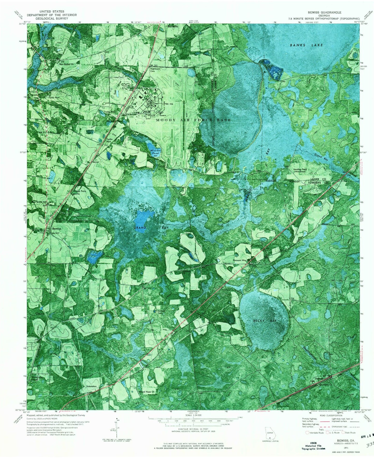
Classic USGS Bemiss Georgia 7.5'x7.5' Topo Map
Couldn't load pickup availability
Historical USGS topographic quad map of Bemiss in the state of Georgia. Map scale may vary for some years, but is generally around 1:24,000. Print size is approximately 24" x 27"
This quadrangle is in the following counties: Lanier, Lowndes.
The map contains contour lines, roads, rivers, towns, and lakes. Printed on high-quality waterproof paper with UV fade-resistant inks, and shipped rolled.
Contains the following named places: Academy Acres, Antioch Cemetery, Antioch Church, Barretts Division, Becky Bay, Bemiss, Bemiss Barretts Volunteer Fire Department Station 5, Bemiss Census Designated Place, Bethel Cemetery, Cat Creek Church, Chapman, Delmar, Good Hope Church, Grand Bay, Grand Bay Public Hunting Area, Hightower Cemetery, Knight Academy, Mallory Field, Mission Pond, Moody Air Force Base, Moody Air Force Base Census Designated Place, Moody Contract Postal Unit, Mount Vienna Cemetery, Mount Vienna Church, New Bethel Church, Pearl Todd Baptist Church, Pine Grove Elementary School, Pine Grove Primary School, Pine Grove School, Pleasant Way Church, Saint Marks Church, Seaford, Washington Chapel, ZIP Codes: 31605, 31699