MyTopo
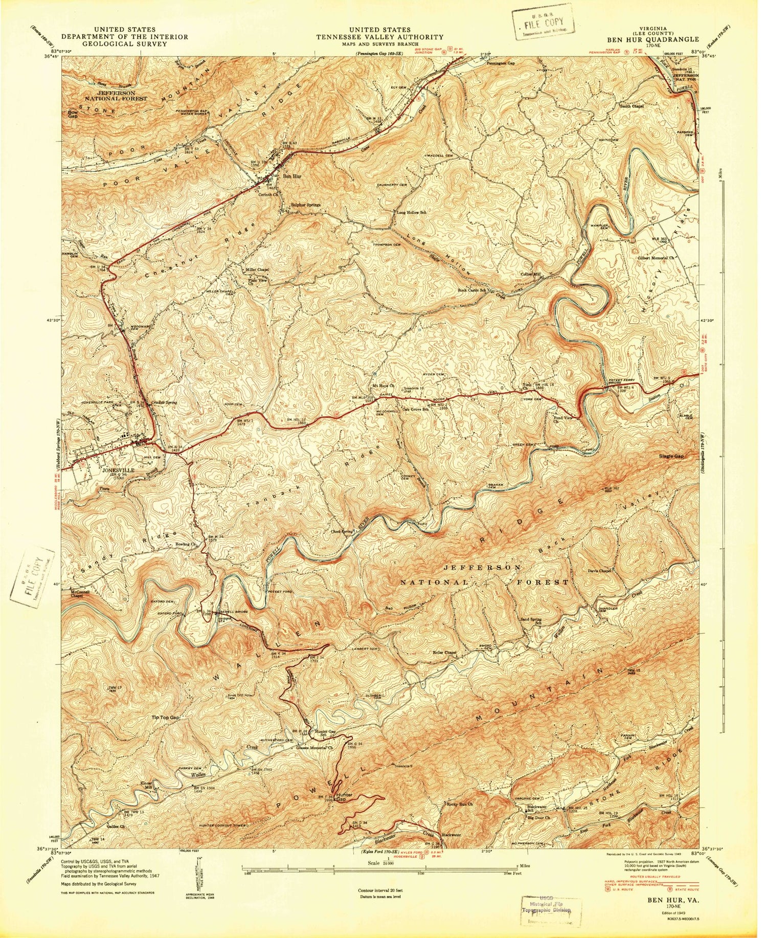
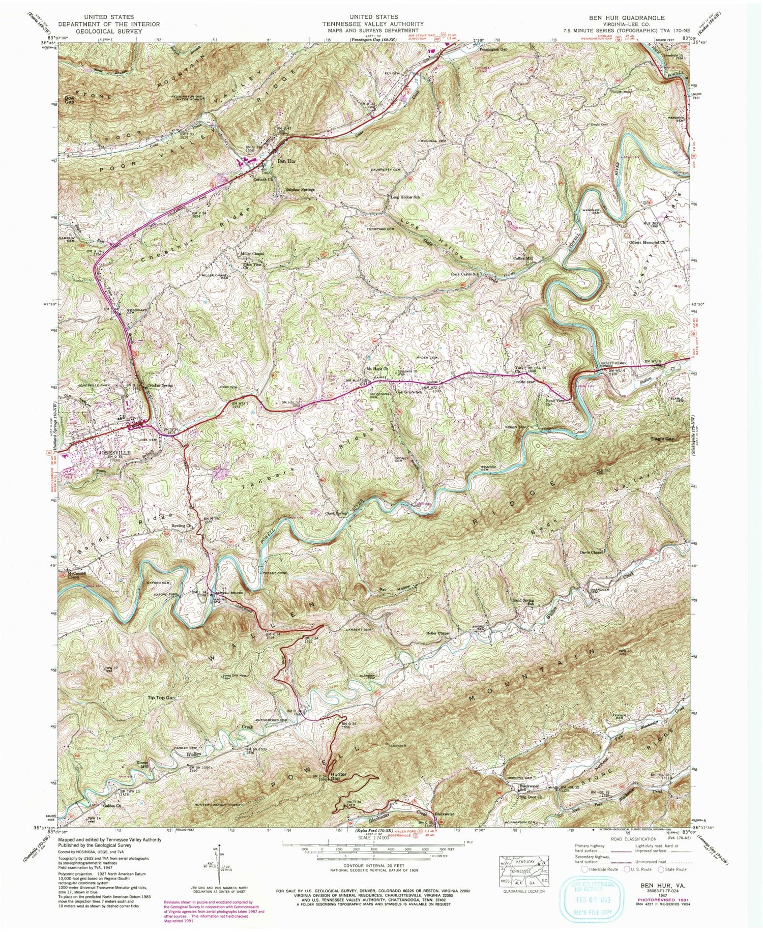
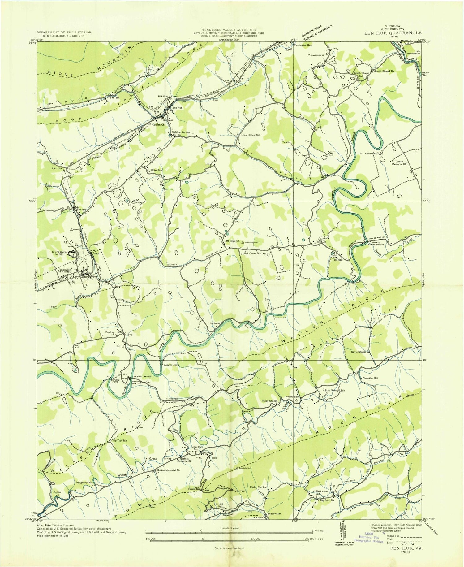
Classic USGS Ben Hur Virginia 7.5'x7.5' Topo Map
Couldn't load pickup availability
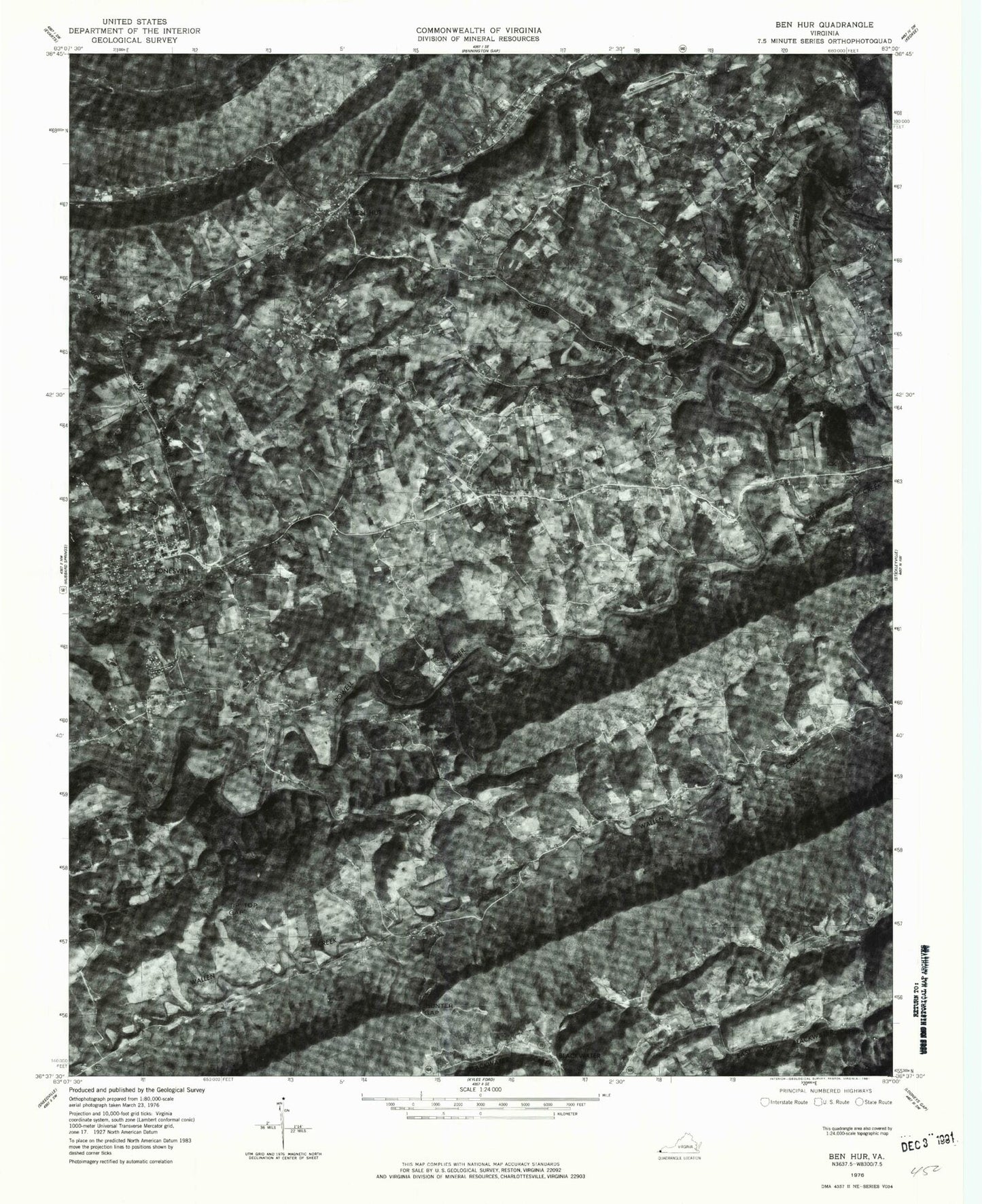
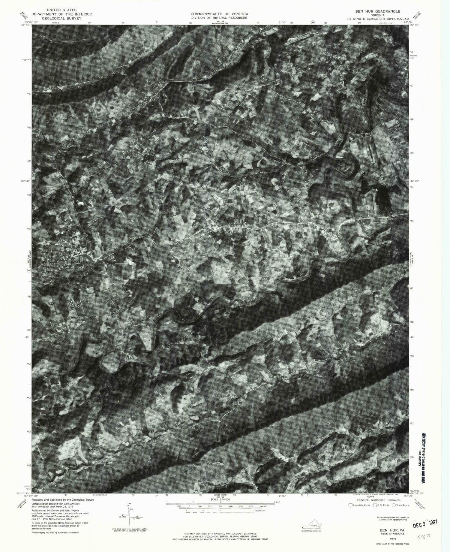
Historical USGS topographic quad map of Ben Hur in the states of Virginia, Maryland. Map scale is 1:24000. Print size is approximately 24" x 27"
This quadrangle is in the following counties: Lee.
The map contains contour lines, roads, rivers, towns, and lakes. Printed on high-quality waterproof paper with UV fade-resistant inks, and shipped rolled.
Contains the following named places: Back Valley, Back Valley, Back Valley, Ball Hollow, Ball Hollow, Ball Hollow, Ben Hur, Ben Hur, Ben Hur, Ben Hur Post Office, Ben Hur Post Office, Big Door Church, Big Door Church, Big Door Church, Blackwater, Blackwater, Blackwater Post Office, Blackwater Post Office, Blackwater School, Blackwater School, Blackwater School, Blackwater Volunteer Fire Company, Blackwater Volunteer Fire Company, Bow Gap, Bow Gap, Bow Gap, Bowling Church, Bowling Church, Bowling Church, Chandler Cemetery, Chandler Cemetery, Chandler Cemetery, Cheek Spring, Cheek Spring, Cheek Spring, Chestnut Ridge, Chestnut Ridge, Chestnut Ridge, Collier Mill, Collier Mill, Cooney Cemetery, Cooney Cemetery, Cooney Cemetery, Corinth Church, Corinth Church, Corinth Church, Crockett Spring, Crockett Spring, Crockett Spring, Daugherty Cemetery, Daugherty Cemetery, Daugherty Cemetery, Davis Chapel, Davis Chapel, Davis Chapel, District 3, District 3, Ely Cemetery, Ely Cemetery, Ely Cemetery, Fannin Cemetery, Fannin Cemetery, Fannin Cemetery, First Baptist Church, First Baptist Church, First Methodist Church, First Methodist Church, Galilee Church, Galilee Church, Galilee Church, Gilbert Memorial Church, Gilbert Memorial Church, Gilbert Memorial Church, Glasses Memorial Church (historical), Glasses Memorial Church (historical), Graham Cemetery, Graham Cemetery, Graham Cemetery, Green Cemetery, Green Cemetery, Green Cemetery, Hamblin Cemetery, Hamblin Cemetery, Hamblin Cemetery, Hickory Flats, Hickory Flats, Hill Cemetery, Hill Cemetery, Horton Memorial Church (historical), Horton Memorial Church (historical), Hunter Gap, Hunter Gap, Hunter Gap School (historical), Hunter Gap School (historical), Hunter Lookout Tower, Hunter Lookout Tower, Hyden Cemetery, Hyden Cemetery, Jonesville, Jonesville, Jonesville District (historical), Jonesville District (historical), Jonesville Middle School, Jonesville Middle School, Jonesville Park, Jonesville Park, Jonesville Police Department, Jonesville Police Department, Jonesville Post Office, Jonesville Post Office, Jonesville Volunteer Fire Department, Jonesville Volunteer Fire Department, Kincer Mill, Kincer Mill, Lambert Cemetery, Lambert Cemetery, Laurel Branch, Laurel Branch, Lee County Career and Technical Center, Lee County Career and Technical Center, Lee County Courthouse, Lee County Courthouse, Lee County Sheriff's Office, Lee County Sheriff's Office, Lee High School, Lee High School, Lee Memorial Gardens, Lee Memorial Gardens, Lee Regional Medical Center, Lee Regional Medical Center, Long Hollow, Long Hollow, Long Hollow School, Long Hollow School, McConnell Cemetery, McConnell Cemetery, McConnell Chapel, McConnell Chapel, McPherson Cemetery, McPherson Cemetery, Miller Chapel, Miller Chapel, Miller Chapel Cemetery, Miller Chapel Cemetery, Miller School (historical), Miller School (historical), Mount Hope Church, Mount Hope Church, Northeast Fork Blackwater Creek, Northeast Fork Blackwater Creek, Oak Grove School, Oak Grove School, Olinger Cemetery, Olinger Cemetery, Osborne Cemetery, Osborne Cemetery, Oxford Cemetery, Oxford Cemetery, Oxford Ford, Oxford Ford, Parkey Cemetery, Parkey Cemetery, Parsons Cemetery, Parsons Cemetery, Plain View Church, Plain View Church, Pond View Church, Pond View Church, Poteet Ferry Bridge, Poteet Ferry Bridge, Poteet Ford, Poteet Ford, Queen Anne Hillsboro Volunteer Fire Company Station 80, Queen Anne Hillsboro Volunteer Fire Company Station 80, Rock Castle School, Rock Castle School, Rocky Run School (historical), Rocky Run School (historical), Roller Chapel, Roller Chapel, Roop Cemetery, Roop Cemetery, Rutherford Cemetery, Rutherford Cemetery, Sand Spring School, Sand Spring School, Sandy Ridge, Sandy Ridge, Sewell Bridge, Sewell Bridge, Shafer Creek, Shafer Creek, Slagle Cemetery, Slagle Cemetery, Slagle Gap, Slagle Gap, Smith Cemetery, Smith Cemetery, Smith Chapel, Smith Chapel, Station Creek, Station Creek, Sulphur Springs, Sulphur Springs, Sword Cemetery, Sword Cemetery, Tanbark Ridge, Tanbark Ridge, Thompson Cemetery, Thompson Cemetery, Tip Top Gap, Tip Top Gap, Tip Top School (historical), Tip Top School (historical), Town of Jonesville, Town of Jonesville, United States Penitentiary Lee, United States Penitentiary Lee, Waddell Cemetery, Waddell Cemetery, Wallen Ridge, Wallen Ridge, Wampler Cemetery, Wampler Cemetery, Woodward Cemetery, Woodward Cemetery, WSWV-AM (Pennington Gap), WSWV-AM (Pennington Gap), WSWV-FM (Pennington Gap), WSWV-FM (Pennington Gap), York Cemetery, York Cemetery, York Church, York Church, York School (historical), York School (historical)