MyTopo
Classic USGS Ben Lomond Arkansas 7.5'x7.5' Topo Map
Couldn't load pickup availability
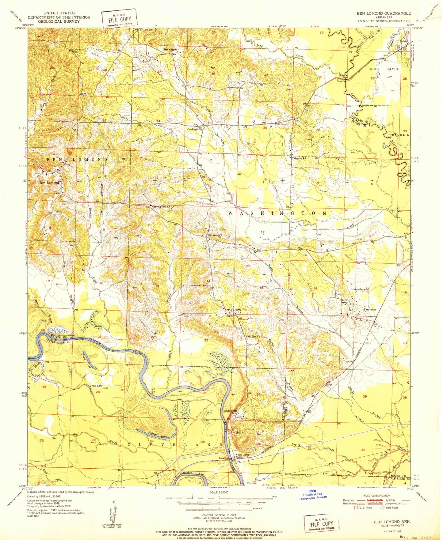
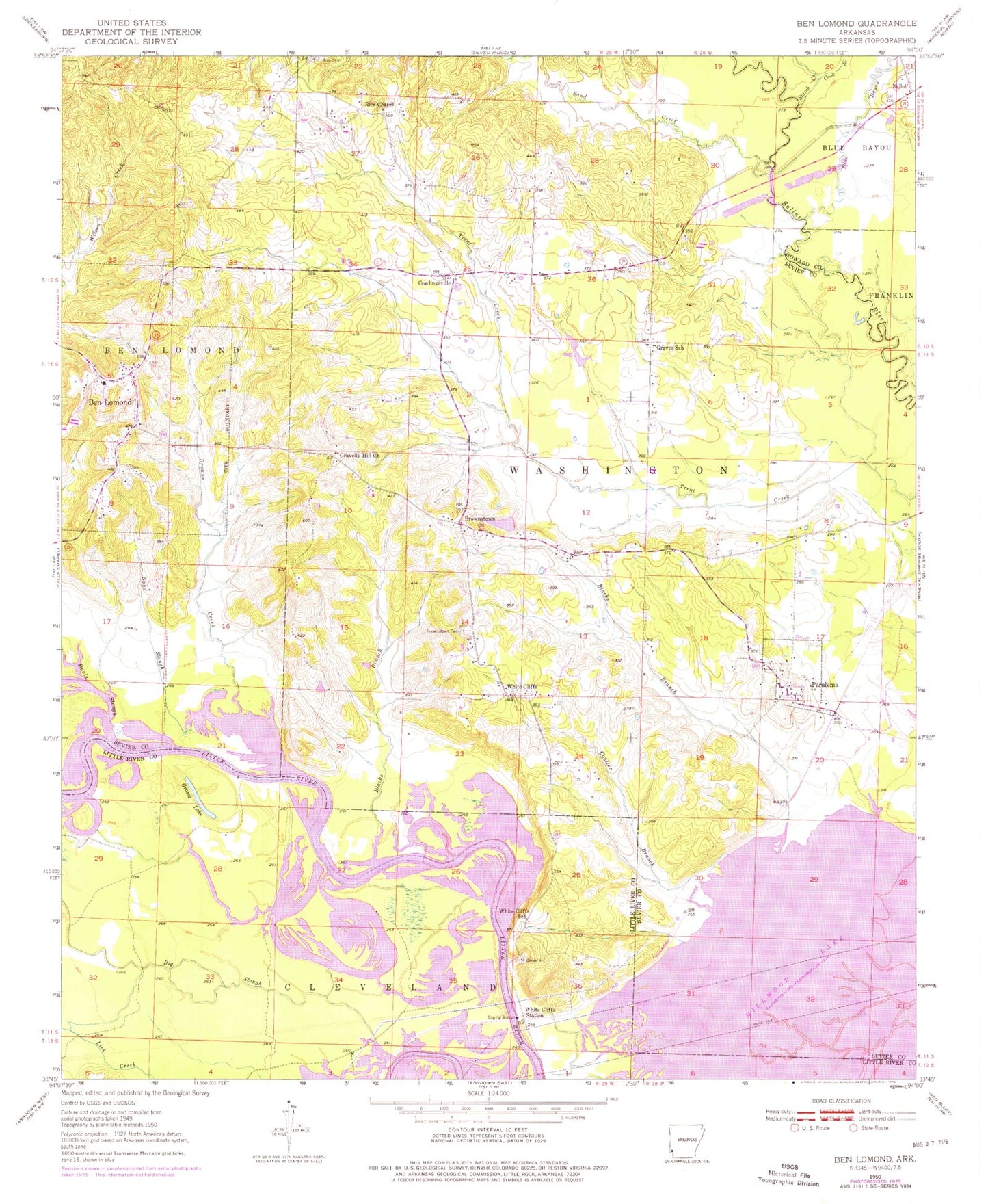
Historical USGS topographic quad map of Ben Lomond in the state of Arkansas. Map scale may vary for some years, but is generally around 1:24,000. Print size is approximately 24" x 27"
This quadrangle is in the following counties: Howard, Little River, Sevier.
The map contains contour lines, roads, rivers, towns, and lakes. Printed on high-quality waterproof paper with UV fade-resistant inks, and shipped rolled.
Contains the following named places: Ben Lomond, Ben Lomond Cemetery, Ben Lomond Post Office, Ben Lomond Volunteer Fire Department, Big Slough, Blacks Branch, Blue Bayou, Browns Creek, Brownstown, Brownstown Cemetery, Brownstown Community Church, Cook Branch, Cornhill, Corns Bridge, Coulter Branch, Cowlingsville, Davis Slough, Grassy Lake, Gravelly Hill Church, Graves School, Lake Hospitality, Lake Hospitality Dam, Paraloma, Parloma Landing, Sand Creek, Sand Slough, Shiloh, Starch Creek, Town of Ben Lomond, Township of Ben Lomond, Township of Washington, Trout Lake, White Cliffs, White Cliffs Public Use Area, White Cliffs School, White Cliffs Station, Wrights Chapel, Wrights Chapel Cemetery, ZIP Code: 71823