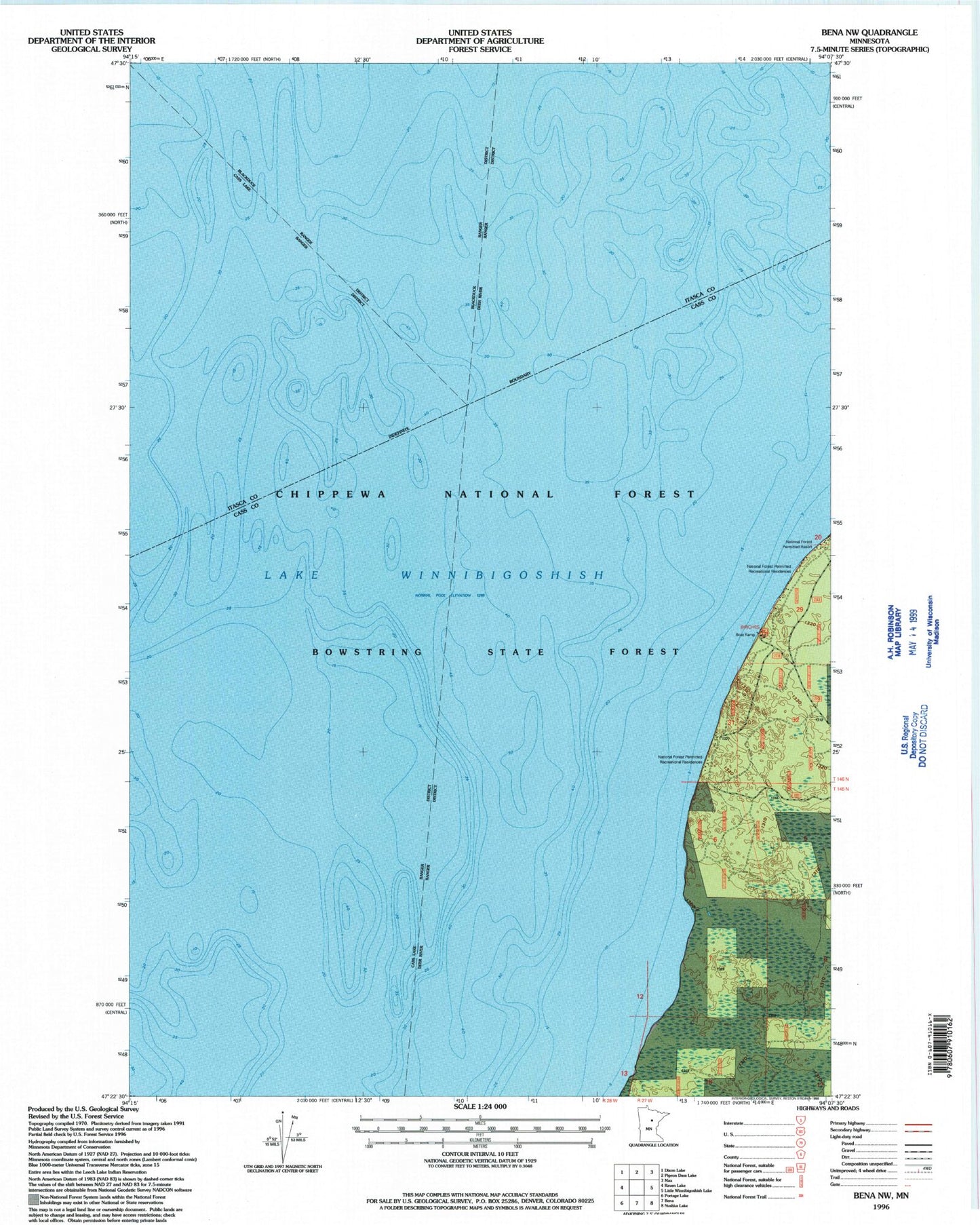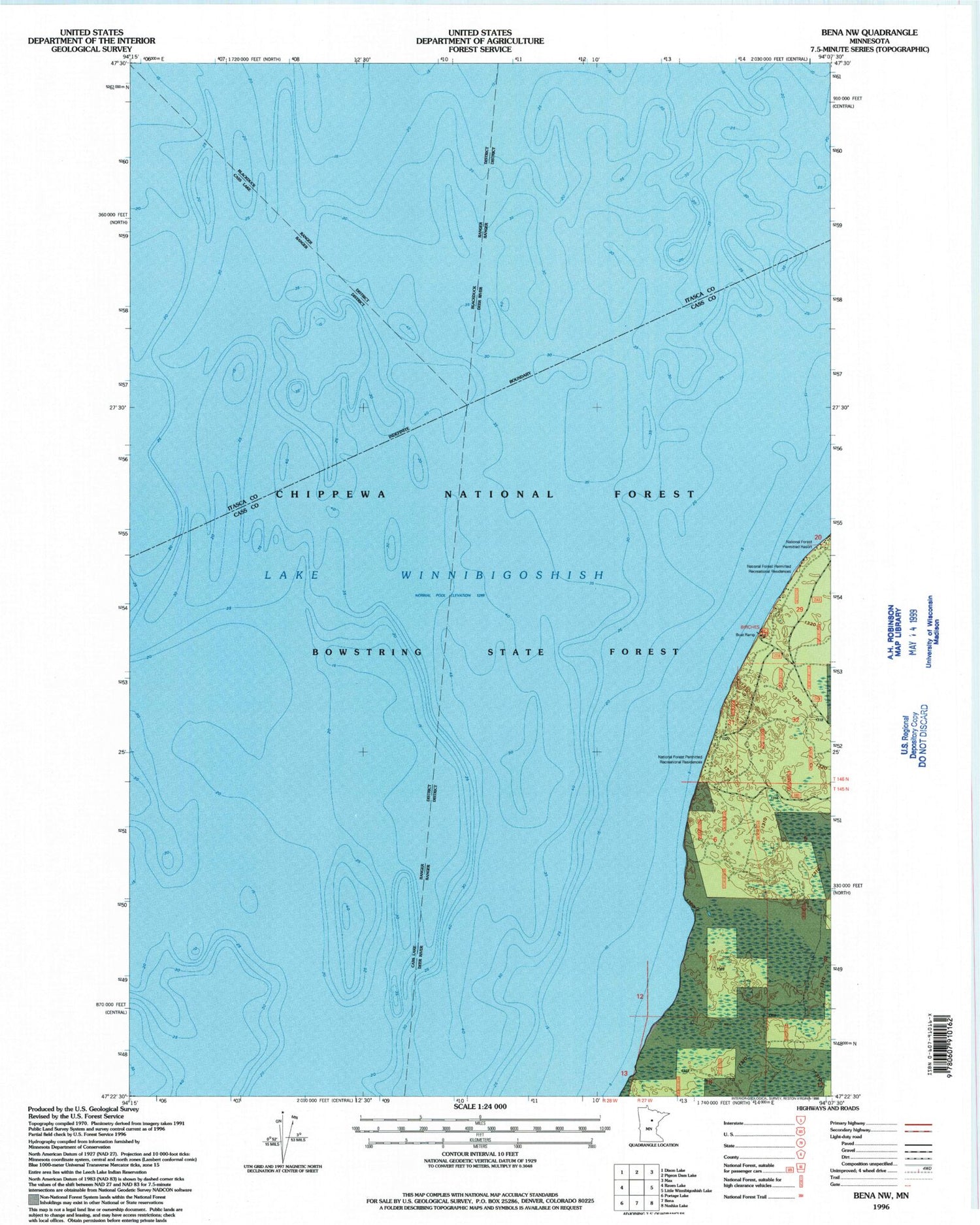
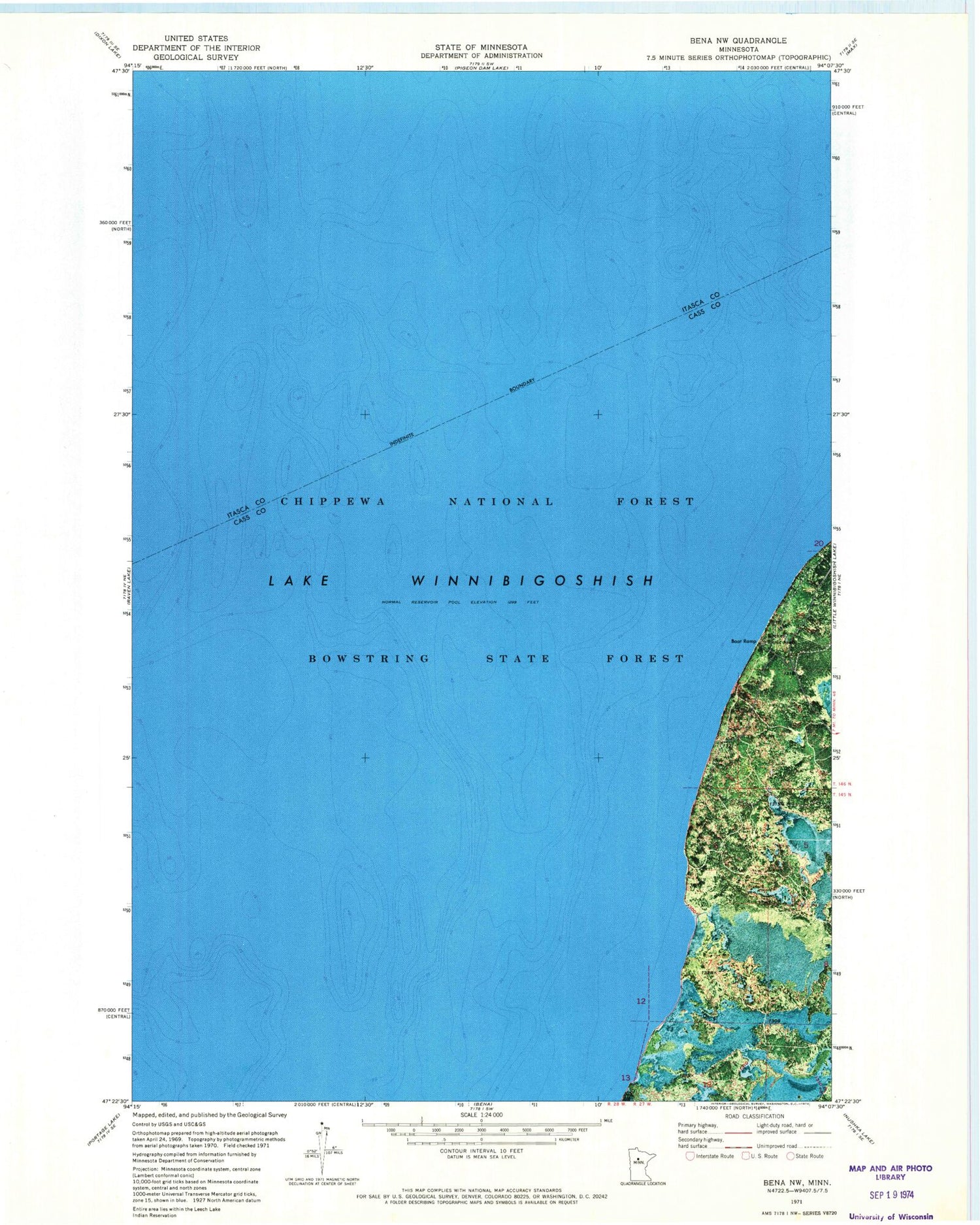
MyTopo
Classic USGS Bena NW Minnesota 7.5'x7.5' Topo Map
Regular price
$16.95
Regular price
Sale price
$16.95
Unit price
per
Couldn't load pickup availability
Historical USGS topographic quad map of Bena NW in the state of Minnesota. Map scale may vary for some years, but is generally around 1:24,000. Print size is approximately 24" x 27"
This quadrangle is in the following counties: Cass, Itasca.
The map contains contour lines, roads, rivers, towns, and lakes. Printed on high-quality waterproof paper with UV fade-resistant inks, and shipped rolled.
Contains the following named places: Birches Picnic Area, Chippewa National Forest, Highbanks Recreation Residences, Lake Winnibigoshish, South Highbanks Recreation Residences, South Highbanks Trail System, Unorganized Territory of Bowstring Lake