MyTopo
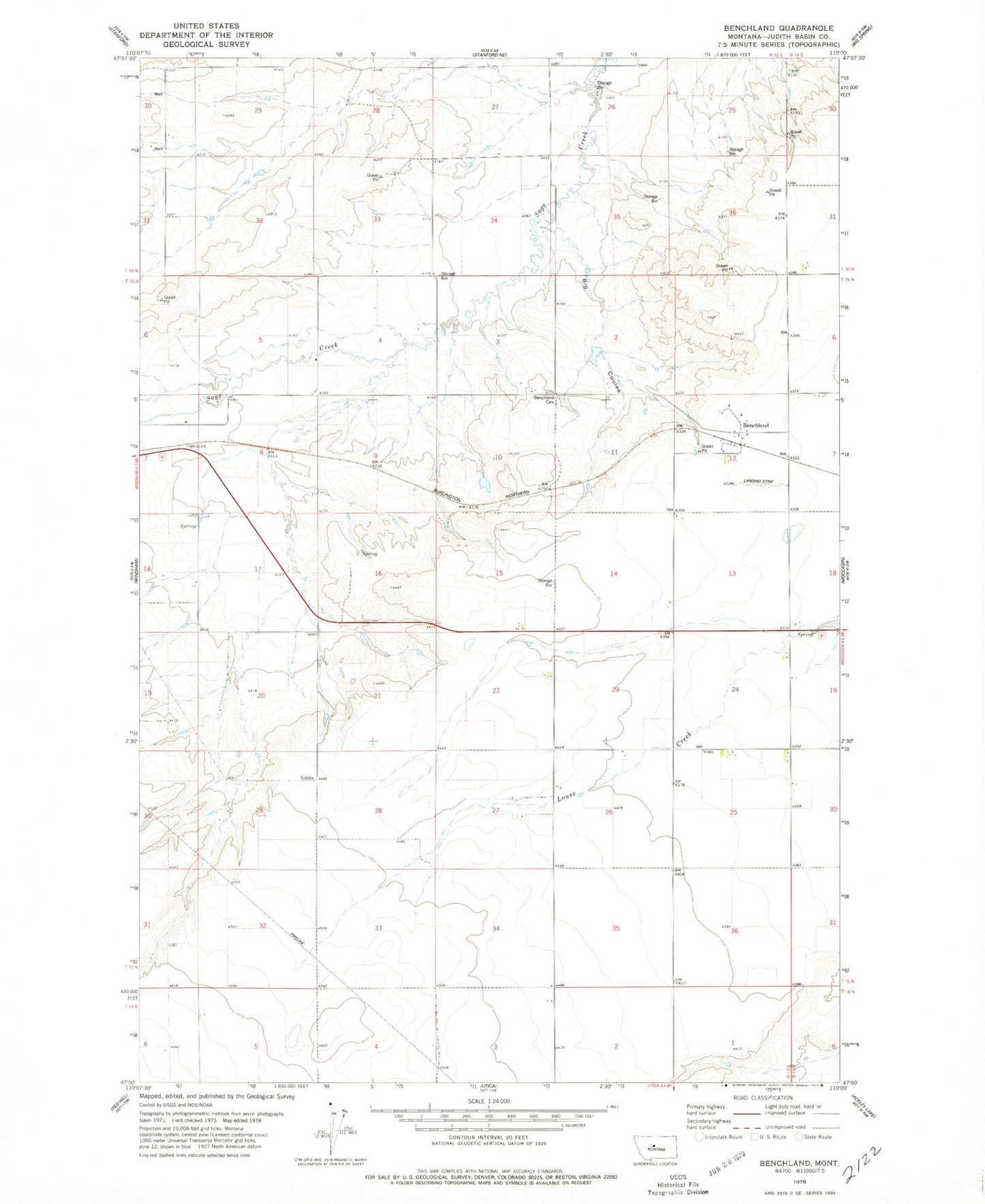
Classic USGS Benchland Montana 7.5'x7.5' Topo Map
Couldn't load pickup availability
Historical USGS topographic quad map of Benchland in the state of Montana. Map scale may vary for some years, but is generally around 1:24,000. Print size is approximately 24" x 27"
This quadrangle is in the following counties: Judith Basin.
The map contains contour lines, roads, rivers, towns, and lakes. Printed on high-quality waterproof paper with UV fade-resistant inks, and shipped rolled.
Contains the following named places: 15N13E02DCC_01 Well, 15N13E03DDD_01 Well, 15N13E07AAA_01 Well, 15N13E16BCA_01 Well, 15N13E16BDBD01 Well, 15N13E20CBD_01 Well, 15N13E25ABA_01 Well, 16N13E27DCC_01 Well, 16N13E30DDB_01 Well, 16N13E34DAA_01 Well, 16N13E35BCD_01 Spring, Benchland, Benchland Cemetery, Benchland Post Office, Benchland School, Big Coulee, Dolcefarniente Dam, Sod Buster Museum