
MyTopo
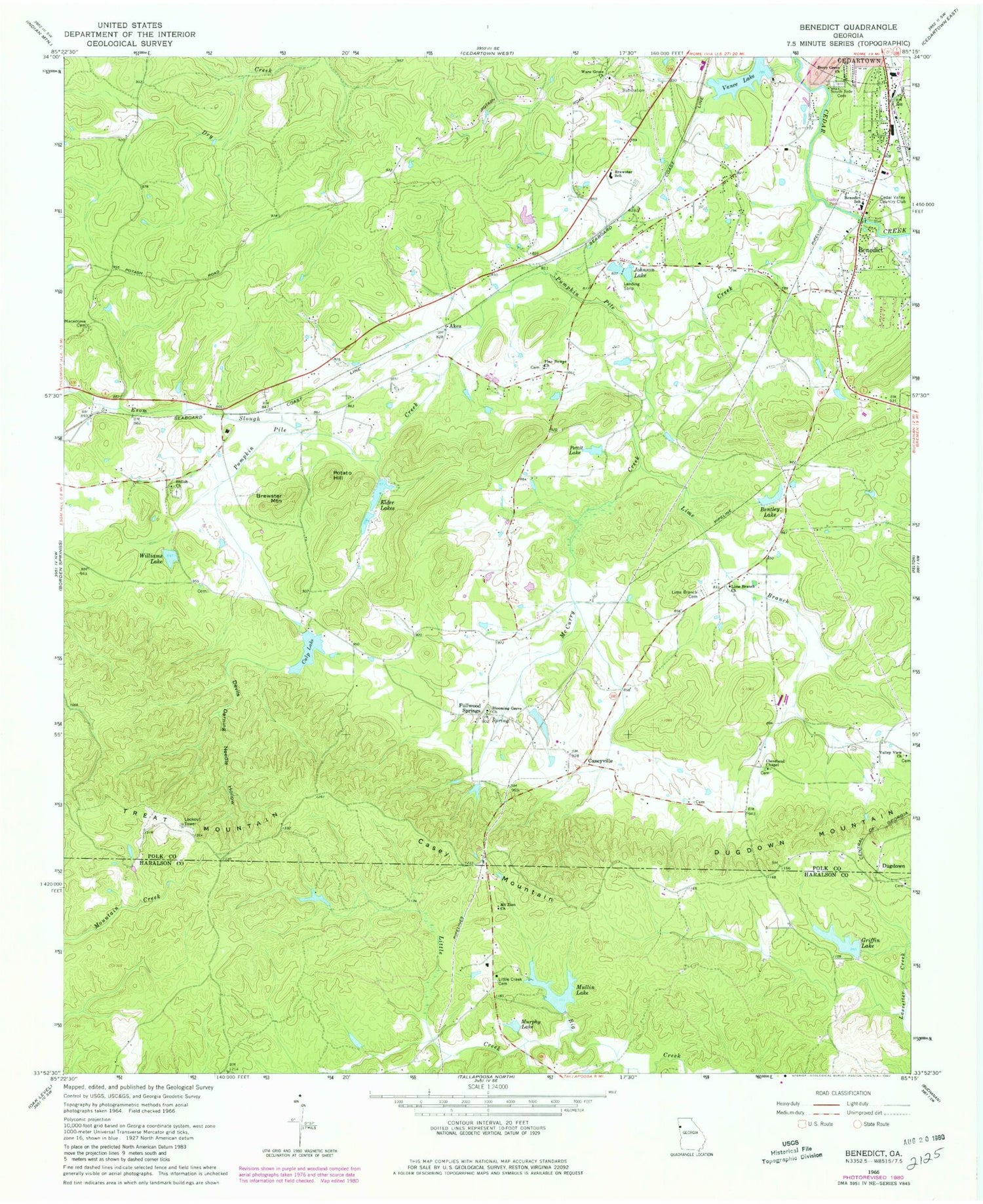
Classic USGS Benedict Georgia 7.5'x7.5' Topo Map
Couldn't load pickup availability
Historical USGS topographic quad map of Benedict in the state of Georgia. Map scale may vary for some years, but is generally around 1:24,000. Print size is approximately 24" x 27"
This quadrangle is in the following counties: Haralson, Polk.
The map contains contour lines, roads, rivers, towns, and lakes. Printed on high-quality waterproof paper with UV fade-resistant inks, and shipped rolled.
Contains the following named places: Akes, Benedict, Benedict Baptist Church, Benedict School, Benedicts Mill, Benedicts Pond, Bentley Lake, Berry Grove Church, Big Cedar Creek Structure Number 13 Dam, Blooming Grove Church, Brewster Mountain, Brewster School, Casey Mountain, Caseyville, Cedar Valley Country Club, Cedartown Division, Cleveland Chapel, Culp Lake, Culp Lake Dam, Devils Darning Needle Hollow, Dugdown, Dugdown Church, Dugdown Mountain, Elder Lakes, Fullwood Springs, Greenway, Griffin Lake, Griffin Lake Dam, Hutching Cemetery, Johnson Lake, Lake Ujihito, Lime Branch, Lime Branch Cemetery, Lime Branch Church, Little Creek, Little Creek Cemetery, Loveless Mountain, Lower Elder Lake, Lower Elder Lake Dam, Macedonia Cemetery, McCurry Creek, Mount Zion Church, Mullin Lake, Mullin Lake Dam, Murphy Lake, Old Brewster School, Pettit Lake, Pine Bower Baptist Church, Pine Bower Baptist Church Cemetery, Polk County Fire Department Blooming Grove Station, Potato Hill, Pumpkin Pile Creek, Shiloh Baptist Church, Shiloh Baptist Church Cemetery, Shiloh Lake, Southview Cemetery, Treat, Treat Mountain, Upper Elder Lake, Upper Elder Lake Dam, Valley View Church, Vance Lake Dam, Walthrall, Ware Grove Church, West Spring, Williams Lake, Williams Lake Dam, Woodward Mine


