MyTopo
Classic USGS Benedict Maryland 7.5'x7.5' Topo Map
Couldn't load pickup availability
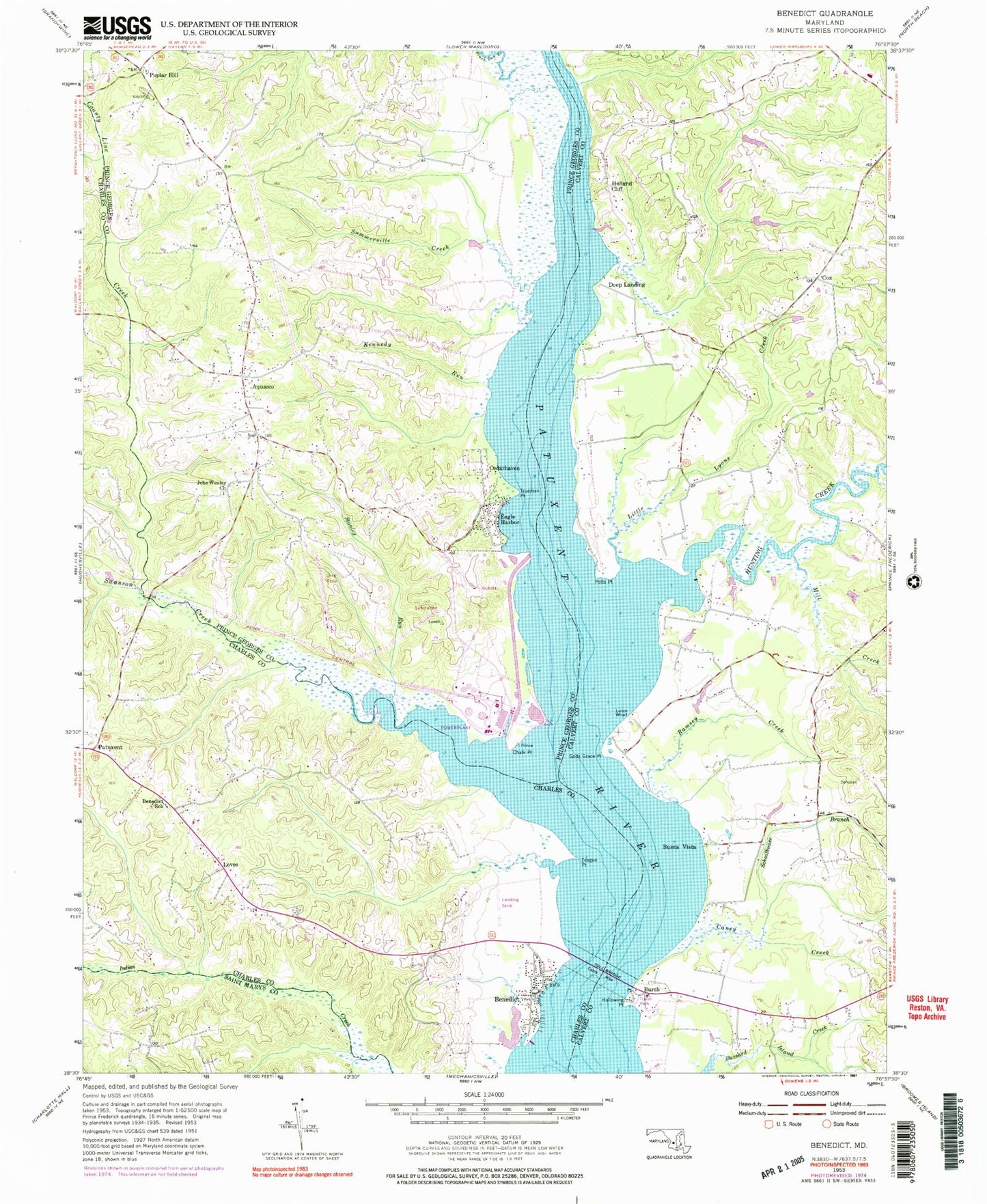
Historical USGS topographic quad map of Benedict in the state of Maryland. Typical map scale is 1:24,000, but may vary for certain years, if available. Print size: 24" x 27"
This quadrangle is in the following counties: Calvert, Charles, Prince George's, St. Mary's.
The map contains contour lines, roads, rivers, towns, and lakes. Printed on high-quality waterproof paper with UV fade-resistant inks, and shipped rolled.
Contains the following named places: Benedict, Benedict School, Caney Creek, Gods Grace Point, Hallowing Point, Holland Cliff, Hunting Creek, Leitch Wharf, Little Lyons Creek, Mill Creek, Potts Point, Ramsey Creek, Schoolhouse Branch, Teague Point, Tucker Creek, Buena Vista, Burch, Cox, Deep Landing, Loves, Patuxent, Abington Cove, Robinson Airport, Aquasco, Cedarhaven, Chalk Point, County Line Creek, Eagle Harbor, John Wesley Church, Kennedy Run, Poplar Hill, Stanley Run, Summerville Creek, Swanson Creek, Trueman Point, Chalk Point Generating Sta Heliport, Jacks Creek, Kings Landing Pier, Abington Shores, Anchorage Park Mobile Home Park, Buena Vista on the Patuxent, Calvert County Industrial Park, Calvert Mobile Home Park, Cedar Beach, Cedar Hill School (historical), Cedar Point, Cedar Point, Deep Landing Estates, Deerfield, Fiddlers Point, Fox Den, Fox Point Creek, Gibson Meadows, Hallmark Estates, Hallowing Point Park, Holland Cliff Shores, Holland Glenn, Hunting Lake, Huntingtown Elementary School, Kings Landing Park, Lowery Oaks, Lowrys Resurvey, Miranda Cemetery, New Enterprise, Patuxent View, Potts Point, Quail Ridge, Shady Hill, Shady Hill Farm, The Alameda, The Oaks, Twirly Hole, Westfield Station, Wild Goose Landing, Woodland Acres, Buenavista Post Office (historical), Benedict Post Office, Indian Branch, Indian Creek Estates, Maxwell Hall, Patuxent River Natural Resource Management Area, Patuxent Woods, Saint Francis De Sales Catholic Church, Swanson Creek Landing, Teagues Point, Twon Point, Trumans Hope (historical), Aquasco Post Office, Aquasco Speedway, Christ United Methodist Church Cemetery, Meadow Woods Estates, Saint Dominics Catholic Church, Saint Dominic Cemetery, Saint Marys Episcopal Chapel Cemetery, Saint Marys Episcopal Church, District 8 Aquasco, District 9 Hughesville, Willim S Schmidt Enviromental Education Center, Benedict Volunteer Fire Department and Rescue Squad, Kings Landing Academy Day School, Town of Eagle Harbor, Aquasco Census Designated Place, Benedict Census Designated Place, Maryland Natural Resource Police Southern Region Indian Creek Office