
MyTopo
Classic USGS Benham Kentucky 7.5'x7.5' Topo Map
Couldn't load pickup availability
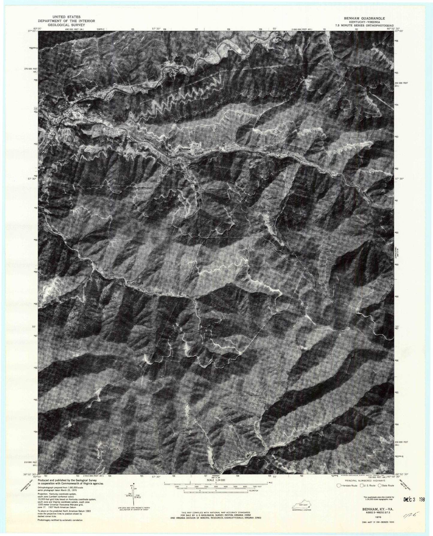
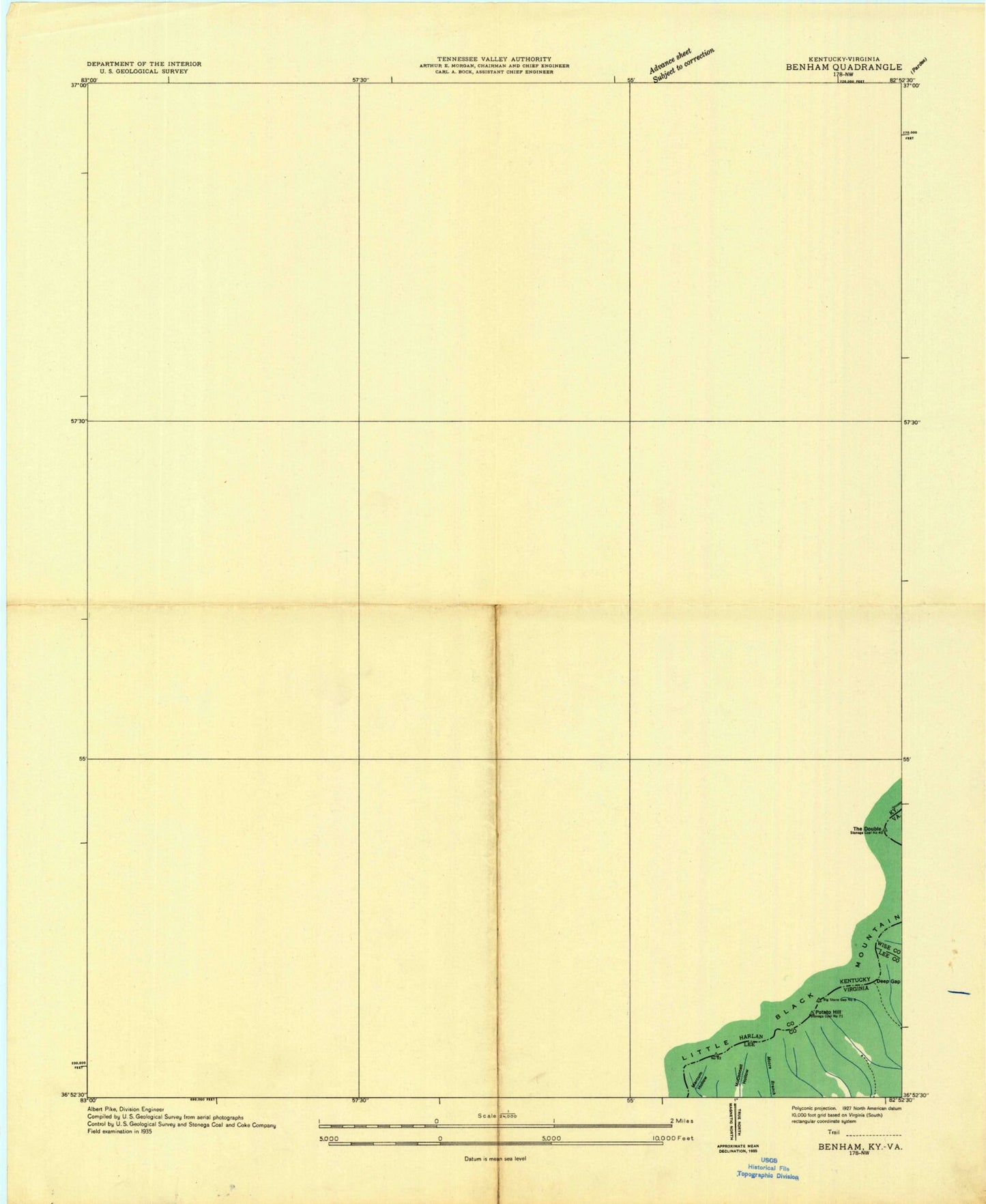
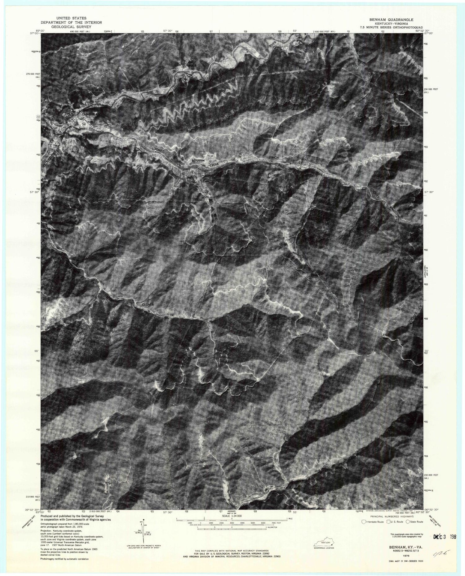
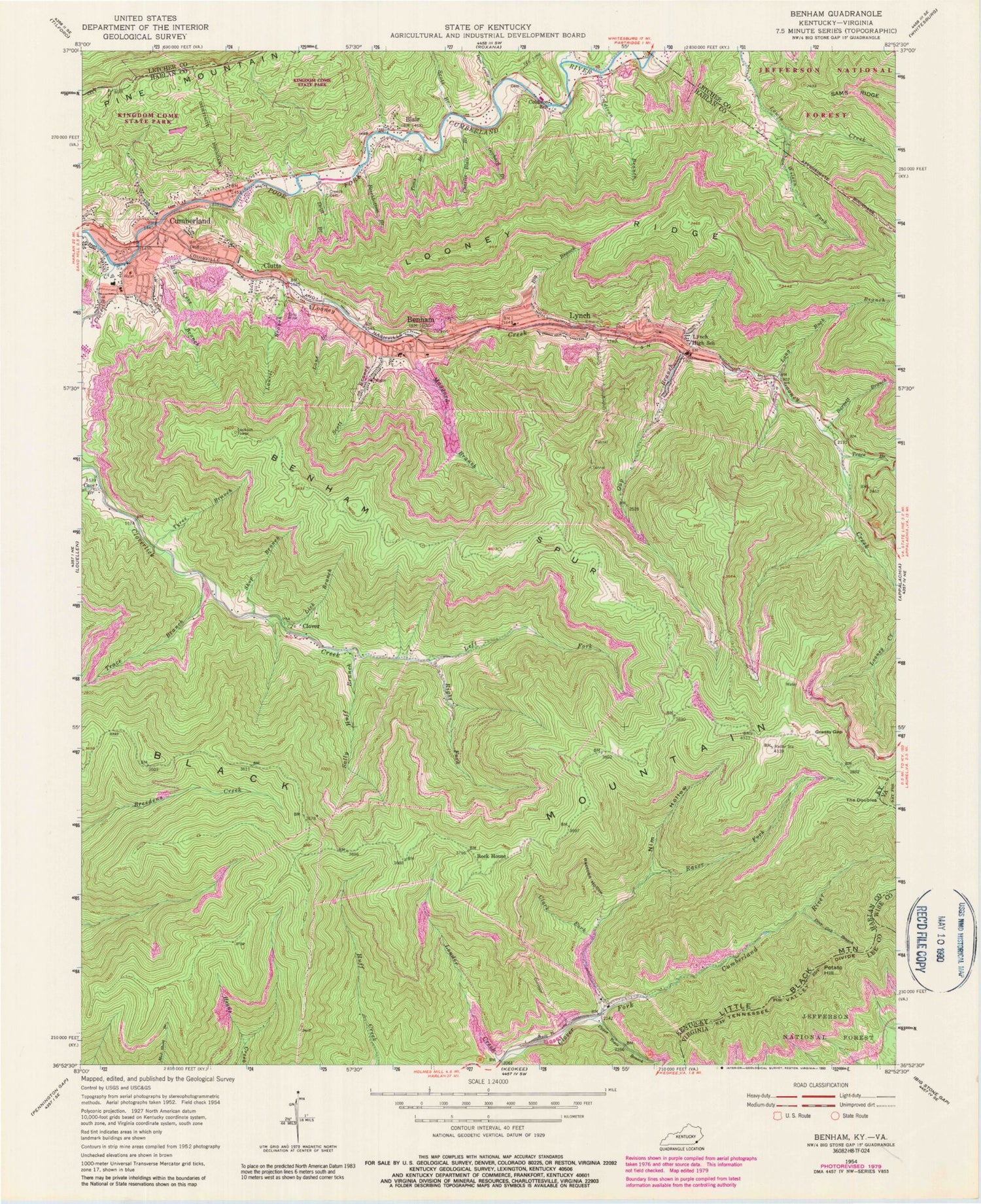
Historical USGS topographic quad map of Benham in the states of Kentucky, Virginia. Typical map scale is 1:24,000, but may vary for certain years, if available. Print size: 24" x 27"
This quadrangle is in the following counties: Harlan, Lee, Letcher, Wise.
The map contains contour lines, roads, rivers, towns, and lakes. Printed on high-quality waterproof paper with UV fade-resistant inks, and shipped rolled.
Contains the following named places: Barnett Branch, Beechbottom Branch, Benham, Big Branch, Big Cove Branch, Blair, Charlie Blair Branch, Clark Fork, Clutts, Coldiron Branch, Coldiron Branch, Coldiron School, Creech Cemetery, Dave Lewis Branch, Deep Gap Branch, Drift Branch, Gap Branch, Grassy Gap, Lane Branch, Laurel Branch, Left Fork Cloverlick Creek, Lick Branch, Long Rock Branch, Looney Creek, Looney Ridge, Louder Creek, Lynch, Lynch High School (historical), Maggard Branch, Nim Hollow, Orchard Branch, Potato Hill, Raccoon Hollow, Razor Fork, Right Fork Cloverlick Creek, Rock House, Sally Huff Branch, Scott Branch, Scott Branch, Shop Branch, Toms Branch, Trace Branch, Tyree Branch, Upper Trace Branch, Wilson Fork, Clover, Black Mountain, Cave Branch, Cloverlick Creek, Cumberland, Trace Branch, Kingdom Come State Park, WCPM-AM (Cumberland), Divide Ridge, Adams Cemetery, Cumberland Division, Mine Rescue Station, Lynch Tipple Mine (historical), Lynch City Hall, Lynch Post Office, Lynch Bathhouse (historical), Lamp House Number 2, Lynch Railroad Station (historical), Portal 30, Portal 31, Benham School House Inn, Benham United Methodist Church, Coal Miners Memorial Park, Coal Miners Memorial Theater, Kentucky Coal Mining Museum, Benham City Hall, Benham Post Office, Benham Hotel (historical), Cumberland Community Comprehensive Center, Squire House (historical), Benham Jail House (historical), Bailey Mine Railroad Station (historical), Lynch Colored Public High School (historical), Cumberland Christian Center, City of Benham, City of Cumberland, City of Lynch, Benham Railroad Station (historical), Big Black Mountain Lookout Tower, Big Branch, Big Ridge, Blair Post Office (historical), Blair School (historical), Camp Fork, Charles Branch, Est Post Office (historical), Garrison Gap, Glenbrook Railroad Station (historical), Cherry Fork, Clover Post Office (historical), Cloverfork Post Office (historical), Clutts Railroad Station (historical), Coal Bank Branch, Indian Hill, Israel Blair Cemetery, Kettle Rockhouse, Laurel Hill Branch, Little Fork, Low Gap, Middle Ridge, Pee Vee Post Office (historical), Poor Fork Railroad Station (historical), Right Fork Looney Creek, Rockhouse Ridge, Sugar Gap, The Town Rocks, Thorps Branch, Yellow Buck Spur, Cumberland Fire Department Station 2, Lynch Fire Department, Benham Fire Department Station 2, Cumberland Fire Department Station 3, Cumberland Fire Department Station 1, Johnsons Lifecare Ambulance Service, Cumberland Police Department, Benham Police Department, Lynch Police Department, Cumberland Post Office, Benham Spur, The Doubles, Deep Gap, Barnett Branch, Beechbottom Branch, Benham, Big Branch, Big Cove Branch, Blair, Charlie Blair Branch, Clark Fork, Clutts, Coldiron Branch, Coldiron Branch, Coldiron School, Creech Cemetery, Dave Lewis Branch, Deep Gap Branch, Drift Branch, Gap Branch, Grassy Gap, Lane Branch, Laurel Branch, Left Fork Cloverlick Creek, Lick Branch, Long Rock Branch, Looney Creek, Looney Ridge, Louder Creek, Lynch, Lynch High School (historical), Maggard Branch, Nim Hollow, Orchard Branch, Potato Hill, Raccoon Hollow, Razor Fork, Right Fork Cloverlick Creek, Rock House, Sally Huff Branch, Scott Branch, Scott Branch, Shop Branch, Toms Branch, Trace Branch, Tyree Branch, Upper Trace Branch, Wilson Fork, Clover, Black Mountain, Cave Branch, Cloverlick Creek, Cumberland, Trace Branch, Kingdom Come State Park, WCPM-AM (Cumberland), Divide Ridge, Adams Cemetery, Cumberland Division, Mine Rescue Station, Lynch Tipple Mine (historical), Lynch City Hall, Lynch Post Office, Lynch Bathhouse (historical), Lamp House Number 2, Lynch Railroad Station (historical), Portal 30, Portal 31, Benham School House Inn, Benham United Methodist Church, Coal Miners Memorial Park, Coal Miners Memorial Theater, Kentucky Coal Mining Museum, Benham City Hall, Benham Post Office, Benham Hotel (historical), Cumberland Community Comprehensive Center, Squire House (historical), Benham Jail House (historical), Bailey Mine Railroad Station (historical), Lynch Colored Public High School (historical), Cumberland Christian Center, City of Benham, City of Cumberland, City of Lynch, Benham Railroad Station (historical), Big Black Mountain Lookout Tower, Big Branch, Big Ridge, Blair Post Office (historical), Blair School (historical), Camp Fork, Charles Branch, Est Post Office (historical), Garrison Gap, Glenbrook Railroad Station (historical), Cherry Fork, Clover Post Office (historical), Cloverfork Post Office (historical), Clutts Railroad Station (historical), Coal Bank Branch, Indian Hill, Israel Blair Cemetery, Kettle Rockhouse, Laurel Hill Branch, Little Fork, Low Gap, Middle Ridge, Pee Vee Post Office (historical), Poor Fork Railroad Station (historical), Right Fork Looney Creek, Rockhouse Ridge, Sugar Gap