MyTopo
Classic USGS Bennet Peak Oregon 7.5'x7.5' Topo Map
Couldn't load pickup availability
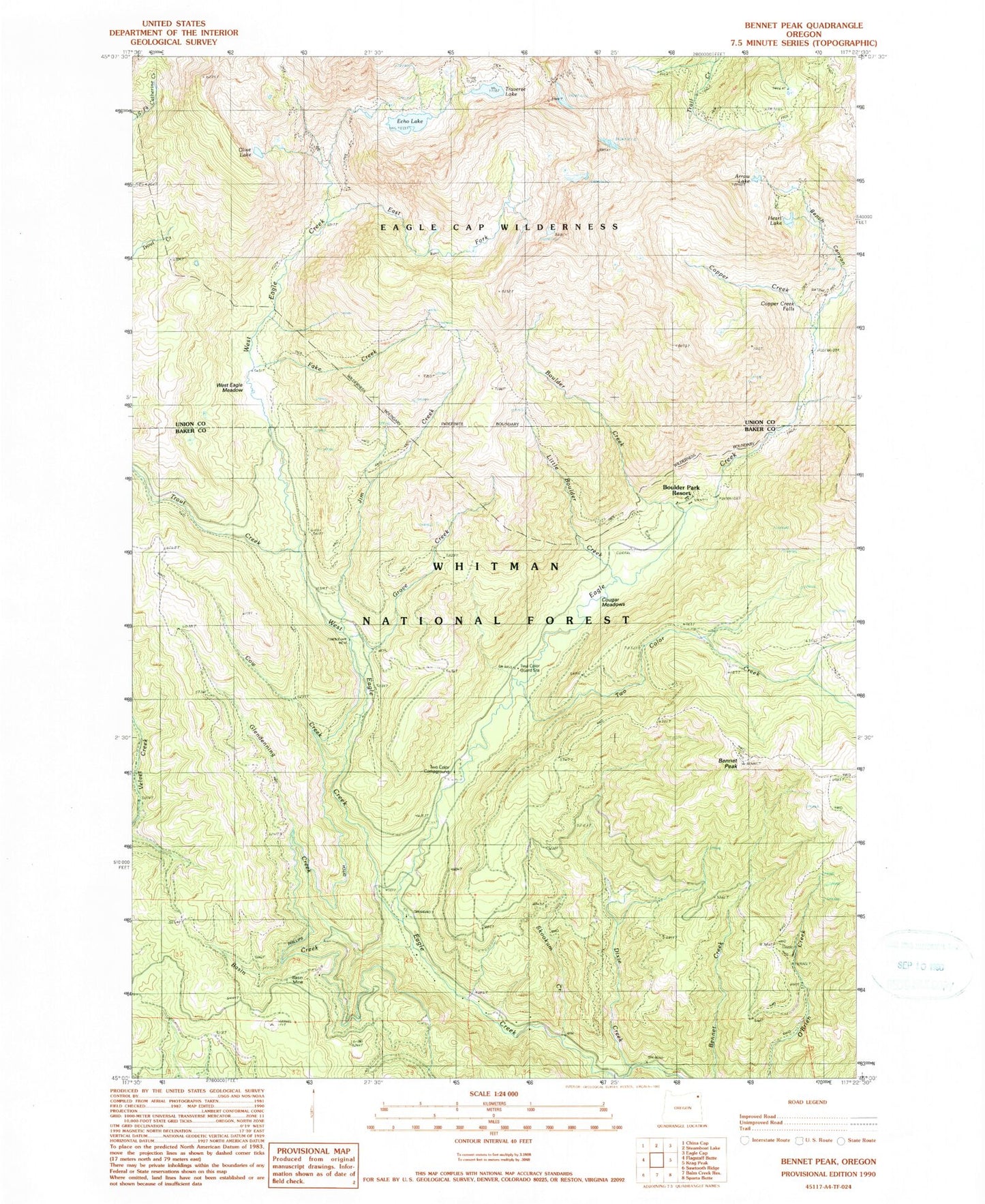
Historical USGS topographic quad map of Bennet Peak in the state of Oregon. Typical map scale is 1:24,000, but may vary for certain years, if available. Print size: 24" x 27"
This quadrangle is in the following counties: Baker, Union.
The map contains contour lines, roads, rivers, towns, and lakes. Printed on high-quality waterproof paper with UV fade-resistant inks, and shipped rolled.
Contains the following named places: Arrow Lake, Basin Creek, Basin Mine, Bench Canyon, Bennett Peak, Boulder Creek, Boulder Park Resort (historical), Copper Creek, Copper Creek Falls, Cougar Meadows, Cow Creek, Dixie Creek, East Fork West Eagle Creek, Echo Lake, Fake Creek, Fake Creek Trail, Flat Rock Forest Camp, Forks Forest Camp, Glendenning Creek, Grove Creek, Heart Lake, Jim Creek, Little Boulder Creek, Olive Lake, Phillips Ditch, Skookum Creek, Trail Creek Trail, Traverse Lake, Two Color Guard Station, West Eagle Creek, West Eagle Meadow, West Eagle Trail, Steiger Spring, Groover Spring, Mammouth Spring, Silver Spring, Lookout Spring, Mud Spring, Jenkins Spring, Echo Lake Dam, Traverse Lake Dam, West Eagle Horse Camp, Boulder Park Recreation Site, Excelsior Gulch, Two Color Creek, Thistle Creek, Eagleton Post Office (historical), Two Color Recreation Site, Tamarack Recreation Site, Two Color Horse Camp