MyTopo
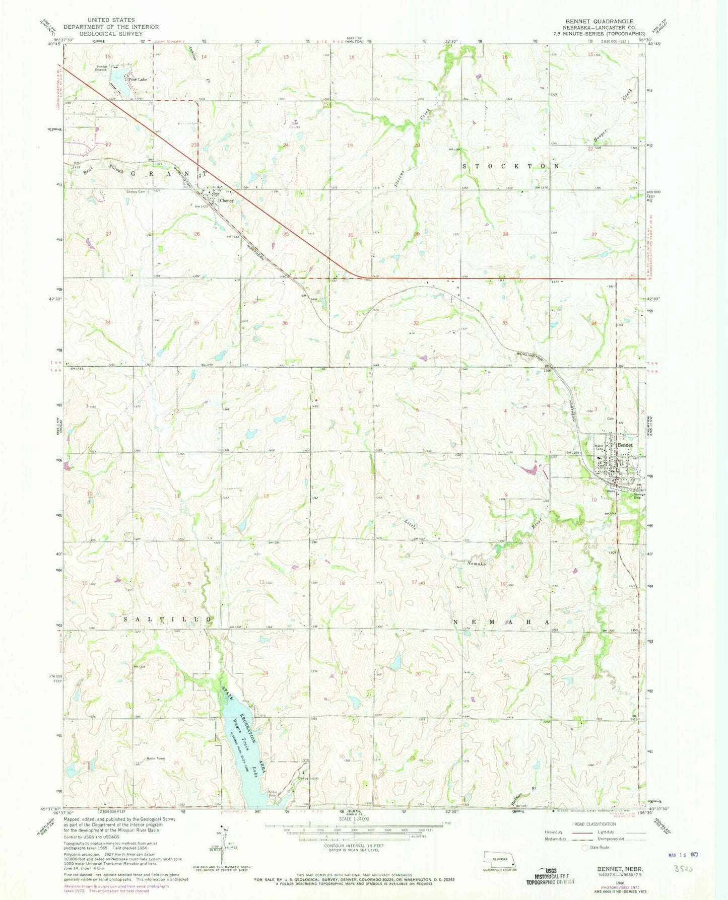
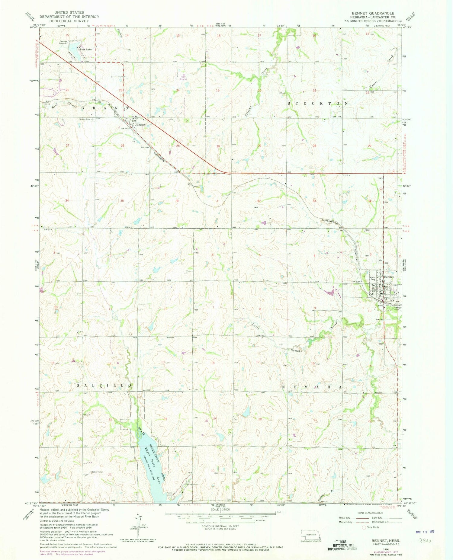
Classic USGS Bennet Nebraska 7.5'x7.5' Topo Map
Couldn't load pickup availability
Historical USGS topographic quad map of Bennet in the state of Nebraska. Typical map scale is 1:24,000, but may vary for certain years, if available. Print size: 24" x 27"
This quadrangle is in the following counties: Lancaster.
The map contains contour lines, roads, rivers, towns, and lakes. Printed on high-quality waterproof paper with UV fade-resistant inks, and shipped rolled.
Contains the following named places: Bennet, Cheney, Cheney Cemetery, Pine Lake, Wagon Train Lake, KEZG-FM (Lincoln), Stewart Field Airport (historical), Mueller Field, Salt Creek 9-3 Dam, Salt Creek Reservoir 9-3, Salt Creek Dam 8-B, Salt Creek Reservoir 8-B, Salt Creek Dam 8-A, Salt Creek Reservoir 8-A, Salt Creek Dam 19-B, Salt Creek Reservoir 19-B, Harlan Reservoir, Salt Creek Dam 9-A, Salt Creek Reservoir 9-A, Pine Lake Dam, Pine Lake Reservoir, Upper Salt Creek Dam 36-1, Upper Salt Creek Reservoir 36-1, Kuhn Dam, Kuhn Reservoir, Wagon Train Lake State Recreation Area, Hidden Valley Golf Course, Pine Lake Golf Course, Saint Michael Catholic Church, Cheney, Cheney Post Office (historical), Township of Nemaha, Cheney Public School, Township of Stockton, Township of Saltillo, Township of Grant, Bennet Community Church, Farmers Co-op Elevator, Bennet, Bennet Post Office, Edenton South Park, Jensen Park, Grant Election Precinct, Nemaha Election Precinct, Stockton Election Precinct, Village of Bennet, Southeast Rural Fire District - Pine Lake Station, Bennet Fire and Rescue, Nebraska Heart Hospital, Walvoord Field, Cheney Census Designated Place