MyTopo
Classic USGS Bennett Springs Missouri 7.5'x7.5' Topo Map
Couldn't load pickup availability
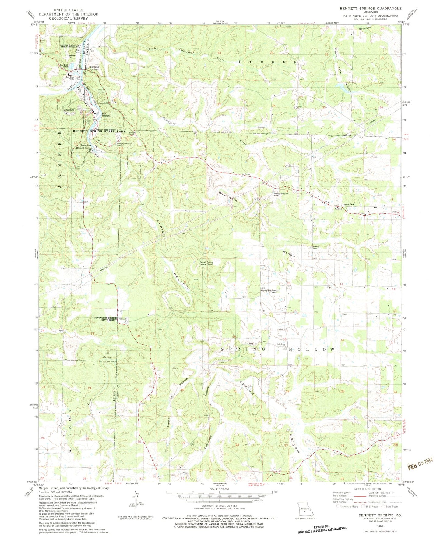
Historical USGS topographic quad map of Bennett Springs in the state of Missouri. Typical map scale is 1:24,000, but may vary for certain years, if available. Print size: 24" x 27"
This quadrangle is in the following counties: Dallas, Laclede.
The map contains contour lines, roads, rivers, towns, and lakes. Printed on high-quality waterproof paper with UV fade-resistant inks, and shipped rolled.
Contains the following named places: Spring Hollow, Bennett Spring State Park, Blackfoot School, Conn School (historical), Danceyard Creek, Dogwood Hollow, Flag Pond School, Flatwoods School, Gannon School (historical), Hackbill Hollow, Mullicane School, Oak Grove Church, Spring Hollow, Union Church, Woodward Hollow, Spring Hollow Creek, Union Chapel (historical), Danceyard Hollow, Bennett Springs, Flatwoods Church, Bennett Spring, Sand Spring, Bennett Spring State Public Access Area, Flatwoods Church State Forest, Bennett Spring Natural Tunnel, Atchley - Blackfoot Cemetery, Lowery Franklin Cemetery, Sportsmen Outdoor Chapel, Bennett Cemetery, Elam Lake Dam, William Elam Lake, Pennel Lake Dam, Township of Spring Hollow, Bennett Springs Census Designated Place, Bennett Spring Fire Protection District, Bennett Spring Branch