MyTopo
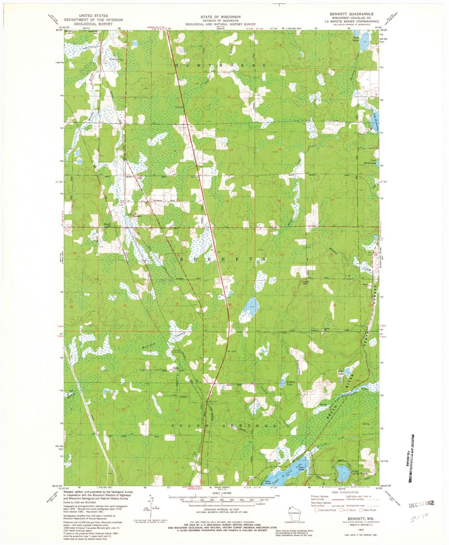
Classic USGS Bennett Wisconsin 7.5'x7.5' Topo Map
Couldn't load pickup availability
Historical USGS topographic quad map of Bennett in the state of Wisconsin. Map scale may vary for some years, but is generally around 1:24,000. Print size is approximately 24" x 27"
This quadrangle is in the following counties: Douglas.
The map contains contour lines, roads, rivers, towns, and lakes. Printed on high-quality waterproof paper with UV fade-resistant inks, and shipped rolled.
Contains the following named places: Beebe, Beebe Creek, Bennett, Bennett Cemetery, Bennett Volunteer Fire Department, Catlin Creek, Douglas County Sheriff's Office Substation, East Fork Moose River, Emmanuel Church, Gilbert Lake, Hansen Creek, Kaspar Creek, Lake of the Woods, Merriam Swamp, Mills Lake, North Country National Scenic Trail, Porcupine Creek, Saint Croix Creek, Town of Bennett, Twin Lakes, Whispering Pines Church