MyTopo
Classic USGS Bennetts Point South Carolina 7.5'x7.5' Topo Map
Couldn't load pickup availability
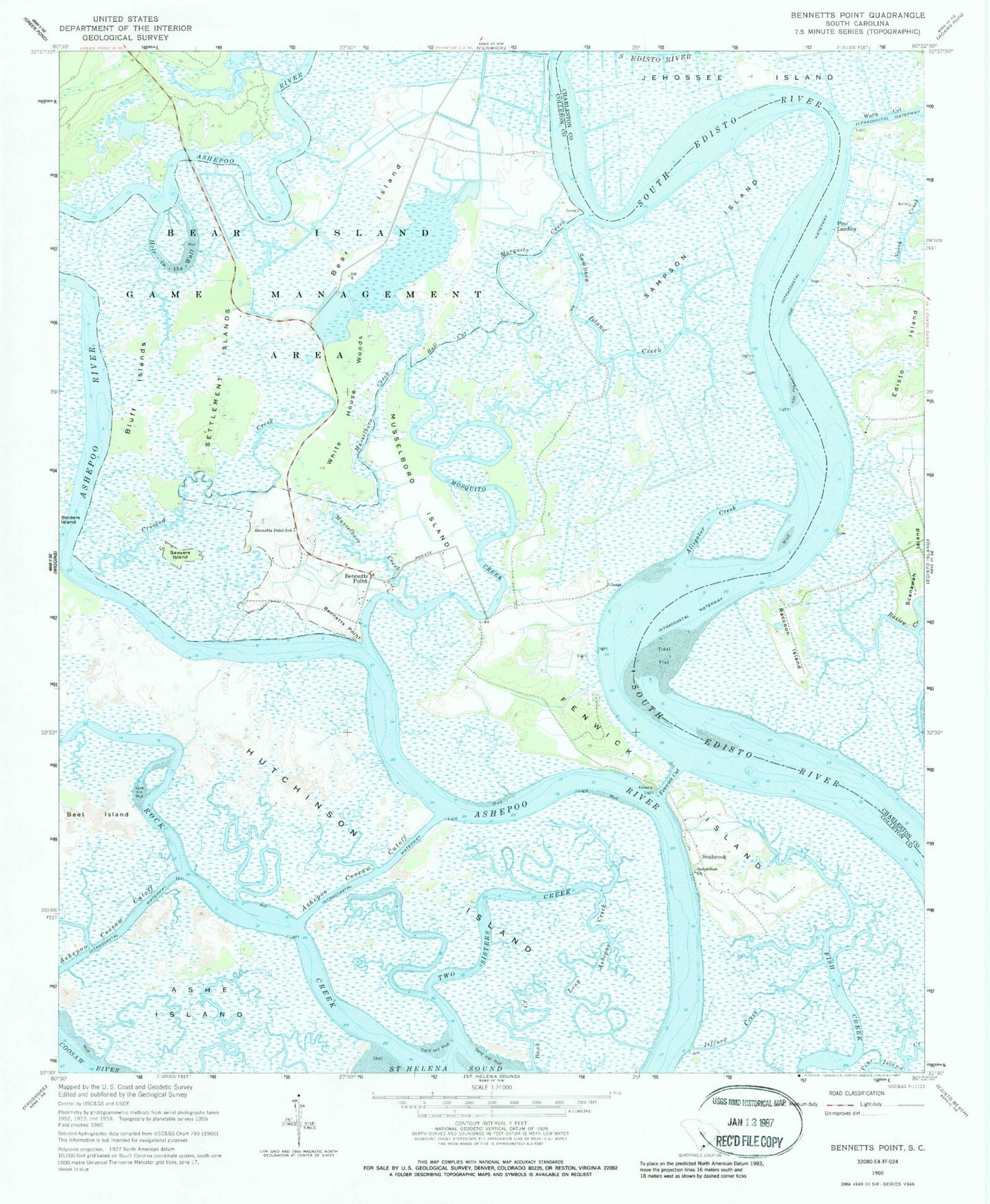
Historical USGS topographic quad map of Bennetts Point in the state of South Carolina. Map scale may vary for some years, but is generally around 1:24,000. Print size is approximately 24" x 27"
This quadrangle is in the following counties: Charleston, Colleton.
The map contains contour lines, roads, rivers, towns, and lakes. Printed on high-quality waterproof paper with UV fade-resistant inks, and shipped rolled.
Contains the following named places: Alligator Creek, Ashe Island, Ashepoo Coosaw Cutoff, Bank Creek, Bear Island, Bear Island Game Management Area, Beet Island, Bennetts Point, Bennetts Point School, Bluff Islands, Bull Cut, Colleton County Fire Rescue Bennett's Point Fire Station, Crooked Creek, Dodge Plantation, Fenwick Cut, Fenwick Island, Green Pond Division, Hole-in-the-Wall, Hutchinson Island, Long Ashepoo Creek, Mosquito Creek, Musselboro Creek, Musselboro Island, Pine Landing, Raccoon Island, Rock Creek, Samaritan Church, Sampson Island, Sampson Island Creek, Sawyers Island, Seabrook, Seabrook School, Settlement Islands, Two Sisters Creek, Watts Cut, White House Woods