MyTopo
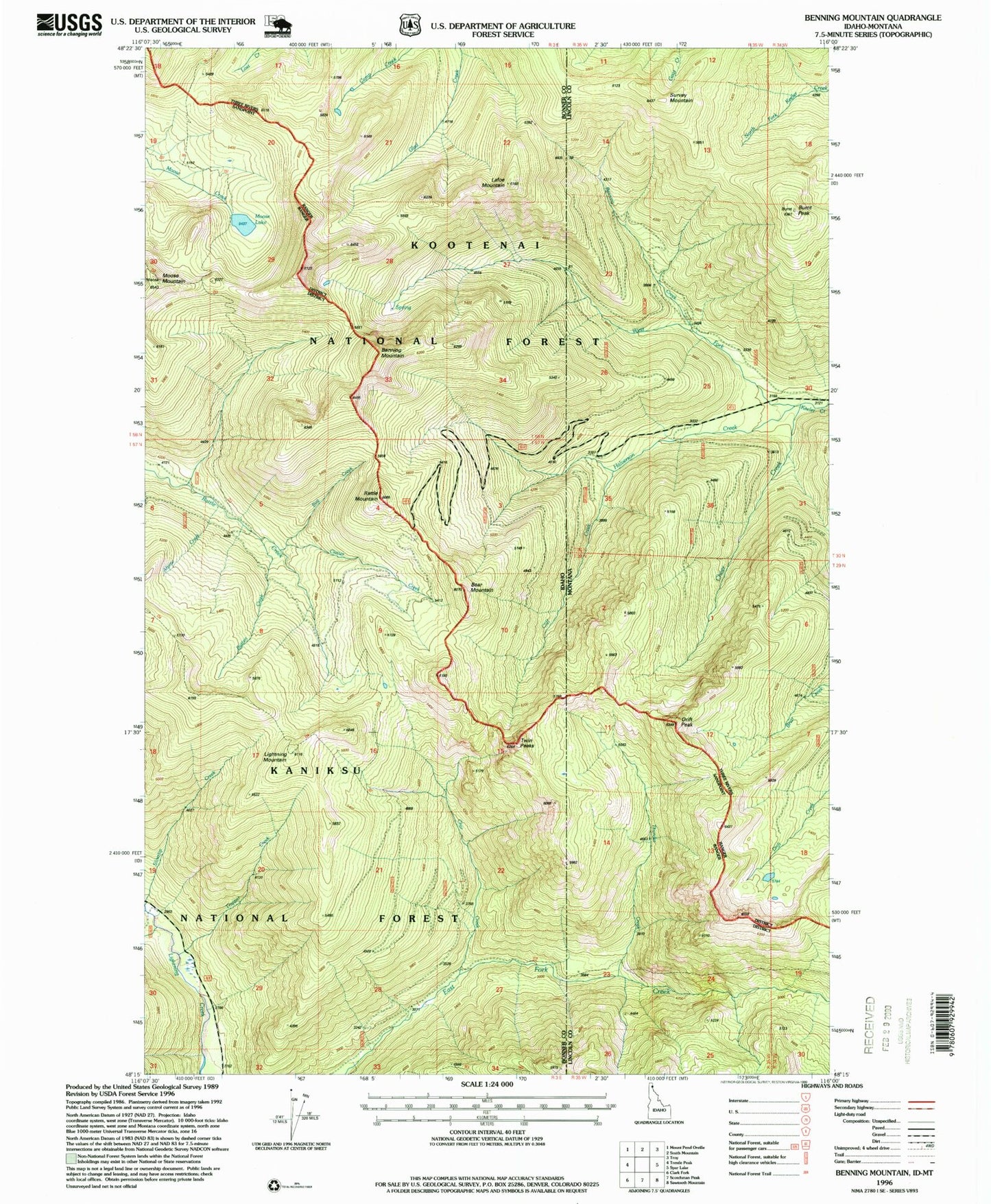
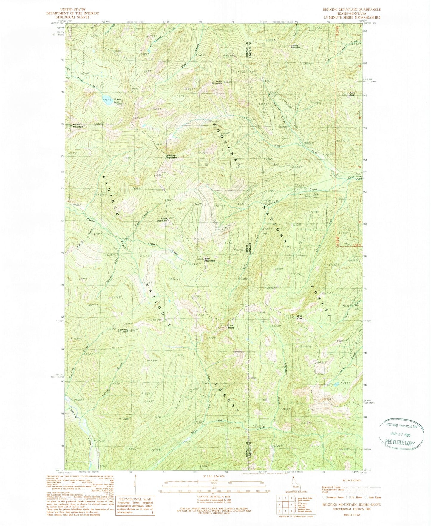
Classic USGS Benning Mountain Idaho 7.5'x7.5' Topo Map
Couldn't load pickup availability
Historical USGS topographic quad map of Benning Mountain in the states of Idaho, Montana. Typical map scale is 1:24,000, but may vary for certain years, if available. Print size: 24" x 27"
This quadrangle is in the following counties: Bonner, Lincoln.
The map contains contour lines, roads, rivers, towns, and lakes. Printed on high-quality waterproof paper with UV fade-resistant inks, and shipped rolled.
Contains the following named places: Bear Mountain, Beaver Cabin (historical), Benning Lookout (historical), Benning Mountain, Cliff Creek, Halverson Creek, Lafoe Mountain, Lightning Mountain, Moose Lake, Moose Mountain, Porcupine Creek, Rattle Mountain, Trapper Creek, Twin Peaks, West Fork Keeler Creek, Thunder Creek, Bug Creek, Button Creek, Clatter Creek, Alpine Creek, Benning Creek, Burnt Peak, Cheer Creek, Drift Peak, Survey Mountain