MyTopo
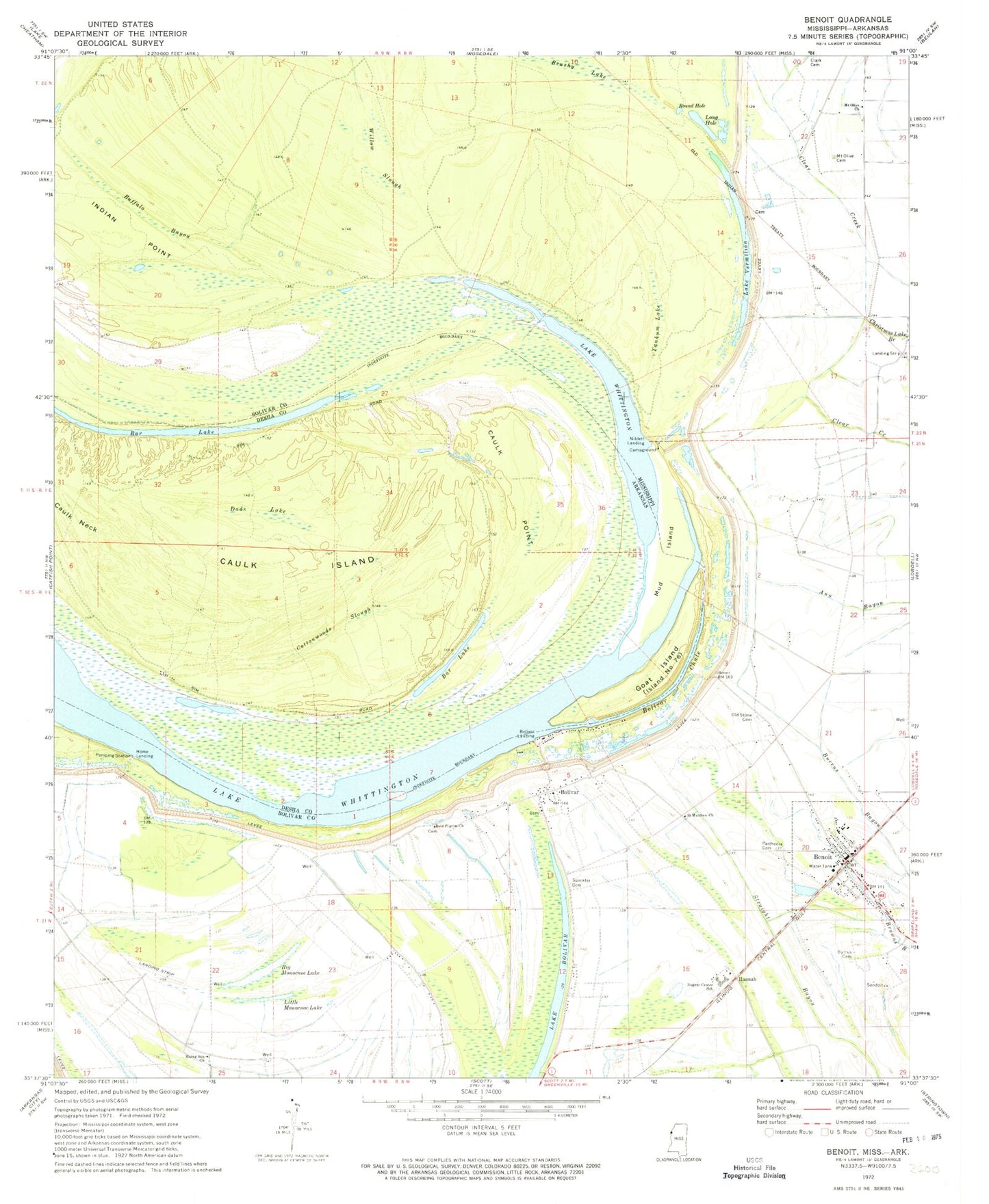
Classic USGS Benoit Mississippi 7.5'x7.5' Topo Map
Couldn't load pickup availability
Historical USGS topographic quad map of Benoit in the states of Mississippi, Arkansas. Map scale may vary for some years, but is generally around 1:24,000. Print size is approximately 24" x 27"
This quadrangle is in the following counties: Bolivar, Desha.
The map contains contour lines, roads, rivers, towns, and lakes. Printed on high-quality waterproof paper with UV fade-resistant inks, and shipped rolled.
Contains the following named places: Bar Lake, Benoit, Benoit High School, Benoit Police Department, Benoit Post Office, Big Monocnoc Lake, Bird Landing, Bold Pilgrim Church, Bolivar, Bolivar Bend, Bolivar Census Designated Place, Bolivar Chute, Bolivar Landing, Brushy Lake, Buckridge Landing, Buffalo Bayou, Burrus Cemetery, Caulk Island, Caulk Point, Cookes Landing, Cottonwoods Slough, Dads Lake, Egypt Ridge, Goat Island, Hannah, Holly Ridge Landing, Home Landing, Indian Point, Jersey Point, Kentucky Landing, Lake Vermilon, Little Monocnoc Lake, Long Hole, Melrose Landing, Mount Olive Cemetery, Mount Olive Church, Mud Island, Niblett Landing, Nugent Center School, Old Stone Cemetery, Parthenia Cemetery, Rising Sun Church, Round Hole, Saint Matthew Church, Speckter Cemetery, Town of Benoit, Willow Slough, Yankum Lake, ZIP Code: 38725