MyTopo
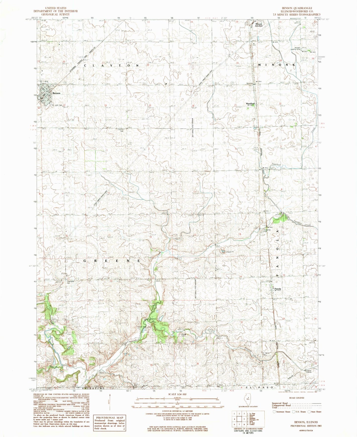
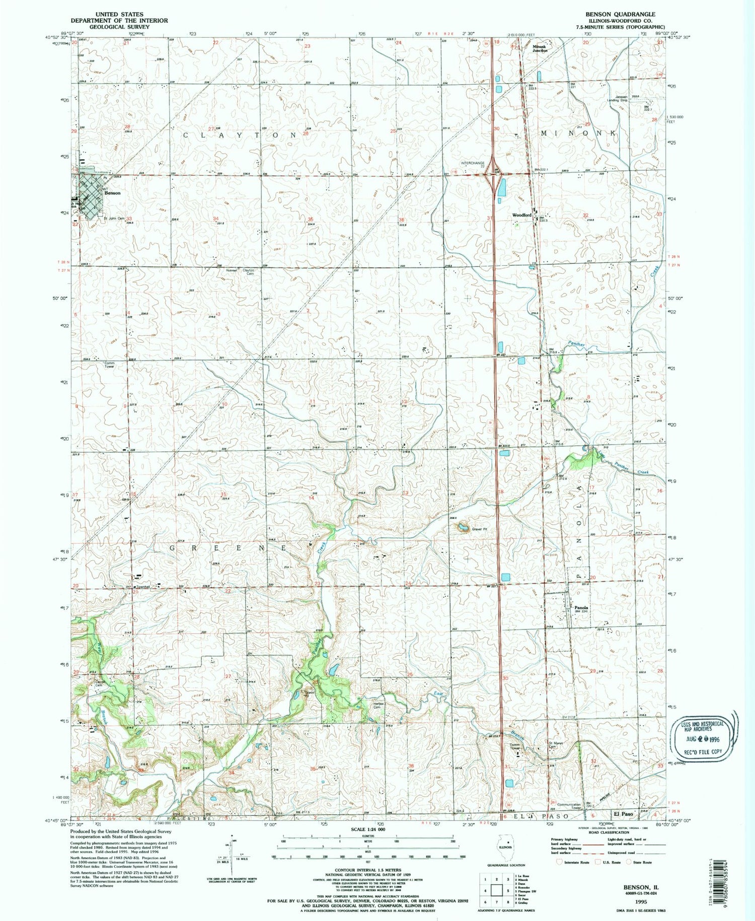
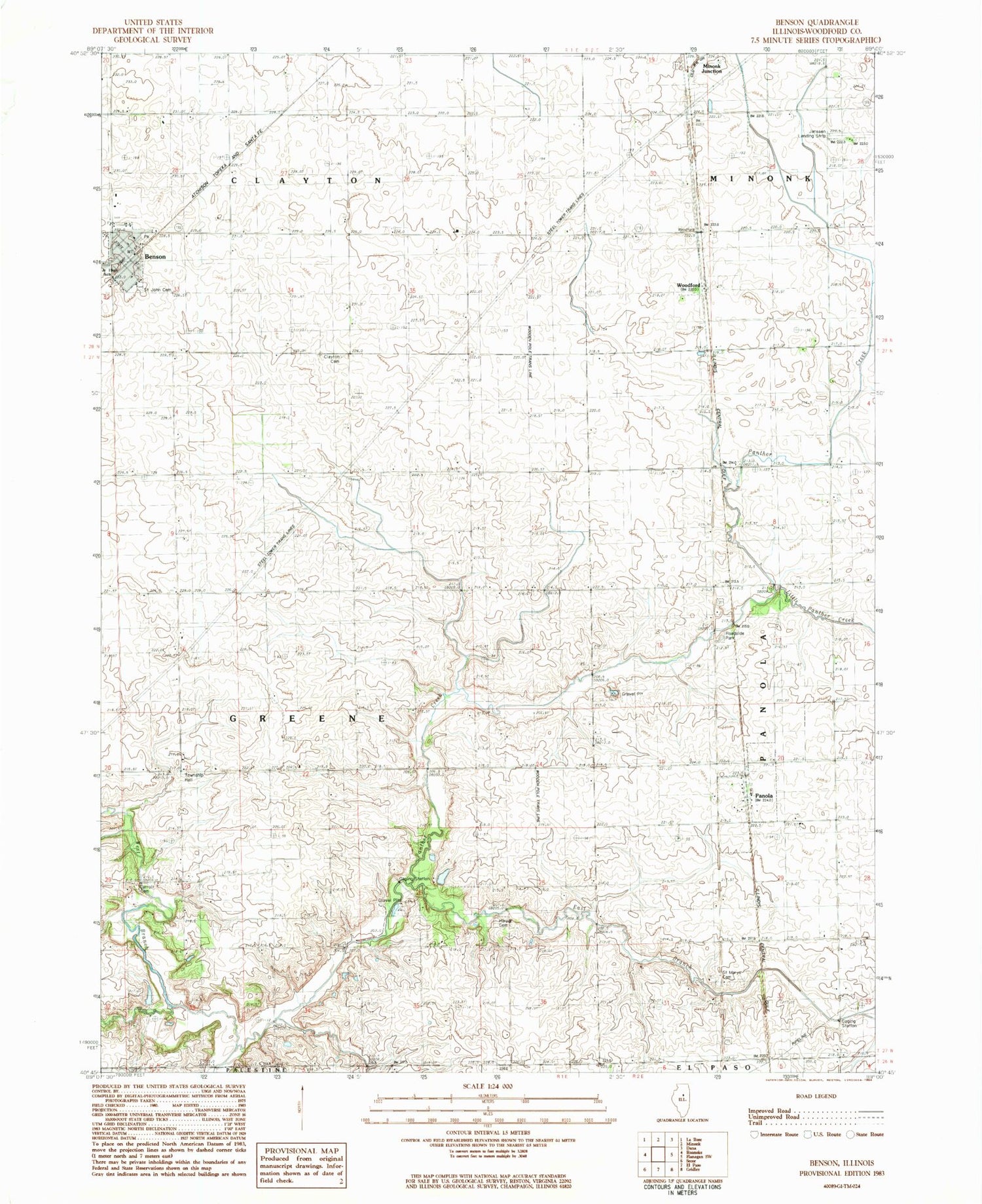
Classic USGS Benson Illinois 7.5'x7.5' Topo Map
Couldn't load pickup availability
Historical USGS topographic quad map of Benson in the state of Illinois. Map scale may vary for some years, but is generally around 1:24,000. Print size is approximately 24" x 27"
This quadrangle is in the following counties: Woodford.
The map contains contour lines, roads, rivers, towns, and lakes. Printed on high-quality waterproof paper with UV fade-resistant inks, and shipped rolled.
Contains the following named places: Barnstorm Field, Benson, Benson Ambulance Service, Benson Baptist Church, Benson Community Fire Protection District, Benson Post Office, Benson Water Tower, Carroll Cemetery, Clayton Baptist Cemetery, Corn Alley 2 Airport, East Branch Panther Creek, Greene Township Hall, Harper Cemetery, Janssen Airport, Little Panther Creek, Panola, Roanoke-Benson Junior High School, Saint Johns Catholic Church, Saint Johns Cemetery, Saint Marys Cemetery, Saint Paul Lutheran Church, Spring Hill School, Township of Greene, Unzicker Airport, Village of Benson, Village of Panola, West Branch Panther Creek, Woodford