MyTopo
Classic USGS Bent Oak Mississippi 7.5'x7.5' Topo Map
Couldn't load pickup availability
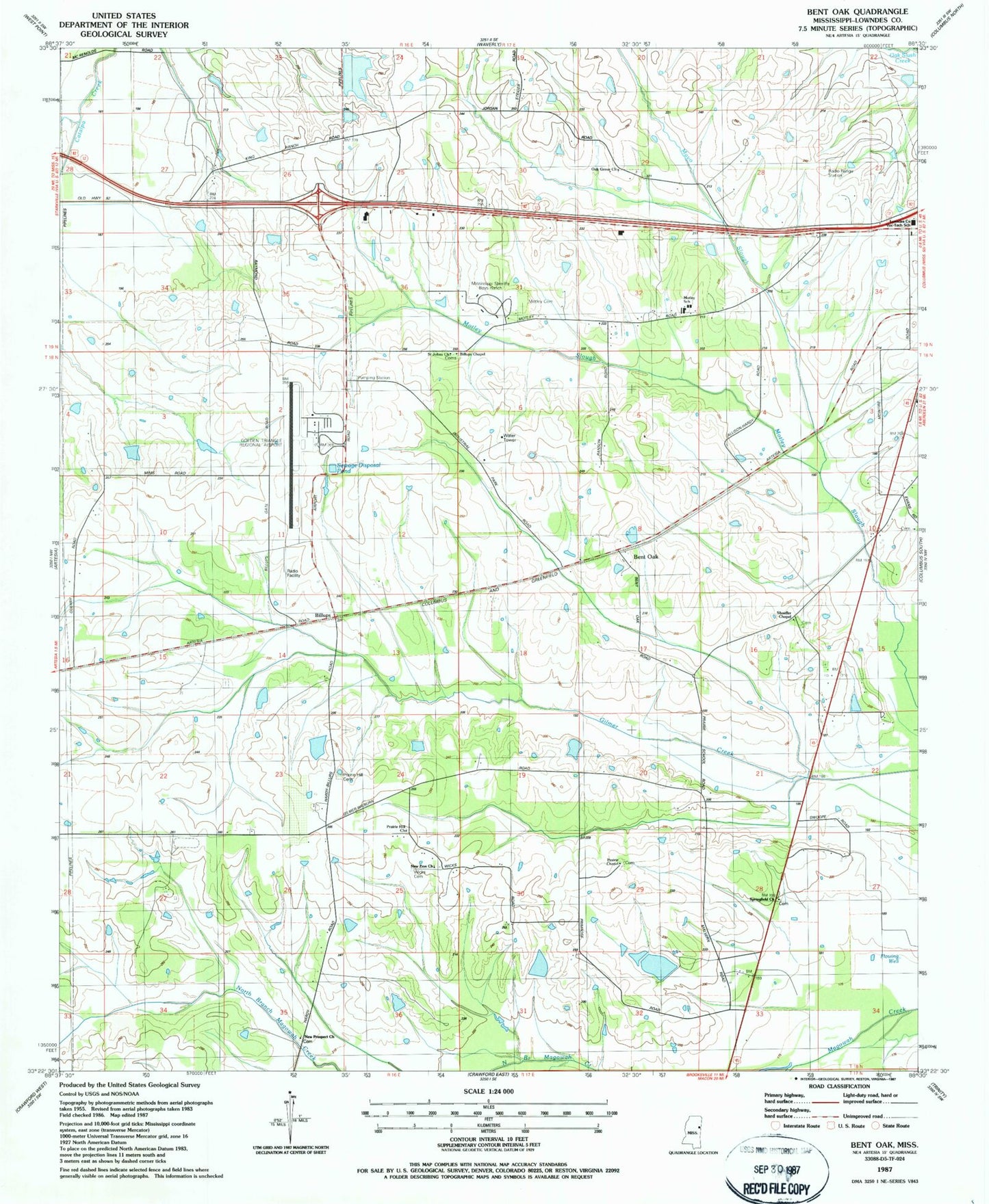
Historical USGS topographic quad map of Bent Oak in the state of Mississippi. Map scale may vary for some years, but is generally around 1:24,000. Print size is approximately 24" x 27"
This quadrangle is in the following counties: Lowndes.
The map contains contour lines, roads, rivers, towns, and lakes. Printed on high-quality waterproof paper with UV fade-resistant inks, and shipped rolled.
Contains the following named places: Allendale, Allendale Church, Angus Farms Lake Dam, Banks School, Bent Oak, Billups, Billups Chapel, Chism Lake Dam, Golden Triangle Industrial Park, Golden Triangle Regional Airport, Imes Lake Dam, Lowndes County District 5 Volunteer Fire and Rescue Department Industrial Park, Lowndes County Farm, Lowndes County Vocational Technical School, Mayo Slough, McIntyre, Mississippi No Name 161 Dam, Mississippi No Name 162 Dam, Mississippi No Name 163 Dam, Mississippi Sheriffs Boys Ranch, Motley Cemetery, Motley Church, Motley School, Mount Ararat Cemetery, Mount Ararat Church, Nemo School, New Prospect Church, New Prospect Missionary Baptist Church Cemetery, New Zion Church, Oak Grove Church, Prairie Chapel, Prairie Hill, Prairie Hill Cemetery, Prairie Hill Church, Prairie Oaks Farm, Saint Johns Church, Shaeffer Chapel, Shula Grove, Springfield Church, Supervisor District 5, Swoope Quarters, Thomas Lake Dam, Thomas Store, White Hawk Ranch, White Oaks Ranch, Wicks Memorial Gardens, ZIP Code: 39701