MyTopo
Classic USGS Bentley Creek Pennsylvania 7.5'x7.5' Topo Map
Couldn't load pickup availability
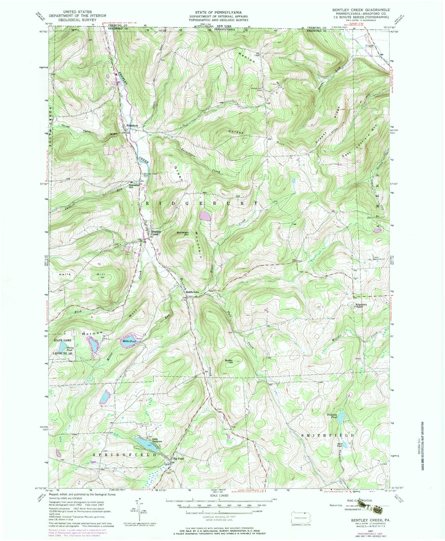
Historical USGS topographic quad map of Bentley Creek in the state of Pennsylvania. Map scale may vary for some years, but is generally around 1:24,000. Print size is approximately 24" x 27"
This quadrangle is in the following counties: Bradford.
The map contains contour lines, roads, rivers, towns, and lakes. Printed on high-quality waterproof paper with UV fade-resistant inks, and shipped rolled.
Contains the following named places: Bardwell Cemetery, Bentley Creek, Bentley Creek Cemetery, Big Pond, Bird Pond, Blakeslee Pond, Buck Creek, Burnham Hill, Butler Hill, Cole Airport, Crandal Cemetery, Doty Hill School, Draper Ridge, Durkee Hill, East Canfield Mountain, Fall Creek, Farrell Run, Galvin Pond, Galvin Pond Dam, Green Mountain, Halls Hill, Hanlon Hill, Hanlon Hill Cemetery, Hanlon Hill School, Hillside Cemetery, Justice Run, Lake Ondawa, Lake Ondawa Dam, Laurel Hill Cemetery, Middletown, Miller Pond, Miller Run, Millers Pond Dam, Mormon Hill, Our Lady of Perpetual Help Cemetery, Owen Cemetery, Paker Run, Ridgebury, Ridgebury Chapel, Ridgebury Lake Dam, Ridgebury Volunteer Fire Company, Smithfield Summit, South Grove School, Stacey Pond, State Game Lands Number 123, Terwiliger Creek, Three Falls Glen, Threefall Run, Township of Ridgebury, Tri - Township Ambulance, Trout Creek