MyTopo
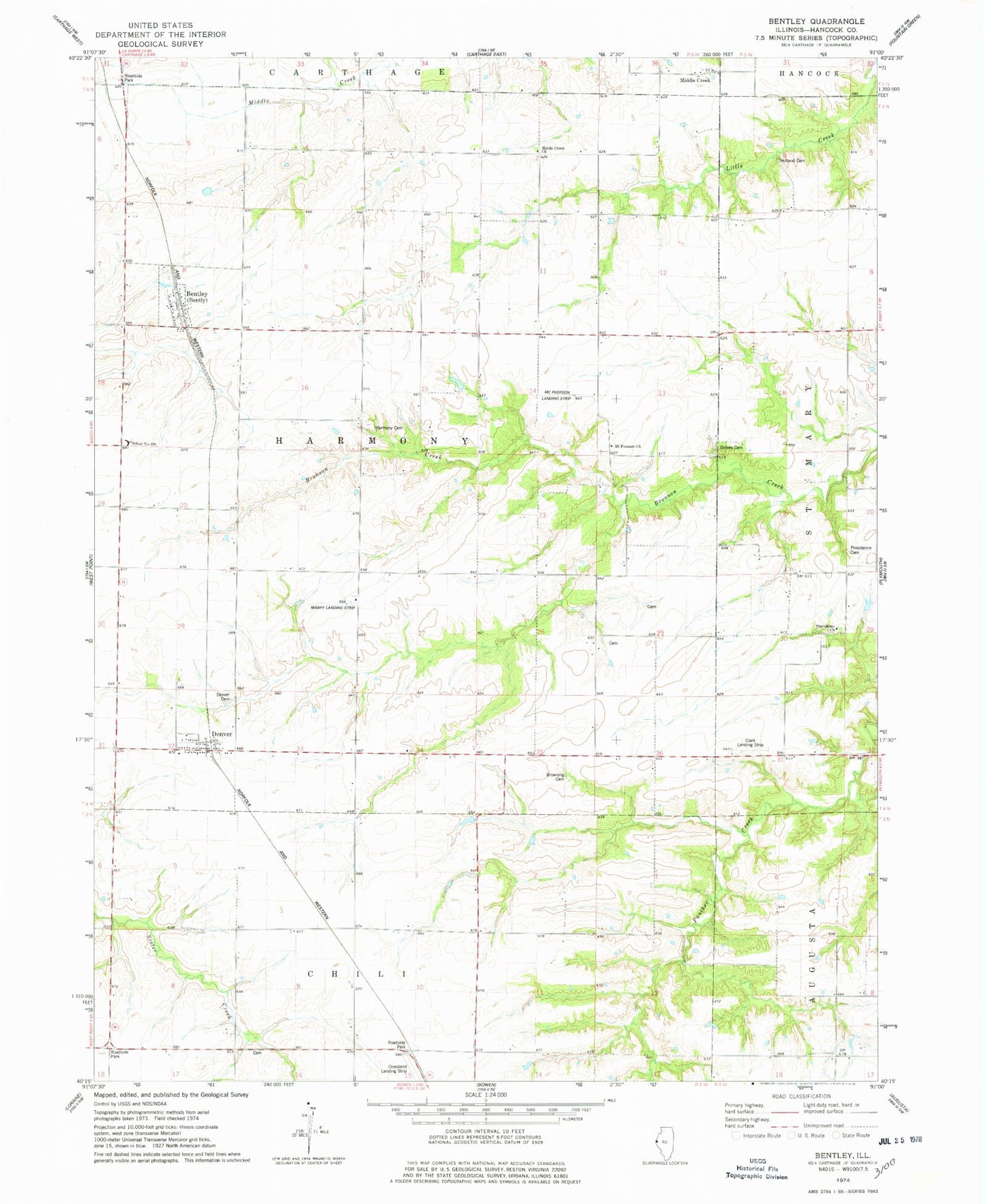
Classic USGS Bentley Illinois 7.5'x7.5' Topo Map
Couldn't load pickup availability
Historical USGS topographic quad map of Bentley in the state of Illinois. Map scale may vary for some years, but is generally around 1:24,000. Print size is approximately 24" x 27"
This quadrangle is in the following counties: Hancock.
The map contains contour lines, roads, rivers, towns, and lakes. Printed on high-quality waterproof paper with UV fade-resistant inks, and shipped rolled.
Contains the following named places: Bentley, Browning Cemetery, Clark Landing Strip, Crossland Landing Strip, Denver, Denver Cemetery, Denver Post Office, Douglas School, Grove Cemetery, Harmony Cemetery, Harmony School, Holland Cemetery, Independence School, Lauderdale School, Liberty School, Mabry Landing Strip, McPherson Airport, Middle Creek, Middle Creek Church, Mount Pleasant Cemetery, Mount Pleasant Church, Mount Pleasant School, Old Sixteen Cemetery, Pleasant Valley School, Providence Cemetery, Providence Church, Providence School, Ramsey Cemetery, Rose Hill School, School Number 338, Scott Cemetery, Shiloh School, Town of Bentley, Township of Harmony, West Union School