MyTopo
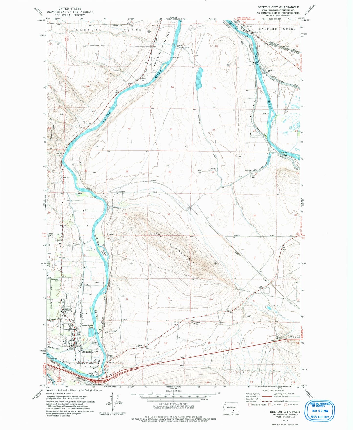
Classic USGS Benton City Washington 7.5'x7.5' Topo Map
Couldn't load pickup availability
Historical USGS topographic quad map of Benton City in the state of Washington. Map scale may vary for some years, but is generally around 1:24,000. Print size is approximately 24" x 27"
This quadrangle is in the following counties: Benton.
The map contains contour lines, roads, rivers, towns, and lakes. Printed on high-quality waterproof paper with UV fade-resistant inks, and shipped rolled.
Contains the following named places: Benton City, Benton City Post Office, Benton County Fire District 2, City of Benton City, City of West Richland, Evergreen Cemetery, Grosscup, Horn Rapids Canal, Kiona - Benton City Elementary School, Lost Lake, McWhorter Canal, Red Mountain, Songbird Island, The Island, ZIP Codes: 99320, 99353