MyTopo
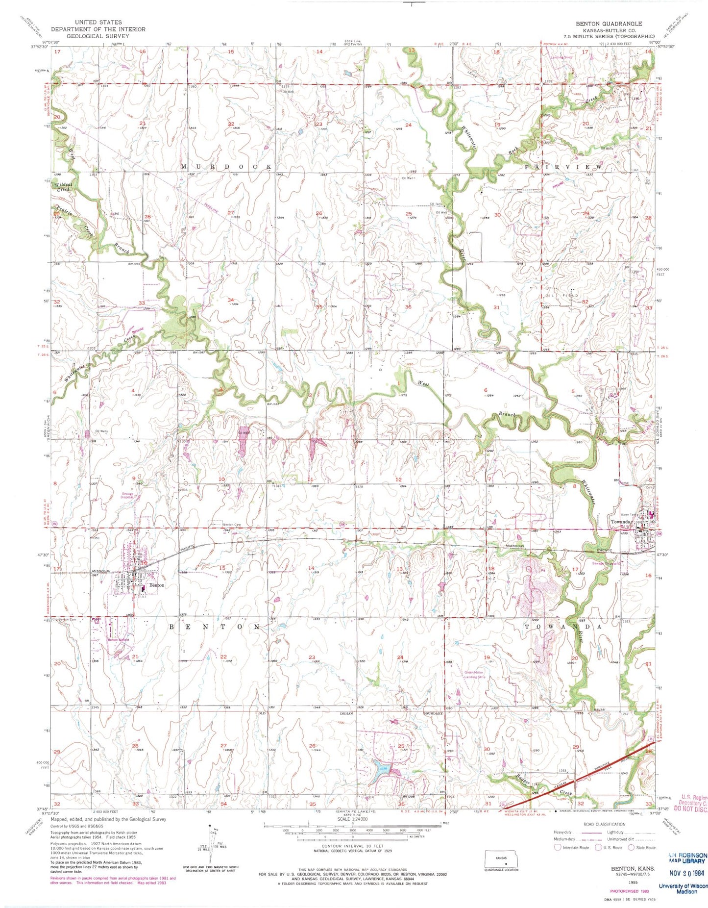
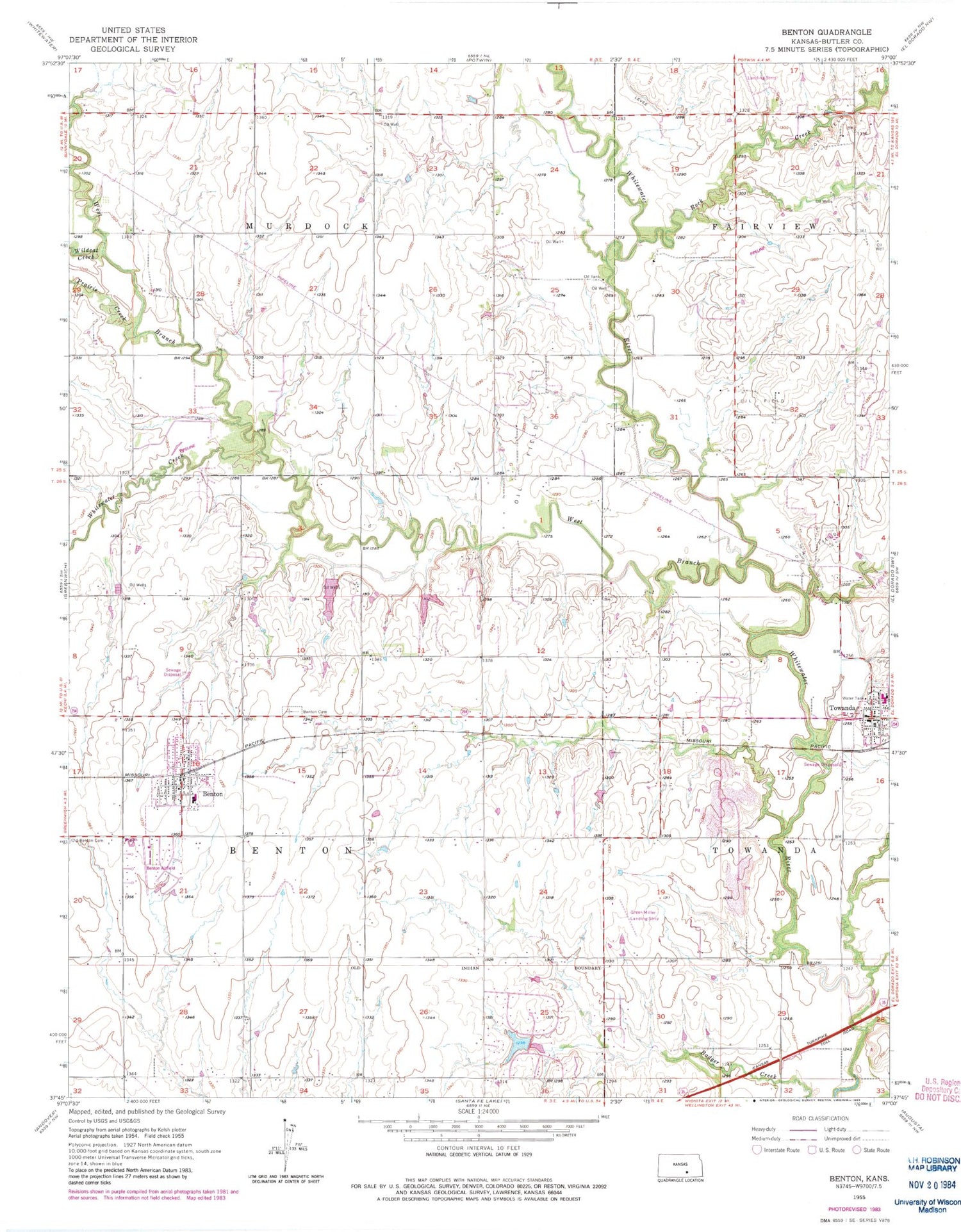
Classic USGS Benton Kansas 7.5'x7.5' Topo Map
Couldn't load pickup availability
Historical USGS topographic quad map of Benton in the state of Kansas. Map scale may vary for some years, but is generally around 1:24,000. Print size is approximately 24" x 27"
This quadrangle is in the following counties: Butler.
The map contains contour lines, roads, rivers, towns, and lakes. Printed on high-quality waterproof paper with UV fade-resistant inks, and shipped rolled.
Contains the following named places: Benton, Benton Cemetery, Benton Christian Church, Benton City Hall, Benton Grade School, Benton Police Department, Benton Post Office, Benton Wastewater Treatment Facility, Butler County Fire District 7 - Benton, Circle Benton Elementary School, Circle Middle School, City of Benton, Freedom Bible Fellowship Church, Greer Miller Landing Strip, Lloyd Stearman Field, Prairie Creek, Prairie Rose Silverscreen Cowboy Museum, Rock Creek, Spring Branch, Taylor Airport, Team Marketing Alliance Grain Elevator Number 3, The Benton Church, The Museum in Towanda, Towanda City Hall, Towanda Fire Department, Towanda Police Department, Towanda Post Office, Towanda Public Library, Towanda United Methodist Church, Towanda Wastewater Treatment Facility, Township of Benton, Township of Murdock, West Branch Whitewater River, Whitewater Creek, Wildcat Creek, ZIP Codes: 67017, 67144