MyTopo
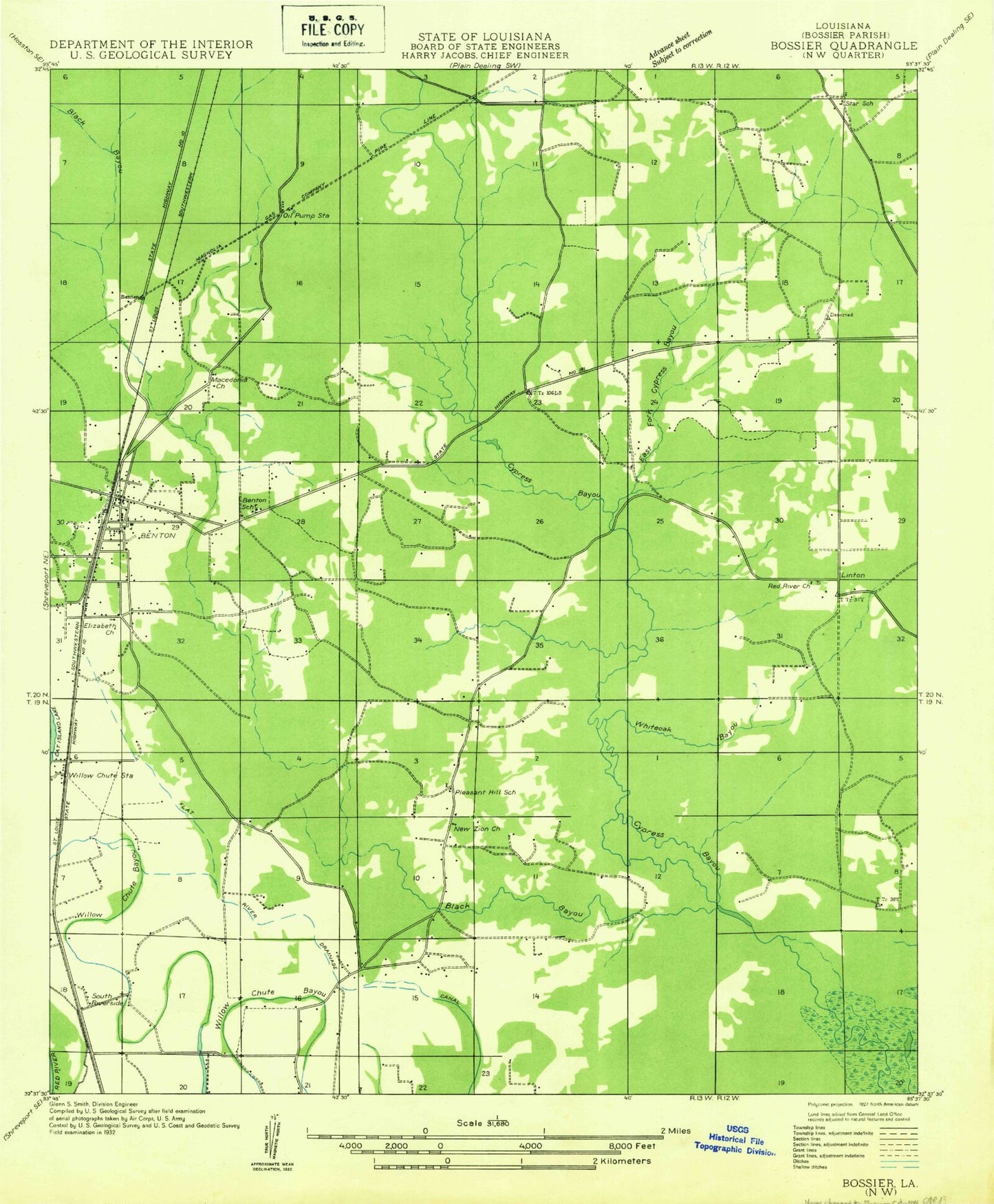
Classic USGS Benton Louisiana 7.5'x7.5' Topo Map
Couldn't load pickup availability
Historical USGS topographic quad map of Benton in the state of Louisiana. Typical map scale is 1:24,000, but may vary for certain years, if available. Print size: 24" x 27"
This quadrangle is in the following counties: Bossier.
The map contains contour lines, roads, rivers, towns, and lakes. Printed on high-quality waterproof paper with UV fade-resistant inks, and shipped rolled.
Contains the following named places: Benton Community Club Cemetery, Black Bayou, Calvary Church, Caney Creek, Little Caney Bayou, Macedonia Cemetery, Mary-Queen of Heaven Chapel, North Calvary Tabernacle, Old Red River Cemetery, Pilkinton Cemetery, Raymond Cemetery, Sibley Cemetery, White Oak Bayou, Pleasant Hill School (historical), Barso, Linton, Dukedale, Willow Chute, Benton Elementary School, Benton Middle School, Benton Intermediate School, Bossier Parish Courthouse, Sentell Gas Field, Benton Oil and Gas Field, Black Bayou Reservoir, Cypress Bayou Dam, Cypress Bayou Reservoir, Player Cemetery, Linton Lake Dam, Cypress Black Site Number Two Dam, Cypress Black Site Number Two Reservoir, New Zion Christian Methodist Episcopal Church, Pleasant Hill Missionary Baptist Church, Red River Baptist Church, Palmetto Country Club, Benton, Benton Post Office, KLKL-FM (Benton), L J Earnest Airport (historical), Parish Governing Authority District 3, Town of Benton, Benton Fire District 4 Station 1, Benton Fire District 4 Station 2, Benton Police Department, Bossier Sheriff's Office, Sonlef Air Strip