MyTopo
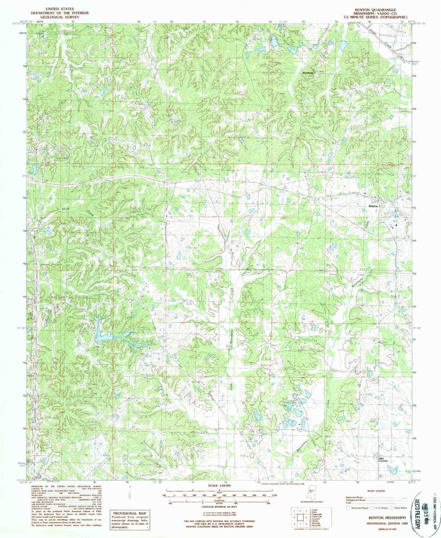
Classic USGS Benton Mississippi 7.5'x7.5' Topo Map
Couldn't load pickup availability
Historical USGS topographic quad map of Benton in the state of Mississippi. Map scale may vary for some years, but is generally around 1:24,000. Print size is approximately 24" x 27"
This quadrangle is in the following counties: Yazoo.
The map contains contour lines, roads, rivers, towns, and lakes. Printed on high-quality waterproof paper with UV fade-resistant inks, and shipped rolled.
Contains the following named places: Anderson Catfish Pond Dam, Anderson Lake Dam, Bells Chapel, Benton, Benton Census Designated Place, Benton Post Office, Benton Volunteer Fire Department, Bethesda, Boylan Church, Captain Simmons Church, Castles Chapel, Cedar Hill, Coopers Cemetery, Edinburg High School, Fletchers Chapel, Forest Park Club Lake Dam, Fouche Lake Dam, Galilee Church, Hilton, Lear Lake Dam, McGraw Lake Dam, Peters Chapel Church, Piney Creek Watershed Y-38-26 Dam, Roadside, Saint Pauls Church, Silver Mountain Church, Silver Mountain School, Smith's Cemetery, Wesley Chapel, Williams Lake Dam, Woodlawn