MyTopo
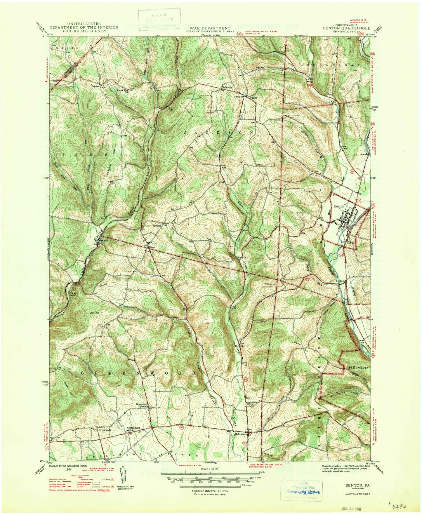
Classic USGS Benton Pennsylvania 7.5'x7.5' Topo Map
Couldn't load pickup availability
Historical USGS topographic quad map of Benton in the state of Pennsylvania. Map scale may vary for some years, but is generally around 1:24,000. Print size is approximately 24" x 27"
This quadrangle is in the following counties: Columbia, Lycoming.
The map contains contour lines, roads, rivers, towns, and lakes. Printed on high-quality waterproof paper with UV fade-resistant inks, and shipped rolled.
Contains the following named places: Bald Hill, Benton, Benton Airport, Benton Boro Police Department, Benton Cemetery, Benton Post Office, Benton Volunteer Fire Company Station 150, Borough of Benton, Bunker Hill, Coles Mill, Culley Run, Davis Hill, Davis Hollow, Derrs, Devil Hole Run, Greenwood, Greenwood Methodist Episcopal Church Cemetery, Greenwood Union Church, Huckleberry Ridge, Jackson, Jackson Township Cemetery, Karnes Hollow, Kline Hollow Run, Kramer Hill, Lemon Cemetery, Little Brier Run, Little Green Creek, Maple Grove, O'Brien Hill, Polkville, Rickard Hollow, Rohr Family Cemetery, Rohrsburg, Rohrsburg Cemetery, Rohrsburg Census Designated Place, Schultz Hollow, Spencer Run, Talmer, Township of Greenwood, Township of Jackson, Waller, Waller Cemetery, Waller Census Designated Place, Waterville, Wesley Chapel Cemetery, West Creek, York Hollow